Download
1 / 33
330 likes | 481 Vues
This comprehensive guide, authored by Terence H. Cooper of the University of Minnesota, details the intricacies of soil evaluation using the 2005 Soil Judging Scorecard and Guidebook. It covers essential topics such as surface soil and subsoil characteristics, soil profiles, horizon depth, color, texture, and erosion control methods. The guide is valuable for agricultural professionals, providing insights into soil classification, drainage, and fertility assessments, thereby supporting sustainable land use and crop production practices.

E N D
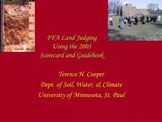
FFA Land JudgingUsing the 2005 Scorecard and Guidebook Terence H. Cooper Dept. of Soil, Water, & Climate University of Minnesota, St. Paul
Soil - the essence of life Darkle, darkle, little grain, I wonder how you entertain a thousand creatures microscopic. Grains like you from pole to tropic support land life upon this planet. I marvel at you, crumb of granite! (Hole, 1989)
Part 1 & 2 Surface Soil & Subsoil • Describing the Soil Profile • Horizon Depth • Soil Color • Soil Texture • Gravel and Rocks
Thickness • Clarion • A = 18 in. • Subsoil = 54-18= 36 in • Nebish • A = 3 in • Subsoil = 48-3=45
Surface Soil Color – Munsell Color Charts Light Medium Dark
Color • Clarion A = 10yr 2/1 = Very Dark • Nebish A = 10yr 3/1 = Very Dark • Subsoil for both = Bright or no mottles or gray colors present.
Texture & Gravel • Clarion A = Loam = Medium • Clarion Subsoil = clay loam = fine • Nebish A = sandy loam = moderately coarse • Nebish Subsoil = sandy clay loam = fine • None to few = gravel in all parts of soil.
Gravel Determination 2mm sieve < 15% 15-34% 35-59% > 59%
Terrace Floodplain
0-2% slope 2-6 % 6-12 % 12-18% 0-2% -flooding or rocks 18-30 % 30-60% > 60%
Interpretations of Soil Features; 6A - E • Residual - Soil formed from Bedrock. In Minnesota mainly only the following: • Sandstone • Limestone • Basalt • Granite
Air and Water Movement – 6D Coarse texture Medium or moderately coarse texture Fine texture Very fine texture
Available Water Capacity – 6E - (1-3) AWC = Clarion 0-18 = loam = .2”/in /in soil= 3.6” H2O Subsoil = 36 = CL = .2”/in/in soil = 7.2” H2O C horizon 60-54 = 6 sandy loam = .15”/in/in soil = .9” H20 Total = 3.6 + 7.2 + .9 = 11.7” H2O = High
6 E -4 Well Drained Moderately Well Somewhat Poorly Poorly Drained
Amount and Kind of Erosion -7 A = original soil depth Texture = fine or coarse > 2 inches > 1” loss of original depth • Orginal Surface soil depth- Clarion = 23” & currenlty=18 or 5 inches lost = erosion present
Need for Erosion Control -8 A & B • None • Sod Cover, Conservation Tillage • Contour, Strip Crop & Conservation Tillage • Grass Waterway and Gully Control.
Poorly Drained • Somewhat Poorly Drained • Both will need tile drainage.
Crop to be planted = small grains- past crop soybeans – use Table 5 • P-test = 21 lbs/acre, K – test = 136 lbs/acre, no manure • Subsoil K = low and Subsoil P = low • SMP BUFFER = 5.9-Area 1- Soil Texture = loam • Corn yield goal = 120 • Fertilizer = ? • N = 40 • P = 20 • K = 70 • Lime = 7.5 tons/acre- from lime table
New Crop = corn – after soybeans. • P-test = 21 lbs/acre, K – test = 136 lbs/acre, no manure • Subsoil K = low and Subsoil P = low Yield Goal = 130 Fertilizer = ? • N = 90 – or choose 100 as the closest answer. • P = 60 • K = 80 • Lime = 7.5
Land Use Limitations -11 Use for Dwellings Use for Septic Tank absorption fields Use for farm lagoons and holding basins
Features for dwellings • Clarion Soil