Download
1 / 32
320 likes | 471 Vues
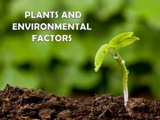
This comprehensive overview explores the critical role of soil in Earth's ecosystem, highlighting its formation, composition, and the various environmental factors affecting it. With only 10% of Earth's land arable and just 1.5% under food production, understanding soil's physical support, nutrients, and moisture is vital for sustainable agriculture. The text examines soil horizons, the influence of climate and topography, and the significance of organic matter, illustrating how these elements interact to create fertile land essential for food production.

E N D
Environmental Factors Soils
Earth’s Surface - 70 % Water - 30 % Land - Only 10 % of land is arable (suitable for cultivation) - Of this arable land, 50 % is under cultivation, therefore, - Only 1.5 % of the Earth’s surface is in cultivated food production
Earth’s Surface 30 % land 70 % water
SOIL PROVIDES Physical support Water Nutrients
5 Components of Soil Mineral Particles Organic Matter Water Atmosphere Organisms/Microorganisms
5 Soil Forming Factors Parent Material Climate Organic Material/Organisms Topography Time
5 Soil Forming Factors Parent Material unconsolidated accumulation forming from the breakdown of parent rocks by chemical and physical weathering
Parent Material Chemical Weathering Four processes: Carbonation – reactions with carbonic acid Hydration – adds molecular water Hydrolysis – reactions with water Oxidation – reactions with oxygen
Parent Material Physical Weathering Examples: Exfoliation by temperature changes Varying coefficients of expansion Expansion of freezing water Glacial grinding Moving water Wind “sandblasting”
Climate Rainfall and Temperature affect formation: High Rainfall – leaching, acid reaction, low fertility, red or yellow colors, rapid chemical weathering note: higher temperatures accelerate formation Arid Climate – low leaching, Ca & Mg accumulate, basic reaction, excess salts, slower weathering
Organic Fraction Residues of Plants and Animals: - prairies more organic matter than forests - type of vegetation affects amounts - temperature and moisture: warm & moist - no gain cold & moist - accumulation tillage - loss of organic matter
Topography Influences drainage and runoff: - erosion - less percolation - leaching (internal drainage dependent) - gentle slopes in heavy vegetation form well- defined profiles - topography affects climate affects vegetation
Time Parent Material affects rate of decomposition - harder rocks (granite) take longer to form soil - softer rocks (limestone) less time biological and chemical reactions form profile: differentiates into Horizons over time more prominent in older soils
Soil Profile The vertical section of a soil through all its horizons (layers), ending in the parent material Each horizon differs chemically/physically
A Horizon Often called topsoil . . . - Higher in organic matter (darker) - Zone of leaching (nutrients, clays) - Zone of biological activity - Highest level of nutrients
B Horizon Referred to as subsoil . . . - Less organic matter - Smaller particles - Lighter in color ? Depends on materials leached - Zone of accumulation (soluble nutrients, clays) A and B together: Rooting Zone . . . Solum
C Horizon Sometimes called substratum . . . - Extends from B horizon to bedrock - Zone of least weathering (parent material)
OLDER SOILS More clearly defined horizons, thus . . . MORE COMPLETE DESCRIPTION OF THE PROFILE
Typical profile: 1 m for a temperate-zone soil
SOIL PHYSICAL FACTORS Texture indicates the percentage of: Sand Silt Clay
Percentages are applied to . . . Textural Triangle: - Percent Sand, Silt, Clay - 12 Textural Classes (fig 8-6, p. 146) - Texture by “Feel” with experience
Structure (p.147) Indicates how individual soil particles group e.g. Clay - develops blocky, massive structure Sand – no structure (each particle independent) Soils with some smaller particles and O.M. demonstrate . . . AGGREGATION – very important to soil quality
Aggregation improves: Aeration Percolation Root penetration
SOIL MOISTURE Soil is the plants water reservoir… Water uptake is by: Diffusion and Osmosis
Water POTENTIAL Refers to the ability of water to move in soil More water in soil = More water potential At saturation, potential is near 0 (zero) As soil dries, values become more negative Water is held more tightly by soil
FOUR CATEGORIES OF SOIL MOISTURE Chemically combined . . . unavailable Hygroscopic . . . unavailable Gravitational . . . moves downward by gravity Capillary . . . taken up by plants
SATURATED SOILS Sandy soil: gravitational water moves rapidly downward Clay loam: gravitational water retained 2-3 days afterward
Once soils lose gravitational water (drain) movement is by . . . Capillarity – movement due to attraction between water molecules and soil particles Rapid in sandy soils but limited in distance Slow in clay soils but may move great distances