Download
1 / 27
270 likes | 512 Vues
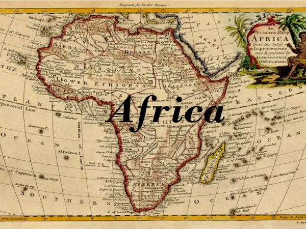
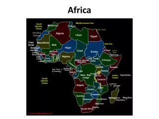
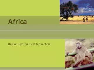
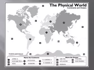
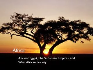
Africa. More About Africa. Africa : Africa is the second-largest of the seven continents on Earth (Asia is the largest continent). Africa is bounded by the Atlantic Ocean on the west, the Indian Ocean on the east, the Mediterranean Sea on the north, and the Red Sea on the northeast.

E N D
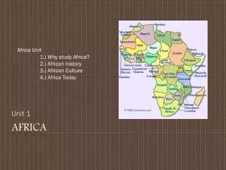
More About Africa • Africa: Africa is the second-largest of the seven continents on Earth (Asia is the largest continent). Africa is bounded by the Atlantic Ocean on the west, the Indian Ocean on the east, the Mediterranean Sea on the north, and the Red Sea on the northeast. • Africa covers 11,700,000 square miles (30,300,000 square kilometers). • Countries: There are about 53 countries in Africa (some countries are disputed). The biggest country in Africa is Sudan, which covers 967,500 square miles (2,505,816 square kilometers). The countries with the largest populations in Africa are Nigeria (107,000,000 people), Egypt (64,800,000 people), and Ethiopia (58,700,000 people). • Highest and Lowest Points: The tallest point in Africa is Mt. Kilimanjaro, in Tanzania (eastern Africa). Mt. Kilimanjaro is 19,340 feet (5895 meters) tall. Africa has no long mountain chains. • The lowest point in Africa is Lake Assal, in Djibouti (in eastern Africa near the Horn of Africa); it is 512 feet (156 meters) below sea level.
Lakes: Africa's largest lake is Lake Victoria; it covers 26,836 square miles (69,500 square kilometers). Other large lakes in Africa are Lake Tanganyika, Lake Malawi, and Lake Chad. • Rivers: The longest river in Africa is the Nile River; it is 4,241 miles (6825 kilometers) long. Other long rivers in Africa include the Congo River, the Niger River and the Zambezi River. • Deserts: Africa has many vast deserts, including the largest hot desert in the world, the Sahara. The Sahara Desert is located in northern Africa and covers 3,500,000 square miles (9,065,000 square kilometers). The Kalahari, in southern Africa, is another large desert. • Islands: The biggest island off Africa is Madagascar, which is near the coast of southeast Africa. Madagascar covers 226,658 square miles (587,000 square kilometers). Other islands include the Seychelles (a chain of islands north of Madagascar), the Comoros (another chain of islands north of Madagascar), the Canary Islands (a chain of islands off the northwest coast), the Madeira Islands (another chain of islands off the northwest coast), the Cape Verde Islands (off the coast of western Africa), Equatorial Guinea (off the coast of Cameroon), and Sao Tome (southwest of Equatorial Guinea).
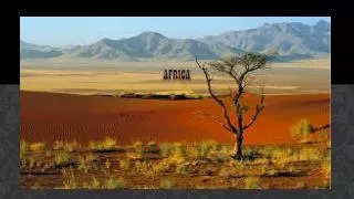
The Sahara • The boundaries of the Sahara are the Atlantic Ocean on the west, the Atlas Mountains and the Mediterranean Sea on the north, the Red Sea and Egypt on the east, and the Sudan and the valley of the Niger River on the south. Sahara is divided into western Sahara, the central Ahaggar Mountains, the Tibesti massif (a region of desert mountains and high plateaus), and the Libyan desert (the most arid region).
Egypt • Location: Northern Africa, bordering the Mediterranean Sea • Area - slightly more than three times the size of New Mexico (US) • Rivers include: Nile • Deserts: Egypt includes parts of the Sahara Desert and of the Libyan Desert • Coastline: 2,450 km • Climate: desert; hot, dry summers with moderate winters • Natural hazards: periodic droughts; frequent earthquakes, flash floods, landslides, volcanic activity; hot, driving windstorm called khamsin occurs in spring; dust storms, sandstorms
The Serengeti - Tanzania • The Animals
Tanzania • Location: Eastern Africa, bordering the Indian Ocean, between Kenya and Mozambique • Area - comparative: slightly larger than twice the size of California • Climate: varies from tropical along coast to temperate in highlands • Geography - Kilimanjaro is highest point in Africa; bordered by three of the largest lakes on the continent: Lake Victoria (the world's second-largest freshwater lake) in the north, Lake Tanganyika (the world's second deepest) in the west, and Lake Nyasa in the southwest • Languages: Swahili (official)
The Republic of Ghana • Location: Western Africa, bordering the Gulf of Guinea, between Cote d'Ivoire and Togo • Area - comparative: slightly smaller than Oregon • Land boundaries:border countries: Burkina Faso 549 km, Cote d'Ivoire 668 km, Togo 877 km • Climate: tropical; warm and comparatively dry along southeast coast; hot and humid in southwest; hot and dry in north • Terrain: mostly low plains with dissected plateau in south-central area • Natural resources:gold, timber, industrial diamonds, bauxite, manganese, fish, rubber, hydropower • Natural hazards: dry, dusty, northeastern harmattan winds occur from January to March; droughts • Languages: English
Mali • Location: Western Africa, southwest of Algeria • Area - comparative: slightly less than twice the size of Texas • Land boundaries: border countries: Algeria 1,376 km, Burkina Faso 1,000 km, Guinea 858 km, Cote d'Ivoire 532 km, Mauritania 2,237 km, Niger 821 km, Senegal 419 km Coastline: landlocked • Climate: subtropical to arid; hot and dry February to June; rainy, humid, and mild June to November; cool and dry November to February • Terrain: mostly flat to rolling northern plains covered by sand; savanna in south, rugged hills in northeast • Languages: French
South AfricaNelson Mandela, diamonds • The name "diamond" comes from the Greek "adamas," meaning unconquerable. Made of pure carbon, diamonds are the hardest natural substance known to man. Diamonds were formed in the depths of the earth and are three quarters of the earth's age—although humans didn't find them until 4,000 years ago. Put another way, if the earth's age was on a twenty-four hour cycle, diamonds would be born in the first hours of the morning, but man didn't find them until seconds before midnight. Former President, African National Congress Former President of South Africa
South Africa • Location: Southern Africa, at the southern tip of the continent of Africa • Area: includes Prince Edward Islands (Marion Island and Prince Edward Island) • Area - comparative: slightly less than twice the size of Texas • Land boundaries: border countries: Botswana 1,840 km, Lesotho 909 km, Mozambique 491 km, Namibia 967 km, Swaziland 430 km, Zimbabwe 225 km • Climate: mostly semiarid; subtropical along east coast; sunny days, cool nights • Terrain:vast interior plateau rimmed by rugged hills and narrow coastal plain • Natural resources:gold, chromium, antimony, coal, iron ore, manganese, nickel, phosphates, tin, uranium, gem diamonds, platinum, copper, vanadium, salt, natural gas • Religions: Christian 68% • Languages: 11 official languages
Niger • Western Africa, southeast of Algeria • Area - comparative: lightly less than twice the size of Texas • Land boundaries:border countries: Algeria 956 km, Benin 266 km, Burkina Faso 628 km, Chad 1,175 km, Libya 354 km, Mali 821 km, Nigeria 1,497 km • Coastline: landlocked • Climate: desert; mostly hot, dry, dusty; tropical in extreme south • Terrain: predominately desert plains and sand dunes; flat to rolling plains in south; hills in north • Elevation extremes:lowest point: Niger River 200 m highest point: Mont Bagzane 2,022 m • Natural resources:uranium, coal, iron ore, tin, phosphates, gold, petroleum • Natural hazards: recurring droughts • Languages: French
Nigeria • Western Africa, bordering the Gulf of Guinea • Area - comparative: lightly more than twice the size of California • Land boundaries:border countries: Benin 773 km, Cameroon 1,690 km, Chad 87 km, Niger 1,497 km • Coastline: 53 km • Climate: varies; equatorial in south, tropical in center, arid in north • Terrain: southern lowlands merge into central hills and plateaus; mountains in southeast, plains in north • Elevation extremes:lowest point: Atlantic Ocean 0 m highest point: Chappal Waddi 2,419 m • Natural resources: natural gas, petroleum, tin, columbite, iron ore, coal, limestone, lead, zinc, arable land • Natural hazards: periodic droughts; flooding • Geography - note:the Niger enters the country in the northwest and flows southward through tropical rain forests and swamps to its delta in the Gulf of Guinea • Languages:English
Congo River Dem Rep of Congo • Location:Central Africa, northeast of Angola • Area - comparative: slightly less than one-fourth the size of the US • Land boundaries: border countries: Angola 2,511 km (of which 225 km is the boundary of Angola's discontiguous Cabinda Province), Burundi 233 km, Central African Republic 1,577 km, Republic of the Congo 2,410 km, Rwanda 217 km, Sudan 628 km, Tanzania 459 km, Uganda 765 km, Zambia 1,930 km • Climate:tropical; hot and humid in equatorial river basin; cooler and drier in southern highlands; cooler and wetter in eastern highlands; north of Equator - wet season April to October, dry season December to February; south of Equator - wet season November to March, dry season April to October • Terrain:vast central basin is a low-lying plateau; mountains in east • Natural resources:cobalt, copper, cadmium, petroleum, industrial and gem diamonds, gold, silver, zinc, manganese, tin, germanium, uranium, radium, bauxite, iron ore, coal, hydropower, timber • Languages:French