Download
1 / 13
130 likes | 271 Vues
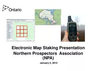
Electronic Map Staking Presentation Northern Prospectors Association (NPA) January 5, 2012. Electronic Map Staking . Ontario is moving to a Province wide, web-based, on-line electronic mining claim staking system.

E N D
Electronic Map Staking Presentation Northern Prospectors Association (NPA) January 5, 2012
Electronic Map Staking • Ontario is moving to a Province wide, web-based, on-line electronic mining claim staking system. • Many challenges exist both in the transition from the existing ground-based staking system to the new world of electronic map-based staking, which will use a defined grid system.
Electronic Map Staking • A number of questions exist associated with Electronic Map Staking and we need input as to what will work best for Ontario. • You are the claim holders and explorationists and as such your input is invaluable as we consider the rules and parameters for the new system. • The questions following are just that, questions, and do not indicate any preconceived direction by the Ministry, but are merely thoughts based on a review of the systems currently in place throughout Canada.
Electronic Map Staking What should the size of a “mining claim” be in the new system? • Currently claims in Ontario range in size from 16ha to 256ha (1 to 16 units). • The size of claims in the future state will to some extent be controlled by the cell size of the electronic grid • Do we want a system similar to the status quo? • Should we allow the size of claims to be smaller?...or larger?....why?
Electronic Map Staking Should there be limits on the shape or configuration of a claim? • Square or rectangle? • Other shapes? • Contiguous?
Electronic Map Staking Claim shape / configuration - other Provinces: Manitoba • Any configuration, contiguous British Columbia • Any configuration, contiguous Newfoundland • Any configuration, contiguous Quebec • Any configuration, no contiguity
Electronic Map Staking Should there be limits put on the size or number of cells / units / claims that can be recorded in an online staking “session”? If so, what should this be based on? • Maximum number of grid cells? • Maximum area (size) of claim? • Maximum number of claims? • Time restriction? (timeout)
Electronic Map Staking Control on claims / units / claims recordable - other Provinces: Manitoba • Max of 30 grid cells per claim • Max claim size of 500ha British Columbia • Max of 20 cells and 400ha within 30 min • No limit of # of claim transactions Newfoundland • Max of 8 cells or 256ha per claim per transaction • No limit of # of claim transactions Quebec • Max 150 grid cells (7500ha) per day north of 51 deg • Max 40 grid cells (2000ha) per day south of 51 deg
Electronic Map Staking Must you have a Prospectors Licence to record (stake) claims on-line? Should we allow others to stake on behalf of a licence / client number holder? (agent?)
Electronic Map Staking On-line staking fees: Ontario is considering Credit Cards as the only payment option for acquiring on-line claims. Do you see any issues with this?
Currently claims are either paper staked or ground staked. In the future claims will be defined by electronic grid coordinates. The present extent definition of a claim needs to be converted (transitioned) to the Electronic Map Staked System (coordinate grid). In this conversion we NEED to know where the old claim fits in the new coordinate grid. How do we accomplish this conversion? Some Questions....... Survey of Claims? (ground proofing) Voluntary or Mandatory or both? Incentives? Time period? Simultaneous or staggered process? Dispute Process? Other? Electronic Map Staking
Electronic Map Staking Other Provinces: • Manitoba:Mandatory to convert, 2 year transition period • British Columbia: Mandatory to convert, 6 month transition period. • Newfoundland: Mandatory to convert, 1 month transition period. • Quebec: Voluntary process, no time limit for conversion