Land Use and Travel Model Integration
270 likes | 472 Vues
Land Use and Travel Model Integration. Linking Land Use and Transportation Models: Transportation User Benefits and Site Values. 13 th TRB National Planning Applications Conference May 8-12, 2011. 2. Presentation Overview. Background Model Integration/Application Analysis/Results

Land Use and Travel Model Integration
E N D
Presentation Transcript
Land Use and Travel Model Integration Linking Land Use and Transportation Models: Transportation User Benefits and Site Values 13th TRB National Planning Applications Conference May 8-12, 2011
2 Presentation Overview • Background • Model Integration/Application • Analysis/Results • Conclusions/Future Directions
Regional Economic Forecasts Transport System URBANSIM Land Use Forecasts Travel Forecasts Air Quality Analysis Benefit-Cost Analysis 4 4 PSRC Model/Analytical Tool Framework
5 5 UrbanSim Characteristics • Micro-simulation of actions of actors on parcels and buildings: • Households and Workers • Jobs • Developers / Landowners • Primary Inputs: • Allowable development (comp plans) • Transportation system • Major planned developments (pipeline developments) • Regional economic forecasts • Many operating assumptions: • Relocation rates • SQFT needed per job by sector • Construction costs • Vacancy rates • Simulates each year from 2001-2040
6 UrbanSim Set of Models Process Pipeline Events Land Development Models Real Estate Price Model Expected Sale Price Model Development Proposal Choice Model Employment Location Models Household Location Models Building Construction Model Household Transition Model Employment Transition Model Household Relocation Model Employment Relocation Model Household Location Choice Model Employment Location Choice Model Economic Transition Model Workplace Location Models Home-based Job Choice Model Workplace Location Choice Model 6
8 8 Model Handshake – Current Setup
9 9 Benefit-Cost Analysis Tool • Post Travel Demand Model • Process • Compare with Base Case • Calculation/Accounting of • Consumer Surplus • Regional/Sub-Region • Geographies • Consumer Surplus Categories: • Travel Time Savings • Improved Reliability • Vehicle Operating Cost Savings • Toll/Fare Cost Savings • Accident Cost Savings • 11 User Classes • 5 Time Periods • 275 Million Calculations
10 Real Estate Price Model Details Process Pipeline Events Real Estate Price Model Expected Sale Price Model Development Proposal Choice Model Building Construction Model 14 of 30 Land Use Types have price prediction sub-models. Non-modeled categories include water bodies, military bases, schools, existing ROW, and other undevelopable types or categories not associated with traditional market pricing / development dynamics 10
11 11 Real Estate Price Model Details
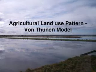
13 13 First Round Analysis Recap • Goal: • Explore correlation of changes in location choices of households and jobs to changes in accessibility across different transportation system alternatives • Literature Review: • Expectation of modest changes to land uses in response to incremental changes in transportation systems • Findings: • Consistent with expectations, but difficult to interpret land use response • Presented at 2010 TRB Innovations in Travel Modeling • Published in Transportation Letters: The International Journal of Transportation Research: Testing the Puget Sound’s land use model response to transportation strategies
14 14 First Round Sensitivity Tests • Base Case Scenario • Transportation Networks (2020, 2040) • Modest investments in roads and road-based transit • Near-term voter-approved rail transit extensions • Very limited tolling (two bridge crossings) • No real growth in vehicle operating costs • Modest real growth in parking costs • Alternative Scenarios • Lower parking costs in selected neighborhoods (zones) • Higher vehicle operating costs forecast • Major extensions of rail transit • Major investments in highway capacity
15 15 Alternatives Light Rail Commuter Rail
16 16 Second Round Analysis • Goal: • Explore correlation between transportation system user benefits (travel time savings) and real estate prices • Expectations: • Travel time savings benefits will be capitalized in land values over the long run • Lower transportation costs should result in higher site values, and vice versa • Analysis: • Keep Operating Cost and LRT Scenarios • Use Broader Sub-Region Geographies • Additional Scenarios Analyzed: • Major Freeway Capacity Halved • Major Freeway Capacity Doubled • Major Freeways = I-5, I-405, I-90, SR520
17 17 Second Round Analysis Results Change in Total Site Values and Travel Time Savings by Alternative (2040)
18 18 Second Round Analysis Results Changes in Total Site Values by Alternative by Sub-Region (2040)
19 19 Second Round Analysis Results Percent Changes in Total Site Values by Alternative by Sub-Region (2040)
20 20 Second Round Analysis Results Travel Time Savings by Alternative by Sub-Region (2040)
21 21 Second Round Analysis Results Correlation of Travel Time Savings and Site Values (All Scenarios)
22 22 Second Round Analysis Results Correlation of Travel Time Savings and Site Values (No LRT Scenario)
24 24 Conclusions/Future Directions • Basic Conclusion • Stronger correlation between site values and user benefits than between choice model results and zonal accessibilities • Follow-Up Analyses • Narrower geographies • User Classes • User benefit categories • Land uses categories/types • Choice models vs. user benefits • More sensitivity tests? • BCA Tool Questions • User benefits shared equally at origins and destinations • Investigate impact of different assumptions for discount rates and terms for present value calculations
25 25 Future Directions • Accessibility Variables • Continue to test zonal composite variables used in the real estate price and employment location choice models • Test simplified accessibilities for household and workplace location choice models • Expansion of zone structure (from 938 to over 3,500) should help alleviate aggregation problems • Activity-based travel model development will open up additional opportunities for disaggregate access measures • Revisit Integration Structure • Frequency of travel model runs for feedback (more or less frequent) • Activity-based model development will probably require a different approach to integration
Puget Sound Regional Council: Matthew Kitchen, Chris Johnson, Peter Caballero, Mark Simonson, and Stefan Coe Maren L. Outwater, Resource Systems Group Inc