Download
1 / 11
110 likes | 274 Vues
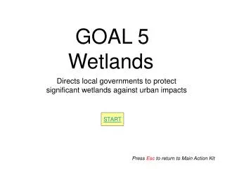
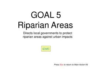
GOAL 5 Riparian Areas. Directs local governments to protect riparian areas against urban impacts. START. Press Esc to return to Main Action Kit. Goal 5 includes two major steps. STEP I. RESOURCE INVENTORY AND ASSESSMENT (What kind?, Where?, How much? Is it locally significant?)

E N D
GOAL 5 Riparian Areas Directs local governments to protect riparian areas against urban impacts START Press Esc to return to Main Action Kit
Goal 5 includes two major steps STEP I • RESOURCE INVENTORY AND ASSESSMENT (What kind?, Where?, How much? Is it locally significant?) • RESOURCE PROTECTION (What protection mechanisms should be used?, What will the results of protection/non-protection be?) SELECT STEP II SELECT Skip to Alternatives Overview Press Esc to return to Main Action Kit
Goal 5 requires jurisdictions to complete the inventory and significance determination for riparian areas using the rules outlined in Oregon Administrative Rule (OAR-660-023-0090) SAFE HARBOR INVENTORY Process follows predefined standards described in Goal 5 Administrative Rules (OAR 660-023-0090) MORE Each Riparian Area in the inventory can be addressed independently resulting in a combination of safe harbor and standard approaches. STANDARDINVENTORY MORE Local government must demonstrate that the inventory process was ”adequate” & justify the decision to identify some resources as “significant.” “Significance” is clearly defined by State for wetlands, but not riparian areas Back
Riparian Safe Harbor Inventory and Significance Determination Process: • Under the safe harbor provision, significant riparian corridors are adjacent to “fish-bearing” lakes and streams. The area of significance is determined using a standard setback distance from all fish-bearing lakes and streams that appear on: • Oregon Department of Forestry stream classification maps; • United States Geological Service 7.5 minute quadrangle maps; • National Wetlands Inventory Maps; • Oregon Department of Fish and Wildlife maps indicating fish habitat; • Federal Emergency Management Agency flood maps; and • Aerial photographs. • The safe harbor inventory specifies that the significant riparian resources will be defined by a boundary extending 50 feet from the banks of lakes and streams with an average annual stream flow less than 1,000 cubic feet per second (cfs). The safe harbor significant area boundary for streams with an average annual stream flow of 1,000 cfs and greater is 75 feet from top of bank Non-Fishbearing Fishbearing & < 1,000 cfs Fishbearing & > 1,000 cfs Non-significant Significant- Resource defined as 75 ft from banks Significant- Resource defined as 50 ft from banks Back Beginning
Riparian Standard Inventory and • Significance Process • The standard inventory approach requires a local government to demonstrate that the inventory process was “adequate” and justify the decision to identify some resources as “significant.” The process involves collecting information regarding all water areas, fish habitat, riparian areas, and wetlands within riparian corridors. Conducting field investigations to verify location, quality, and quantity of resources within the riparian corridor is encouraged, but optional. At a minimum, the following sources, where available, should be consulted during the inventory: • Oregon Department of Forestry stream classification maps; • United States Geological Service 7.5 minute quadrangle maps; • National Wetlands Inventory Maps; • Oregon Department of Fish and Wildlife maps indicating fish habitat; • Federal Emergency Management Agency flood maps; and • Aerial photographs. Significance Determination Beginning Back
Standard Riparian Area Significance Determination For sites where information is adequate, local governments shall make a determination of whether the site is significant. The determination needs to be based on: • The quality, quantity, and location information; • Supplemental or superseding significance criteria set out in the Goal 5 Administrative Rules; and • Any additional criteria adopted by the local government, provided that the criteria do not conflict with Goal 5 Administrative Rule requirements. Beginning Back
For the protection phase, the OAR’s direct local governments to adopt comprehensive plan provisions and land use regulations to achieve Goal 5 protection for all significant riparian areas. As with the Inventory process, Local governments may meet these Goal 5 requirements through either a standard process (ESEE analysis) or the safe harbor provision. Safe Harbor vs Standard Beginning Back
SAFE HARBOR PROTECTION Specifies activities allowed (or not) in the resource area: A) Prevent permanent alteration from grading or the placement of structures or impervious surfaces B) Control the removal of riparian vegetation MORE Each riparian area in the inventory can be addressed independently resulting in a combination of safe harbor and standard approaches. STANDARD PROTECTION • ESEE analysis required • Program for protection based on ESEE • Goal 5 met only with “Clear & Objective” Standards • Identify as “conflicting” uses: • A) Structures, structure replacements, impervious • surfaces that alter the riparian corridor uses; • B) Vegetation removal MORE Beginning Back
Riparian Standard Process Program to Protect • The standard process for determining a program to protect the riparian resource allows for the valuable functions of riparian areas to be considered along side other priority local policy issues through the ESEE (economic, social, environmental, and energy) analysis evaluating the consequences of allowing, limiting or prohibiting uses that conflict with each significant resource site. The steps in an ESEE process include the following: • Identify conflicting uses; • Determine the impact area; • Analyze the economic, social, environmental, and energy consequences of allowing, partially allowing, or not allowing the conflicting use; and • Develop a program to achieve Goal 5 • Compliance under Goal 5 is achieved using the ESEE process when at least the following activities are identified as conflicting uses in riparian corridors: • 1) Placement of structures or impervious surfaces that permanently alter the riparian • corridor except for water-dependent or water-related uses and replacement of existing • structures in the same location that do not disturb additional riparian surface area; and • 2) Vegetation removal except on lands designated for agricultural or forest use outside the • UGB, for restoration activities, and for the development of water-related or water- • dependent uses. Beginning Back
Riparian Safe Harbor Program to Protect • The safe harbor program specifies activities to be allowed or not allowed in the riparian area. Local governments may meet riparian corridor Goal 5 requirements by adopting an ordinance that protects significant riparian corridors by: • Preventing permanent alteration to riparian areas from grading or the placement of • structures or impervious surfaces. The following uses are permitted, provided they are designed and constructed to minimize intrusion into the riparian area: • Streets, roads, and paths; • Drainage facilities, utilities, and irrigation pumps; • Water-related and water-dependent uses; and • Replacement of existing structures in the same location. • 2) Controlling the removal of riparian vegetation, except for removal of: • Non-native vegetation and replacement with native plant-species; and • Vegetation necessary for the development of water-related or water-dependent uses. • Ordinance must include a procedure to consider hardship variances, claims of map error, • and reduction or removal of restrictions for parcels that have been rendered unbuildable by the riparian protection ordinance. Ordinance may permit permanent alteration of significant riparian areas from the placement of structures or impervious surfaces if restoration, enhancement of buffers, or similar measures offset the permanently altered area. Such alteration shall not occupy more than 50 percent of the width of the riparian area measured from the upland edge of • the corridor. Back Beginning
Goal 5: Example of Riparian Area Process Alternatives Individual Goal 5 Riparian Resources (can be individualized down to the “reach” level) Safe Harbor vs. Standard • More affordable • Reduces litigation • Provides little flexibility • Can be costly • Increased potential • for legal challenges • Greater flexibility Riparian Area Z Phase II Riparian Area X Phase I Protection Standard Inventory & Assessment ESEE Analysis required (Environmental, Social, Economic and Energy) Program for protection must be based on ESEE Goal 5 met only with “Clear & Objective” Standards Identify as “conflicting” uses: A) Structures, impervious surfaces that alter the riparian corridor (except water-dependent or related) uses; B) Vegetation removal except for restoration activities, &water- dependent uses. Standard Safe Harbor Safe Harbor Inventory: Consult “official” map resources, & conduct field investigations where possible Assessment: Determine significancebased on: the quality, quantity, & location; superseding significance criteria set out in the Goal 5 OAR’s & any additional criteria adopted by the local government, (provided they do not conflict with Goal 5 OAR’s • Specifies activities allowed • (or not) in the resource area: • Preventing permanent • alteration to riparian areas • (with a few exceptions) • B) Controlling the removal of • riparian vegetation(with the • exception of non-native veg & veg • required for water dependent & related • uses) “Riparian Area” defined using standard setbacks: 50 ft. from bank < 1,000 cfs 75 ft. from bank > 1,000 cfs Applied to all “officially” mapped fish bearing streams Back Beginning