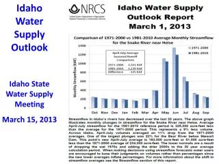
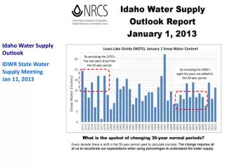
Download
1 / 29
290 likes | 403 Vues
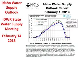
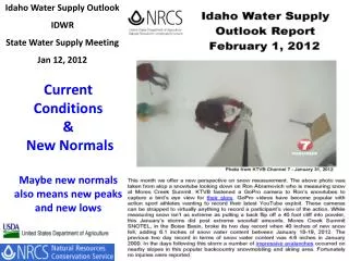
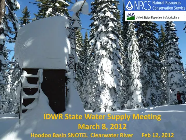
IDWR State Water Supply Meeting March 8, 2012 Hoodoo Basin SNOTEL Clearwater River Feb 12, 2012. Time is running out……. As of March 7 Snowpacks Range from : Lowest : Big Lost Today % of Peak 58% 47% Highest: N Panhandle & Clearwater

E N D
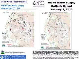
IDWR State Water Supply Meeting March 8, 2012 Hoodoo Basin SNOTEL Clearwater River Feb 12, 2012
As of March 7 Snowpacks Range from : Lowest : Big Lost Today % of Peak 58% 47% Highest: N Panhandle & Clearwater Today % of Peak 100% 87%
Chocolate Gulch Soil Temperatures WY2012 2” 8” 20” deep Minimum = -3.2 C = 26 F
Chocolate Gulch Soil Temperatures WY2011 2” 8” 20” deep Minimum = -1.5 C = 29 F
Chocolate Gulch Soil Temperatures WY2005 2” 8” 20” deep Minimum = -7.3 C = 19 F
The best analogsyears from Pete Parson’s are now: 2009, 1972, and 1968. Here’s what they reveal: Contact: ODF Meteorologist Pete Parsons at 503-945-7448 pparsons@odf.state.or.us http://oregon.gov/ODA/NRD/weather.shtml#Weather_forecasts
Owyhee River, March –July Runoff: 2012 Forecast 25% of Average 2011 Runoff 191% 1987 23%
Bruneau River March –July Runoff: 2012 Forecast 62% of Average 3 months with flow above 1000 cfs 2011 Runoff 191% 1968 44%
Measuring Creator Meadows SNOTEL Site NF Clearwater River Basin Feb 12, 2012 2012 Problems at SNOTEL Sites Mountain Meadows – Clearwater- Salmon basin divide: tree fell on top of 5 feet of snow covering snow pillow. Used winterized chainsaws to remove trees before snow melts that may puncture pillow.
Snow Pillow suddenly went flat Feb 25 Snow depth still OK . Possible leak in shelter under pillow/plumbing
This site at 8,330 feet is a challenge to: • Access and measure. • Edit due to wind allowing and snow water values to exceed year to date precipitation every year. • Use with caution this year. Pole Creek R.S. SNOTEL, Nevada
BOGUS BASIN Elev. 6340 ******************** Date, PST time SWE AIR Depth 12-03-05 00:00 16.8E 2.9 51.0 12-03-05 01:00 17.0 2.3 52.0 12-03-05 02:00 17.1 1.5 122.0S 12-03-05 03:00 17.0 1.5 122.0S 12-03-05 04:00 17.0 2.0 122.0S 12-03-05 05:00 17.0 1.8 122.0S 12-03-05 06:00 17.0 0.9 121.0S 12-03-05 07:00 17.0 1.1 51.0 12-03-05 08:00 17.0 1.9 51.0 12-03-05 09:00 16.9 8.0 -144.0S 12-03-05 10:00 17.0 6.3 1.0 Snow Depth Sensors
Four “shifts” downward. They occurred on 12/31, 1/22, 2/19, 2/26. • Each time the depth decreased ~10” . Looking at date/time of each shift, shows a pattern, with each occurring on Sundays around lunch, the weekend after a good snowfall. • Theory is snowmobilers are riding across the area under the depth sensor and packing the snow down. • On 2/19,removed 0.7 of SWE by possibly sliding/spinningtheir sleds/tracks on pillow.
Lochsa River Looking west-southwest towards Selway confluence Feb 12, 2012 Questions - Comments