Insights from Intensive Atmospheric Sampling: A Comprehensive Analysis of CO2 Variability
250 likes | 378 Vues
This document discusses the significance and findings of intensive atmospheric sampling field programs, particularly the CO2 Budget and Rectification Airborne Study (COBRA). It highlights the methods used to measure spatial variability of CO2 and other tracers, the impact on regional-scale flux assessments, and the effectiveness of model testing to improve atmospheric simulations. The research underscores the vital role of airborne observations in validating satellite data and thereby informing climate modeling and policy decisions.

Insights from Intensive Atmospheric Sampling: A Comprehensive Analysis of CO2 Variability
E N D
Presentation Transcript
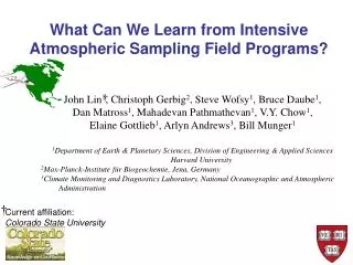
What Can We Learn from Intensive Atmospheric Sampling Field Programs? John Lin1, Christoph Gerbig2, Steve Wofsy1, Bruce Daube1, Dan Matross1, Mahadevan Pathmathevan1, V.Y. Chow1, Elaine Gottlieb1, Arlyn Andrews3, Bill Munger1 1Department of Earth & Planetary Sciences, Division of Engineering & Applied Sciences Harvard University 2Max-Planck-Institute für Biogeochemie, Jena, Germany 3Climate Monitoring and Diagnostics Laboratory, National Oceanographic and Atmospheric Administration Current affiliation: Colorado State University
Unique Value of Intensive Aircraft Sampling The ability to probe tracers both in the vertical and the horizontal at multiple scales, enabling: • Determination of spatial variability of CO2 and other tracers • Direct constraint of regional-scale fluxes from airmass-following experiments • Model testing: diagnosis of errors in atmospheric modelling (e.g., PBL ht, wind vectors, convection) • Validation of space-borne sensors
COBRA (CO2Budget & Rectification Airborne Study) COBRA 2000: www-as.harvard.edu/chemistry/cobra/ COBRA 2003: www.fas.harvard.edu/~cobra/ COBRA 2004 (Maine): www.deas.harvard.edu/cobra/ Supported by: NASA, NSF, NOAA, and DoE
“Coalition of the Willing” COBRA Participants: Steven C. Wofsy, Paul Moorcroft, Bruce Daube, Dan Matross, Bill Munger, V.Y. Chow, Elaine Gottlieb, Christoph Gerbig, John Lin: (Harvard University) Tony Grainger, Jeffrey Stith: (University of North Dakota) Ralph Keeling, Heather Graven: (Scripps Institution of Oceanography) Britton Stephens: (National Center for Atmospheric Research ) Pieter Tans, Peter Bakwin, Arlyn Andrews, John Miller, Jim Elkins, Dale Hurst: (Climate Monitoring & Diagnostic Laboratory) Dave Hollinger: (University of New Hampshire) Ken Davis: (Pennsylvania State University) Scott Denning, Marek Uliasz: (Colorado State University) Larry Oolman, Glenn Gordon: (University of Wyoming)
Determination of spatial variability of CO2 and other tracers • Direct constraint of regional-scale fluxes from airmass-following experiments • Model testing: diagnosis of errors in atmospheric modelling (e.g., PBL ht, wind vectors, convection) Lin, J.C., C. Gerbig, B.C. Daube, et al., An empirical analysis of the spatial variability of atmospheric CO2: implications for inverse analyses and space-borne sensors, Geophysical Research Letters, 31 (L23104), doi:10.1029/2004GL020957, 2004. Gerbig, C., J.C. Lin, S.C. Wofsy, B.C. Daube, et al.. Toward constraining regional-scale fluxes of CO2 with atmospheric observations over a continent: 1. Observed spatial variability from airborne platforms, J. Geophys. Res., 108(D24), 4756, doi:10.1029/2002JD003018, 2003.
Models of the Atmosphere Divide it Up into Many Individual Boxes (gridcells) For spatially heterogeneous field of CO2 concentration over land, there is can be large differences between an observation at a point location and the gridcell-averaged value. (“representation error”)
Aircraft Observations used in analysis of CO2Spatial Variability Latitude Longitude
Representation Error derived from Spatial simulation for CO2, based on Variogram error dependent on grid size (hor. resolution) and spatial variability of tracer CO2 [ppm] Representation error: Stdev(CO2) within each subgrid of size x y
Representation error: continent vs ocean COBRA-2000 PBL Pacific 0.15~3km Pacific 3~6km Pacific 6~9km
Determination of spatial variability of CO2 and other tracers • Direct constraint of regional-scale fluxes from airmass-following experiments • Model testing: diagnosis of errors in atmospheric modelling (e.g., PBL ht, wind vectors, convection) Lin, J.C., C. Gerbig, S.C. Wofsy, et al., Measuring fluxes of trace gases at regional scales by Lagrangian observations: Application to the CO2 Budget and Rectification Airborne (COBRA) study, J. Geophys. Res., 109 (D15304, doi:10.1029/2004JD004754), 2004.
Planning and Analysis of “Air-Following” Experimentsusing STILT Objective: test method for providing tight atmospheric constraint on fluxes in targeted regions UPSTREAM DOWNSTREAM direction of time, wind Mixed layer top CO2 Lin et al., “Measuring fluxes of trace gases at regional scales by Lagrangian observations”, J. Geophys. Res. [2004].
ME (daytime) UT14 (1) UT19 (2) log10[ppm/(mmole/m2/s)] Upstream CO2 (1) [ppmv] Downstream CO2 [ppmv] Upstream CO2 (2) [ppmv]
ME (daytime) Forest Cropland Fossil Fuel UT14 (1) UT19 (2) log10[ppm/(mmole/m2/s)] (a) CO2 Flux [mmole/m2/s] CO2 Flux [mmole/m2/s] Howland eddy covariance Observed Tot Modeled (c) (d) Optimized
Determination of spatial variability of CO2 and other tracers • Direct constraint of regional-scale fluxes from airmass-following experiments • Model testing: diagnosis of errors in atmospheric modelling (e.g., PBL ht, wind vectors, convection) Gerbig, C., J.C. Lin, S.C. Wofsy, B.C. Daube, et al., Toward constraining regional-scale fluxes of CO2 with atmospheric observations over a continent: 2. Analysis of COBRA data using a receptor-oriented framework, J. Geophys. Res., 108(D24), 4757, doi:10.1029/2003JD003770, 2003.
0 Caution: Potential Effect of Errors in Wind Fields UT18 UT22 Upstream CO2 [ppmv] Downstream CO2 [ppmv] Downstream CO [ppbv] Upstream CO [ppbv]
Conclusions and Future Steps • Intensive atmospheric observations provide unique information on the spatial variability of CO2 • Airmass-following experiments yield constraints on regional fluxes • The high-resolution atmospheric observations are valuable for improving models => Intensive atmospheric sampling is an important complement to the long-term observational network! (within context of coordinated research efforts such as the North American Carbon Program)
“Intensive aircraft campaigns during targeted periods that yield enhanced observations to evaluate the representativeness of long-term network observations and to develop modeling and analysis tools” North American Carbon Program
Intensive Atmospheric Sampling as Complement to Long-term Observational Network Inversion using intensive data + long term network ? = Inversion using long term network only
40 30 2g(h) [ppm2] 20 10 0 100 200 300 400 500 distance h [km] “Grain size” of atmospheric CO2: Variogram For pairs of locations xi, xj within a given “distance bin” and measured within 3 hours of each other 2g(h)=var(CO2(xi)-CO2(sj))
Improved Forecasting for Planning Lagrangian Experiments: using wind fields from multiple mesoscale models b) a) Lin et al, “Designing Lagrangian Experiments to Measure Regional-scale Trace Gas Fluxes”, Manuscript.
COBRA-2000 Large-scale Observations CO2 [ppm] Vegetation Condition Index (NOAA Environmental Satellite, Data, and Information Service) CO2 [ppm]
Large-scale “biospheric” CO2 signal Meas. CO2 [ppm] CO2 [ppm] Model zero conv. NORTH SOUTH CO2 [ppm] CO2 [ppm]
Large-scale “biospheric” CO2 signal Meas. CO2 [ppm] CO2 [ppm] Model excess. conv. NORTH SOUTH CO2 [ppm] CO2 [ppm]
Caution: Potential Effect of Errors in Wind Fields After adjustment to match tracer gradients Before adjustment UT18 UT18 UT22 UT22 CO2 Flux [mmole/m2/s] CO2 Flux [mmole/m2/s] Distance Along Cross-section [km] Distance Along Cross-section [km]