Ram Sethu, Sethumandir
290 likes | 548 Vues
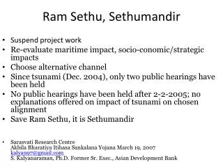
Ram Sethu, Sethumandir. Suspend project work Re-evaluate maritime impact, socio-conomic/strategic impacts Choose alternative channel Since tsunami (Dec. 2004), only two public hearings have been held

Ram Sethu, Sethumandir
E N D
Presentation Transcript
Ram Sethu, Sethumandir • Suspend project work • Re-evaluate maritime impact, socio-conomic/strategic impacts • Choose alternative channel • Since tsunami (Dec. 2004), only two public hearings have been held • No public hearings have been held after 2-2-2005; no explanations offered on impact of tsunami on chosen alignment • Save Ram Sethu, it is Sethumandir • Sarasvati Research CentreAkhila Bharatiya Itihasa Sankalana Yojana March 19, 2007kalyan97@gmail.comS. Kalyanaraman, Ph.D. Former Sr. Exec., Asian Development Bank
How Ram Sethu saved Bharatam coastline on Dec. 26, 2004 (computer simulation)
Google earth 2007 satellite image showing Dhanushkodi (India), Palk Strait (Globe2) and Ramar Bridge (Globe1) and Talaimannar (Srilanka) Ramar bridge Park Straits
Malabar Bowen map (1747) drawn by Netherlands shows Ramarcoil I (that is, Rama temple).
Ramar Bridge cited in map drawn by Joseph Parks, Australian Botanical explorer (1788) (Map in Sarasvati Mahal Lib., Thanjavur)
Ram Sethu renamed as Adam’s Bridge (by Colonial regime) • Map of 1804 called Ram Sethu asAdam’s bridge • This map was drawn by Rennell, the First Surveyor General of British India • Since 15th cent. all geographers have always referred to it as a BRIDGE connecting Dhanushkodi (Bharatam) and Talaimannar (Srilanka)
Ram Sethu as World Heritage site • Valmiki describes the construction of Sethu in detail. hastimaatraan mahaakaayaaH paaSaaNaamshca mahaabalaaH parvataamshca samutpaaTya yantraiH parivahanti ca Valmiki Ramayana 2-22-58Vaanara having huge bodies, with mighty strength uprooted elephant-sized rocks and mountains and transported them by mechanical contrivances (yantraih). • Vedavyasa refers to Nalasetu nalasetur iti khyāto yo 'dyāpi prathito bhuvi rāmasyājñāṃ puraskṛtya dhāryate girisaṃnibhaḥMBh. 3.267.45 .... which even today, popular on earth as Nala's bridge, mountain-like, is sustained out of respect for [Lord] Rama's command. (Nala was son of Vis’wakarma)
Strategic implications • The bridge area is close to region with Thorium sands of Kerala (the largest deposits known in the world) . • Explore the maritime zone for mineral resources to support Bharatam’s nuclear plans
Forster L, Forster P, Lutz-Bonengel S, Willkomm H, Brinkmann B (2002) Natural radioactivity and human mitochondrial DNA mutations. Proc Natl Acad Sci USA 99:13950-13954http://www.mcdonald.cam.ac.uk/genetics/images/kerala_lowres.jpg Close to Ramsethu, natural radioactivity from the black thorium sands of Kerala (India) is accelerating the DNA mutation rate in the local population. Most of these new mutations have hit the same DNA positions that have mutated naturally in at least the past 60,000 years of human evolution.
Importance of Thorium for Bharat • From BARC website: Thorium deposits - ~ 3,60,000 tonnes • The currently known Indian thorium reserves amount to 358,000 GWe-yr of electrical energy and can easily meet the energy requirements during the next century and beyond. • India’s vast thorium deposits permit design and operation of U-233 fuelled breeder reactors. • These U-233/Th-232 based breeder reactors are under development and would serve as the mainstay of the final thorium utilization stage of the Indian nuclear programme. http://www.barc.ernet.in/webpages/about/anu1.htm
India’s nuclear fuel reserves: explore near Ramsethu (ilmenite sands) • The US study can be downloaded from www.carnegieendowment.org/publications: Tellis notes that India reserves of 78,000 metric tons of uranium. • eight reactors allocating a quarter of their cores for the production of weapons-grade material, uranium needed would be: 19,965 to 29,124 tons. • two research reactors will need 938 to 1,088 tons. • These would yield India 12,135 to 13,370 kilograms of weapons-grade plutonium. • Thorium blanket as fuel will be the nuclear fuel of the future for Bharatam, which has the largest reserves of thorium in the world. .
THORIUM, a very rare metal, is a gray powder with metallic lustre which, heated in Air, burns with great splendour.Produces Thoria, snow-white whilst hot, yellow when cold. Thorium does not exist native, but combined with Silica in Thorite Found in Norway,and in min'ral Monascite.J. Carrington Sellars, Chemistianity, 1873, p. 156-157 • http://elements.vanderkrogt.net/images/thorite.jpg • Thorium was named after Thor, the mythical Scandinavian god of war. • The most important source of thorium is the mineral monazite. The largest reserves of thorium are in placer deposits. (A placer deposit is a deposit of heavy-mineral sands deposited by moving water.) Some thorium has been recovered from igneous veins and igneous carbonate deposits called carbonatites.
This is a mid-sea channel (unlike Panama and Suez Canals which are land-based) • A team of scientists from led by Dr.V.J.Loveson of the Council for Industrial and Scientific Research (CISR) New Delhi, studying placer deposits in the area, says an estimated 40 million tonnes of Titanium alone has been deposited in the entire stretch of 500 kilometer coastline. • Tsunami of Dec. 2004 has changed bathymetry (sea-depth) of the region • NIOT core samples should be subjected to detailed geological analysis for evaluation of mineral resources
Alternative alignments identified since 1961 (need reevaluation wrt tsunami) Kilakarai reef (red): s’ankha (Rs. 50 crore turn-over p.a.8000 yr old industry)Manali reef (blue): algae (ayurvedic drug) http://sethusamudram.gov.in
Strategic locus: Diego garcia, Trincomalee, Straits of Malacca • Bharatam has a geostrategic role in safeguarding the sea-lanes between Straits of Hormuz and Straits of Malacca. • The channel should be close to Pamban island and not close to Kaccha Tivu or the international waters (ocean border between Bharat and Srilanka) • Decide on alignment in consultation with coast guard, navy and nuclear & other security experts.
US Navy operational directive: historic waters, intl. waters • India's ClaimsARCHIPELAGIC, STRAIGHT BASELINES, & HISTORIC CLAIMS • Aug 76 Act No. 80 Enables government to declare waters as historic. Jun 79 Law No. 41Waters of Palk Bay between coast and boundary with Sri Lanka claimed as internal waters; waters of Gulf of Mannar between coast and maritime boundary claimed as historic waters.This claim is not recognized by the United States. U.S. conducted operational assertions in 1993 and 1994, to Gulf of Mannar claim in 1999.
Violation of due process • NEERI did NOT review the present alignment • NEERI (environment) and NIOT (sea-depth or bathymetry) reviews did NOT take into account impact of tsunami (which happened on Dec. 26, 2006, two years after NEERI evaluation) • PMO asked (March 8, 2005) for a review of tsunami impact • Raghupathy, Chairman, Tuticorin Port Trust gave a reply on 30 June 2005 (without consulting NEERI and NIOT) • On 2 July 2005 PM and Chairperson UPA inaugurate project at Madurai • PM should explain how he satisfied himself within two days the adequacy of the replies given by Raghupathy. • Why were the 16 questions raised by PMO NOT referred to NEERI and NIOT?
Present channel alignment: will it cope with a tsunami? Prof. Tad S Murthy says, NO.
Serious concerns raised by scientists about the present alignment • Prof. Tad S Murthy’s objections were cited in PMO’s letter of Jan. 2005 • Prof. Tad S Murthy is a tsunami expert who advised Govt. of India on tsunami warning system and edited Tsunami journal for over 20 years • He said: Change the mouth of the alignment (Bay of Bengal) norwestwards to avoid destruction of Kerala by next tsunami • Scientists say tsunami is likely to recur as in Japan and Hawaii. Japan has built protective coastal walls • Tsunami protective measures should become an integral part of the channel and the channel should be re-aligned
Prof. Tad S. Murthy’s views (1) The Tuticorin Port Trust, which is executing the channel project, does not think a realignment is necessary."(This) I absolutely disagree with. I have analysed the problem to my complete satisfaction," Murty maintained. He cited the example of the Alberni canal on Vancouver Island in British Columbia."The Sethusamudram canal has many characteristics similar to the Alberni canal, and this is the reason I am concerned. "In the March 28, 1964, Alaska earthquake tsunami, outside of Alaska the largest tsunami amplitude was at the head of the Alberni canal well inland and not at the open coast as everyone expected. Later, I explained this was due to (a phenomenon known as) quarter wave resonance amplification," Murty explained. • http://www.elaw.in/issue/sethu.htm
Prof. Tad S. Murthy’s views (2) • From: tad murty < tadmurty@gmail.com>Date: Feb 21, 2007 12:56 AM To: Kumar Chellappan <kumarchellappan@gmail.com > • Q. Could you be specific about the south Kerala angle in the eventuality of another tsunami?------ • A. During the Indian Ocean tsunami of 26th December 2004, the very southern part of Kerala was generally spared from a major tsunami, mainly because the tsunami waves from Sumatra region travelling south of the Sri Lankan Island, partially diffracted northward and affected the central part of the Kerala coast.Since tsunami is a long gravity wave (similar to tides and storm surges) during the diffraction process, the rather wide turn it has to take spared south Kerala coast. On the otherhand, deepening the Sethu Canal might provide a more direct route for the tsunami and this could impact south Kerala.In late 2005 I had a face to face discussion in Chennai during a very cordial meeting with Shri Raghupathy(I do not know his exact title, but he is the head of the project, to the best of my knowledge) during which I raised this point. I requested him to consider slightly re-orienting the entrance of the Sethu canal on the Bay of Bengal side, so that in future tsunami events, tsunami energy will not be preferentially funnelled into the Sethu canal. Shri Raghupathy assured me that he will look into this matter. When a senior IAS officer like Shri Raghupathy says something, I beleive him and I have no further concerns on this matter.
Heritage, Eco-wealthDhanushkodi washed away in 1964 Rama-paadam1220 m. mandapam Ramalinges’vara mandir(17th cent.) Coral reef
Summary • PMO’s 16 queries of Jan. 2005 should be evaluated by a multi-disciplinary team • Re-evaluate and choose from four previous alignments (no impact on Ramasethu (Adam’s Bridge) • Re-evaluate environmental and bathymetry reports based on impact of the last tsunami of Dec. 24, 2006 • Start maritime exploration to place Bharatam’s nuclear program on a self-reliant phase using thorium • Suspend channel work until this re-evaluation is completed • Respect peoples’ sentiments
Dredging status: 16 March 2007 No progress in Palk Bay II (40.68 kms.) Total dredging quantity: 20.95 m. cum http://sethusamudram.gov.in/Projectstatus.asp
What can be done? 1. PM to be asked to get a fresh evaluation done by NEERI and NIOT 2. Demonstrate the implications to: His Excellency President of India Hon’ble Chief Justice, Supreme Court Hon’ble Judge, Rames’waram Court 3. PIL in Supreme Court [The last PIL filed (June 2005) in Madras HC was not entertained stating: ‘…mega projects should not be stalled in the name of environmental concerns and directed that proceedings of the public hearings be immediately sent to the Union Environment Ministry.’) ] http://www.deccanherald.com/deccanherald/Jun292005/national1251322005628.asp 4. Issues related to impact of tsunami were NOT brought up in the the June 2005 PIL. 5. Create public awareness on the issues involved to force the government to re-evaluate and/or re-align the channel after consultations with multi-disciplinary teams. 6. Raise the issue in Parliament – as serious a world heritage concern as Ayodhya.