Download
1 / 39
390 likes | 527 Vues
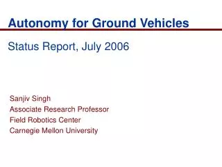
Sanjiv Singh Associate Research Professor Field Robotics Center Carnegie Mellon University. Autonomy for Ground Vehicles Status Report, July 2006. Automation of All Terrain Vehicles. Main issues: Path tracking Obstacle Detection at 4-6 m/s Reliable operation Low-cost system

E N D
Sanjiv Singh Associate Research Professor Field Robotics Center Carnegie Mellon University Autonomy for Ground VehiclesStatus Report, July 2006
Automation of All Terrain Vehicles Main issues: • Path tracking • Obstacle Detection at 4-6 m/s • Reliable operation • Low-cost system • Intuitive interface for • Teaching • Teleoperation • For conducting surveillance
Vehicles 2003 2004
Accomplishments (2003-2005) • Retrofitted 3 vehicles for autonomous operation • Helped design and Implemented general positioning solution • Designed and Implemented optimized design of laser scanner • Designed & implemented optimized electronics/power/computing package to support autonomy • Implemented path tracking at 6 m/s • Implemented method to detect “stuck condition” • Designed and Implemented collision avoidance merging data from two lasers scanners at 4 m/s • Designed and Implemented joint method of collision avoidance and path tracking. • Designed Implemented PDA control of vehicle and feedback of essential variables. • Designed and implemented method to plan smooth paths from via points specified on base station.
Issues for 2006 • Perception • Calibration • New interface for sweeping laser • Vegetation detection • Guidance • Varied Traversability • Learned parameters • Improvement for tight spaces like tunnels • Experimentation • New vehicle testbed
Calibration • New calibration method for calibrating relative pose of two laser scanners • Method was improved in Feb 2006.
New Interface to Sweep Laser • Current version
New Interface to Sweep Laser • New version
New Interface to Sweep Laser • Board replaces Sync box.
Vegetation Detection • In progress Classification into three components Example data shown to system
Vegetation Detection • In progress Classification into three components Example data shown to system
Vegetation Detection • In progress Classification into three components Example data shown to system
Varied Traversability • Tested in simulation Vehicle avoids vegetation when possible Vehicle drives over vegetation if necessary
Learned Parameters • Have added damping to decrease oscillations. Values are obtained from observation of human driving • Needs to be tested Vehicle oscillates when near many large obstacles New method (with damping) decreases oscillations
Improved performance for Dodger • For tight spaces with possible GPS shift
Comparison to other Algorithms • Compared with other methods
Experimentation • Testing on real vehicle is very important. Golf cart is not suitable for high speed experimentation • Will give us ability to try different configurations • Status: ready to test end of July, 2006
Potential Agenda • Done • Implementation of design with lower cost components • Smaller obstacle detection • Smoother steering • In progress • Navigation in cluttered environments • Immunity to small and medium vegetation • Immunity to GPS dropout • No plan yet • Road Following • Detection of moving obstacles • Immunity to large vegetation • Water/negative obstacle detection • All weather operation
DARPA Urban Challenge 2007 • Fully Autonomous operation in Urban Environments • Competition to complete mission of 100 km in less than 6 hours • Other moving vehicles will be present (no pedestrians) • Vehicle must • Plan route automatically/ Replan routes when road is blocked • Follow roads • avoid collisions with other vehicles • Stop accurately at stop signs • Pass stopped vehicles • Go through intersections • Park in parking spot • CMU will enter one vehicle in competition
Learned Parameters • New test vehicle has different steering characteristics than Grizzly • Learned parameters with damping for new vehicle • These are used in following vehicle tests
Preventing Off-Path States Detected obstacles with cost 1.0 • Add rows of obstacle points to keep vehicle closer to path • Vehicle is allowed to cross these points Border obstacles with cost 0.1 Border obstacles with cost 0.3 Border obstacles with cost 0.8
Planning Combined with Dodger • Previously: showed how planning helps prevent stuck situations • Planning only invoked when stuck state is predicted
Planning Combined with Dodger • Previously: showed how planning helps prevent stuck situations • Planning only invoked when stuck state is predicted • Planning every iteration improves this further • Helps deal with desired path offsets (GPS jumps/outages) • Better at finding tunnel openings • Shifts goal point to center of tunnels
Planning Combined with Dodger • Planning provides good direction for vehicle to go • Dodger provides: • smooth control • resistance to infeasible motions in the plan • another level of safety in obstacle avoidance
Planning Combined with Dodger Dodger uses plan, but drives smoothly and gives more space to obstacles Planned path is jagged, not achievable by vehicle
Planning Combined with Dodger • Show movies here: • Combination of movies taken at LTV on Friday • First three scenarios: MVI_0661 • Slalom (fourth): MVI_0667 • Wide and big slalom (fifth and sixth): MVI_0668 • Bonus footage: • 5 m/s complete loop: MVI_0669 • 6 m/s ¾ of the loop: MVI_0670 • Views from the vehicle: MOV05982, MOV05989 • dataReplayLoop.avi
Tunnels Desired path has jumped to side of tunnel.Planner shifts goal point away from the wall.
Tunnels • Regular operation: avoid obstacles that are meters away • In tunnels, walls are less than two meters away • Different set of parameters to track paths in a tunnel • Difficulty: When to switch parameter sets • Show movies here: • Tunnel movies from LTV: MVI_0678, MVI_0679 • dataReplayTunnel.avi
Terrain Classification • System should classify laser data based on: • Height • How much it looks like a 2-d surface • How much it looks like a 3-d cluster • Show system hand-labeled data • System learns classifier using the three attributes
Terrain Classification Results White: confident it’s ground • Tested on data taken at LTV Red: confident it’s not traversable Blue/purple: Classified as ground, but with low confidence Green: classified as not ground, confident it’s traversable
Terrain Classification Results Ground Fence and bushes Lowgrass Grass
Terrain Classification Results Cars Grass Road
Terrain Classification Results Garage wall
Terrain Classification Results Low grass Bush Grass
Terrain Classification Results Grass Grass Grass Grass Road
Terrain Classification Results • Small boxes (should be labeled ‘obstacle’) sometimes classified incorrectly Box classified as traversable
Terrain Classification Results • Small boxes (should be labeled ‘obstacle’) sometimes classified incorrectly • Need more training data with small obstacles