Download
1 / 13
130 likes | 688 Vues
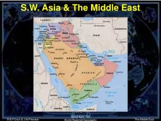
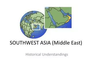
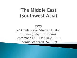
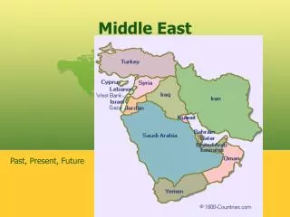
The Middle East (Southwest Asia). FSMS 7 th Grade Social Studies; Unit 2 Environmental Issues October 11th; Day 27 Georgia Standard SS7G6 ( a.b ). The Middle East Location, Climate, Physical Characteristics, Distribution of Natural Resources & Population. Standard

E N D
The Middle East(Southwest Asia) FSMS 7th Grade Social Studies; Unit 2 Environmental Issues October 11th; Day 27 Georgia Standard SS7G6 (a.b)
The Middle EastLocation, Climate, Physical Characteristics, Distribution of Natural Resources & Population Standard SS7G6 The student will discuss environmental issues across SWA. (a). Explain how water pollution and the unequal distribution of water impacts irrigation and drinking water.
FIRST FIVE Agenda Message: Before school tutoring is Tuesday starting at 7:30. CDA II is Friday, November 2nd. Standard: Explain how water pollution & the unequal distribution of water impacts irrigation and drinking water. E.Q.Monday; 10/29/12: What is the definition for irrigation? Why is it both good and bad when used in agriculture? Warm Up: List the four factors that influence economic growth and provide a brief definition for each factor. TODAY WE WILL • Quick Quiz make-ups/Parent Calls • Entrepreneur Review • Environmental Issues
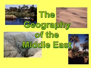
The Middle EastLocation, Climate, Physical Characteristics, Distribution of Natural Resources & Population Rivers (review) Three Major Rivers • Tigris River (Where does it flow?) • Euphrates River (Where does it flow?) • Jordan River (Where does it flow?) These three rivers are important because they furnish water for drinking and irrigation, as well as routes for transportation and trade for those who live along their routes. Many of the major cities in Southwest Asia are located on or near these rivers. These cities and towns are also centers of industry, because that is where workers can be found.
The Middle EastLocation, Climate, Physical Characteristics, Distribution of Natural Resources & Population Deserts Southwest Asia has a number of very large desert areas: • The great Syrian Desert shared between Syria and Iraq, and • The Rug al-Khali, or “empty quarter,” in southern Saudi Arabia. These deserts have historically provided Southwest Asia with natural barriers against invasion. They have also led to a way of life that developed around the need to survive in such harsh surroundings.
The Middle EastLocation, Climate, Physical Characteristics, Distribution of Natural Resources & Population Deserts cont. Some people have always managed to live in and around the desert. These people live in tent camps, surviving as sheep and camel herders. They also make their living by trading animals and handmade goods with towns on the desert’s edge. These people are known as “Bedouins,” or desert nomads (people who roam the desert in search of water and food), and their way of life is gradually disappearing.
The Middle EastLocation, Climate, Physical Characteristics, Distribution of Natural Resources & Population Climate The countries of Southwest Asia generally have a very hot and dry climate. (Climate is defined as the type of weather a region has over a very long period.) Four large bodies of water, the Mediterranean Sea, the Red Sea, the Persian Gulf, the Arabian Sea, border Southwest Asia. Even so, mountain ranges close to many of the coastal areas block rains coming from these bodies of water. The result is that much of the interior of Southwest Asia is desert.
The Middle EastLocation, Climate, Physical Characteristics, Distribution of Natural Resources & Population Climate cont. Because there are coastal areas as well as a number of large rivers, other parts of this region have enough water to support agriculture and towns and cities of significant size. Trade Southwest Asia is located between three major continents: • Europe • Africa, and • Asia. For this reason, the region has played a major role in trade among these continents through the centuries.
The Middle EastLocation, Climate, Physical Characteristics, Distribution of Natural Resources & Population Trade cont. Ships loaded with trade goods from Asia would travel to the coast of Southwest Asia. These goods would then be loaded onto caravans that traveled across the desert to the coast on the other side of Southwest Asia. Today the Suez Canal in Egypt links the Mediterranean Sea with the Red Sea and Indian Ocean, therefore making it possible to continue trade among the continents without having to use overland caravans.
The Middle EastLocation, Climate, Physical Characteristics, Distribution of Natural Resources & Population Farming (agriculture) Many people in Southwest Asia practice subsistence agriculture, growing small amounts of crops, to take care of their local needs. Because the climate is so dry, agriculture nearly always depend on irrigation, directing water from small rivers and streams to the farmer’s fields. There is some commercial agriculture (growing crops for industrial markets), but even that is limited by lack of water.
The Middle EastLocation, Climate, Physical Characteristics, Distribution of Natural Resources & Population Water Water is a critical resource in Southwest Asia, both as a source of life and as a route for trade. Because the Tigris and Euphrates rivers run through more than one country, access to the water has led to many political conflicts in recent years. Several countries have built dams along their portion of these rivers, to create lakes for irrigation and to generate hydroelectric power (electricity created using the energy of running water). Each dam cuts down on the amount of water available to the countries further downstream causing conflicts.
The Middle EastLocation, Climate, Physical Characteristics, Distribution of Natural Resources & Population Water cont. No agriculture or animal herding can take place without access to adequate sources of water. People in this region have used many creative ways to bring water to fields where it is needed, • Using water wheels and pumps powered by animals or electricity, • Digging wells, • Qanats(underground tunnels that bring water from the hills to dry plains), and • Building irrigation canals.
The Middle EastLocation, Climate, Physical Characteristics, Distribution of Natural Resources & Population Water cont. An additional problem comes with irrigation. • Irrigated land usually needs chemical fertilizers. • Repeated use of fertilizer eventually causes salts to build up in the soil, making it hard to grow anything. Many places in Southwest Asia have been irrigated for many years. As a result, these farming areas no longer produce crops as well as they once did. This condition is called soilpollution.