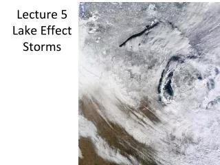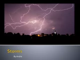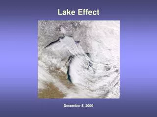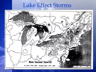
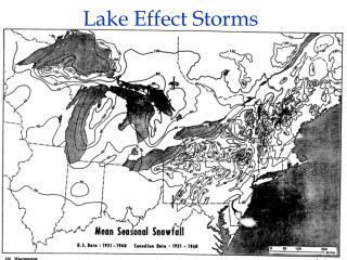
Lake Effect Storms
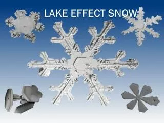
Lake effect storms occur when cold air moves over warmer lake waters, leading to steam fog and intense precipitation. This phenomenon involves complex interactions between heat and moisture fluxes, creating various storm types, such as shore and wind/shear parallel bands. Notably, shore parallel bands are capable of producing heavy snow, often affecting localized regions. The study of these storms is crucial, as they can result in severe weather conditions, impacting areas like Buffalo, NY, and Gary, Indiana. Insights into predicting these storms enhance preparedness for their potential impacts.

Lake Effect Storms
E N D
Presentation Transcript
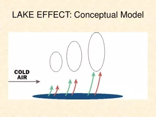
Cold Air Moving Over Water Surface – Steam Fog • Cold air off continent moves over relatively warm water surface • Fluxes of heat and moisture from water into air (bulk formulae):
Lake Effect Storm Types • Wind/Shear Parallel Bands • Shore Parallel Bands • Shore based • Midlake • Mesoscale Vortex
Shore Parallel Bands • Land breeze mesoscale circulation • Deeper than wind parallel bands ( up to 4 km AGL) • Very intense precipitation over a small area • May be short lived or last several days
Shore Parallel Bands • Wind blows roughly parallel to major axis of lake • Air warms from heat flux from water creating a strong land-water air temperature contrast • Land Breeze is created forcing a land breeze front and meso-beta scale convergence • Meso-beta scale lifting of air to as high as 4 km AGL (compared to 1 km AGL for wind parallel bands) along land breeze front (s) • Land breeze fronts usually combine into single convergence line • Parallel to shoreline of lake • Pushed to downwind shoreline when winds are not completely parallel to shoreline • Down center of lake when winds are exactly parallel to shoreline of lake
Shore Parallel Bands • Most intense snows of all the different lake-effect snow types, because: • Concentrates all of the absorbed moisture and heat along a single narrow band • Mesoscale lifting deepens the system to several kilometers allowing precipitation processes to be more efficient • Colder than –20 C • Deeper layer Bergeron – Findeisen Process • Bands extend off shore and drop massive amounts of snow over small region • Buffalo, NY (Lake Erie, WSW wind) • Gary, Indiana (Lake Michigan, Northerly wind)
Wind or Shear Parallel Bands • Rayleigh Benard Instability • Relatively shallow, i.e. depth of Boundary Layer • So shallow, often can not form a viable precipitation process • Long periods of light snow
Visible Satellite Loop • Cloud rolls over water • Spectacular Cloud streets over land • Effect of lake shoreline • Gravity waves perpendicular to flow 1704 UTC - 1748UTC
Shore Parallel Bands • Most intense snows of all the different lake-effect snow types, because: • Concentrates all of the absorbed moisture and heat along a single narrow band • Mesoscale lifting deepens the system to several kilometers allowing precipitation processes to be more efficient • Colder than –20 C • Deeper layer Bergeron – Findeisen Process • Bands extend off shore and drop massive amounts of snow over small region • Buffalo, NY (Lake Erie, WSW wind) • Gary, Indiana (Lake Michigan, Northerly wind)
Predicting Wind Parallel Lake Effect Storms • Lake temperature minus 850 mb temperature >13C • Wind fetch >100 km • Wind speed moderate to high, i.e. >10 m/s
Predicting Shore Parallel Lake Effect Storms • Wind nearly parallel to long axis of lake • Lake temperature minus 850 mb temperature >13C (can occur with less temperature contrast) • Wind speed light to high, i.e. > 5 m/s