Download
1 / 22
220 likes | 237 Vues
Remote Sensing of Water Properties Using the SWIR-based Atmospheric Correction Algorithm. Acknowledgements Supports from NOAA/NASA funding, NASA SeaBASS in situ data, in situ data from Lake Taihu ( J. Tang and Y. Zhang ), and MODIS Level 1B data. Menghua Wang Wei Shi and SeungHyun Son

E N D
Remote Sensing of Water Properties Using the SWIR-based Atmospheric Correction Algorithm AcknowledgementsSupports from NOAA/NASA funding, NASA SeaBASS in situ data, in situ data from Lake Taihu (J. Tang and Y. Zhang), and MODIS Level 1B data. Menghua Wang Wei Shi and SeungHyun Son NOAA/NESDIS/STAR E/RA3, Room 102, 5200 Auth Road Camp Springs, MD 20746, USA Menghua.Wang@noaa.gov MODIS Science Team Meeting Marriott Inn/Conference Center, College Park, Maryland, May 18-20, 2011
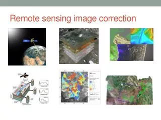
Atmospheric Correction:SWIR Bands(Wang & Shi, 2005; Wang, 2007) • At the shortwave infrared (SWIR) wavelengths (>~1000 nm), water has much stronger absorptions. Thus, atmospheric correction (Gordon & Wang, 1994) can be carried out for coastal regions with the black pixel assumption at the SWIR bands. • Water absorption for 869 nm, 1240 nm, 1640 nm, and 2130 nm are 5 m-1, 88 m-1, 498 m-1, and 2200 m-1, respectively. • MODIS has three SWIR bands at 1240, 1640, and 2130 nm, designed for atmosphere and land applications. • We use the SWIR band for the cloud masking. This is necessary for coastal region and inland lake waters. • Require sufficient SNR characteristics for the SWIR bands and the SWIR atmospheric correction has slight larger noises at the short visible bands (compared with those from the NIR algorithm). 2
nLw(443)Scale: 0.-3.0 (mW/cm2m sr) NIR-SWIR Data Processing July, 2005 Chlorophyll-a0.01-10 (mg/m3)(Log scale) Wang, M., S. Son, and W. Shi (2009), “Evaluation of MODIS SWIR and NIR-SWIR atmospheric correction algorithms using SeaBASS data,” Remote Sens. Environ., 113,635-644. NIR-SWIR Data Processing July, 2005
Results from Inland Lake Taihu Using the SWIR algorithm, we have derived the water optical properties over the Lake Taihu using the MODIS-Aqua measurements during the spring of 2007 for monitoring a massive blue-green algae bloom, which was a major natural disaster affecting several millions residents in nearby Wuxi city. Wang, M. and W. Shi (2008), “Satellite observed algae blooms in China’s Lake Taihu”, Eos, Transaction, American Geophysical Union,89, p201-202, May 27. Wang, M., W. Shi, and J. Tang (2011), “Water property monitoring and assessment for China’s inland Lake Taihu from MODIS-Aqua measurements”, Remote Sens. Environ., 115, 841-854. • The work was featured in the NASA 2008 Sensing Our Planet (http://nasadaacs.eos.nasa.gov/articles/2008/2008_algae.html) 5
Geo-location of Lake Taihu Extremely Turbid Waters • The third largest fresh inland lake in China (~2,250 km2). • Located in one of the world’s most urbanized and heavily populated areas. • Provide water resource for several million residents in nearby Wuxi city.
Methodology (1) • The SWIR atmospheric correction algorithm (Wang, 2007; Wang & Shi, 2005) is used for the water property data processing. • Since MODIS 1240 nm band is not always black for the entire Lake Taihu, we have developed three-step method in the data processing for each MODIS-Aqua data file: • First, regions for the black of 1240 nm band are determined using the SWIR data processing. • Second, a dominant aerosol model from the region with black of 1240 nm band is obtained, and • Finally, with the derived aerosol model, the SWIR atmospheric correction algorithm is run using only 2130 nm band (with fixed aerosol model). • The Lake Taihu water property data are then derived. Wang, M., W. Shi, J. Tang (2011), “Water property monitoring and assessment for China’s inland Lake Taihu from MODIS-Aqua measurement,” Remote Sens. Environ., 115,841-854.
Validation Results for MODIS-derived Water-leaving Radiance Spectra
Methodology (2) • Black pixel assumption at the SWIR 1640 and 2130 nm is generally valid for Lake Taihu. • The SWIR atmospheric correction algorithm using bands 1640 and 2130 nm (Wang, 2007) can be used for the water property data processing. • However, for MODIS-Aqua, four out of ten detectors for the SWIR 1640 nm band are inoperable (dysfunctional). • We focus on deriving seasonal results for the lake using the SWIR 1640 and 2130 nm atmospheric correction algorithm. • More in situ data (five seasonal cruises in 2006-2007 in the lake) are also available to us now.
Validation Results for MODIS-derived Water-leaving Radiance Spectra
Spring Summer Fall Winter
Seasonal Histograms in nLw(1240) TOA Radiance at 1240 nm ~0.1 mW cm-2 um-1 sr-1
Climatology Histogram in nLw(1240) TOA Radiance at 1240 nm ~0.1 mW cm-2 um-1 sr-1
Conclusions • For the turbid waters in coastal regions and inland lakes, it has been demonstrated that the SWIR bands can be used for atmospheric correction. • Future ocean (water) color satellite sensor needs to include the SWIR bands with sufficient SNR values for cases with turbid waters. 20