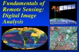
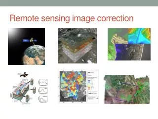
Remote sensing image correction
Remote sensing image correction. Introductory readings – remote sensing http://www.microimages.com/documentation/Tutorials/introrse.pdf. Preprocessing. Digital Image Processing of satellite images can be divided into: Pre-processing Enhancement and Transformations

Remote sensing image correction
E N D
Presentation Transcript
Introductory readings – remote sensing http://www.microimages.com/documentation/Tutorials/introrse.pdf
Preprocessing • Digital Image Processing of satellite images can be divided into: • Pre-processing • Enhancement and Transformations • Classification and Feature extraction • Preprocessing consists of: radiometric correction andgeometric correction
Preprocessing • Radiometric Correction: removal of sensor or atmospheric 'noise', to more accurately represent ground conditions - improve image‘fidelity’: • correct data loss • remove haze • enable mosaicking and comparison • Geometric correction: conversion of data to ground coordinates by removal of distortions from sensor geometry • enable mapping relative to data layers • enable mosaicking and comparison
Landsat ETM+ scan line corrector (SLC) – failed May 31 2003http://landsat.usgs.gov/products_slc_off_data_information.php SLC compensates for forward motion of the scanner during scan
Geometric Correction Corrected image scene orientation ‘map’ Uncorrected data ‘path’ Pixels and rows
Group discussion • Why is rectification needed for remote sensing images?
Why is rectification needed • Raw remote sensing data contain distortions preventing overlay with map layers, comparison between image scenes, and with no geographic coordinates • To provide georeferencing • To compare/overlay multiple images • To merge with map layers • To mosaic images • e.g.google maps / google earth • *** Much imagery now comes already rectified … YEAH !!
Image distortions In air photos, errors include: topographic and radial displacement; airplane tip, tilt and swing (roll, pitch and yaw). These are less in satellite data due to altitude and stability. The main source of geometric error in satellite data is satellite path orientation (non-polar)
Geocorrection Rectification – assigning coordinates to (~6) known locations - GCPs GCP = Ground Control Point Resampling - resetting the pixels (rows and columns) to match the GCPs
Rectification • Data pixels must be related to ground locations, e.g. in UTM coordinates • Two main methods: • Image to image (to a geocorrected image) • .... to an uncorrected image would be 'registration' not rectification • Image to vectors (to a digital file).... • (black arrows point to known locations • - coordinates from vectors or images) • Ortho-rectification = this process (since ~2000) enables the use of a DEM to also take into account the topography
New DN values are assigned in 3 ways a.Nearest Neighbour Pixel in new grid gets the value of closest pixel from old grid – retains original DNs b. Bilinear Interpolation New pixel gets a value from the weighted average of 4 (2 x 2) nearest pixels; smoother but ‘synthetic’ c. Cubic Convolution (smoothest) New pixel DNs are computed from weighting 16 (4 x 4) surrounding DNs Resampling methods http://www.geo-informatie.nl/courses/grs20306/course/Schedule/Geometric-correction-RS-new.pdf
Resampling http://www.geo-informatie.nl/courses/grs20306/course/Schedule/Geometric-correction-RS-new.pdf Good rectification is required for image registration – no ‘movement between images
Canadian Arctic mosaic See also google maps, lrdw.ca/imap etc..
Northern Land Cover of Canada – Circa 2000 http://ccrs.nrcan.gc.ca/optical/landcover2000_e.php
Striping from projecting SRTM data, from Lat/long to UTM; Chile
Now for something completely different – perfect registration needed…. 100% Marilyn Monroe -> 100% Margaret Thatcher