Download
1 / 14
140 likes | 244 Vues
Explore mountain meteorology research using TODWL data presented at the 2012 WG meeting in Boulder. Investigate complex terrain flow and nocturnal flows, supported by ARO funding ferry flights. Gather data on aerosols, fluxes, surface temperature, and wind profiles with the Twin Otter aircraft. Evaluate EDMF parameterization over land and organized structures. Support MATERHORN IOPs and pursue UPP objectives with ONR support. Comb through TODWL data products for easterly legs and conical scans to prospect structures and acquire nadir profiles. Validate WRF model with flights over Granite Mountain and Ruby Mountains, studying various weather patterns over the study area. Utilize UAVs, tethered balloons, and ground-based instruments for comprehensive mountain meteorology research.

E N D
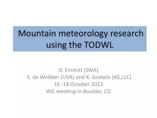
Mountain meteorology research using the TODWL D. Emmitt (SWA) S. de Welkker (UVA) and K. Godwin (KG,LLC) 16 -18 October 2012 WG meeting in Boulder, CO
CIRPAS Twin Otter at MATERHORN • ARO (Videen) funding ferry flights from Monterey and 10 hours on site. • Support MATERHORN IOPs • Provide 3D context for complex terrain flow • ONR(Ferek) allowing 10 -15 UPP flight hours to be used at GMAST. • Pursue UPP objectives with evaluation of EDMF parameterization over land in the presence of organized structures; nocturnal flows
CIRPAS Twin Otter • Aerosols (probes) • Fluxes • Surface temperature • Wind profiles • Aerosol profiles
Flight profile • Aircraft is based out of U42 (current plan) • ~ 30 minute to Granite Mountain • climb to 12K feet (~5K feet above peaks) • Twin Otter in Utah between 5 Octoberand 18October • Missions last~ 4 hours • 7 missions • 12 hour rules for pilots apply • 12 hours on call • 12 hours between “on calls”.
Easterly Leg 3 Easterly Leg 2 Easterly Leg 1
TODWL data products • Downward conical scans (12 point step stare) • Off-nadir angle of 20 degrees • 20 -25 seconds for full 360 scan ( ~ 1 -1.2km) • U,V,W with 50 m vertical resolution • Sigma (U,V) ~ .10 m/s ; Sigma (W) ~ ?? • SNR (aerosols) • Nadir samples • 5 seconds between conical scans • 50 m vertical resolution with sigma(w) ~ .10m/s` • Structure prospecting • Straight ahead and down 3 -6 degrees
Data to date • 4 hours of nadir profiles between Monterey and SLC from 12 -14k feet. • Excellent triple pass over Ruby Mt with 50m/s winds aloft and significant lee waves. Great case study for validating WRF model. Rawinsonde support from Elko. • 5 flights over Granite Mountain with several hours flown at differing heights in the BL to measure fluxes with TODWL providing the context.
Ruby Mountains (waves) Granite Mtn
Summary • Weather patterns provided several different flow patterns over study area (Dugway Proving Grounds) • TODWL performed well • Other data provided by UAVs, tethered balloon, ground-based DWLs, instrumented towers, rawinsondes and smoke releases. • TODWL data will support model (WRF/NCAR and WRF/Pu) validation and development.