Download
1 / 34
340 likes | 459 Vues
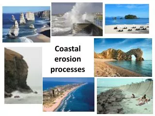
Preserving the legacy of research at Barrow through cyberinfrastructure. Enhancing collaboration for sustainable development with local stakeholders.

E N D
baid.utep.edu • web apps - DGPS surveys - met stations - wetlands mapping • coastal erosion - decision support - local expertise & capacity Allison Gaylord nunatech@usa.net
Preserving the legacy of research at Barrow 1973 2000 2008
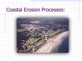
Research Sites and Instrumentation • Initiated in Microsoft Access in 2000. • Data collection sites with info on investigators, site name, project title, lat / long, URLs, grant number, data links, web site, start date/end data, keywords, etc. • Visualizes the location of research projects (1947-2008) funded by NSF and other agencies (9,800+), plus ancillary layers
…data collection sites, with links to project info Arctic Research Logistics Support Service Directory of Arctic Researchers Photos
Funding Focus Audience Area of interest NSF Preserve the legacy of research at Barrow through cyberinfrastructure Academic scientist,local stakeholders Barrow based data collection activities CIAP Applied/directed research: Sustainable community development Local land managers Barrow Area (UIC Lands) Complementary, parallel efforts Both kicked off in mid-2013
The Team CIAP NSF Lars Nelson and Qaiyaan Aiken Craig Tweedie, and students Craig Tweedie, postdoc, and students Allison Gaylord Allison Gaylord William Manley, Leanne Lestak NSIDC, Julia Collins
Renewal Award Funded by NSF BAID “This project will continue to develop an end-to-end operational cyberinfrastructure (CI) that provides users with tools and systems for sustained access and analysis of current and diverse information and data about the Barrow area. Our overarching goal is to enhance virtual scientific and other collaboration and to meet the current and growing needs of our user community through the maintenance, development of the Barrow Area Information Database”
BAID Objectives: • Continue to liaise with users to identify, prioritize and meet their needs for field data collection, data layer generation, and DGPS surveys and mapping support. • Maintain the existing suite of BAID applications and develop a new mapping application that will update the former BAID Internet Map Server (BAID-IMS) to offer a faster, user-friendly web interface with improved scalability, functionality and stability. • Update aging hardware supporting BAID. • Improve the interoperability of BAID with other Arctic data and CI through improved work flows, web services, and use of controlled vocabularies • Establish direct links from BAID to external data at the NSIDC and develop, test and establish a range of protocols that will enable CI like BAID to link to data archived at such data centers. • Train the next generation of environmental and computer scientists at a leading minority-majority university and conduct extensive education and outreach to advertise BAID and better inform and train the BAID user community.
Web Mapping Application Improve upon the old BAID • new fast, stable, and intuitive interface • new map layers • more functionality • decision making tools
Met Stations Installed in test mode with lower sampling rate this first winter Plan to support output in multiple data formats Beta data visualization for AGU Soil Temp / MoistureLeaf WetnessPrecipitationWindspeed / DirectionAir Temp / Moisture Solar Radiation-PAR
Interoperability Provide “data collection sites” to other efforts ADIwg Project metadata schema for ISO, use ADIwg translator Publish OGC webservices Hope to integrate with other North Slope Met stations
New Project (CIAP) BAID Decision Support Tools Development Goal: “Expand capacity for informed, multi-stakeholder environmental decision making on Ukpeaġvik Iñupiat Corporation lands in the coastal zone near Barrow, Alaska.”
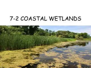
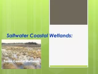
BAID Decision Support Tools Development Objectives: • Develop a high spatial resolution map of wetlands and conduct coastal erosion studies • Expand on an existing web mapping application to develop a new interactive decision support tool for erosion monitoring and coastal development and land management • Develop an office with newly trained staff in Barrow capable of improved local mapping and analytical capabilities
2002 QuickBird imagery New Satellite Imagery • -new 2013 WorldView-2 imagery • -50cm resolution • -entire UIC area • -basis for wetlands map and coastal erosion studies • -ground control points used for orthorectification of satellite imagery surveyed with DGPS.
NPR-A Landcover New Wetlands Map Layer • new 2013 data layer • 50 cm resolution • entire UIC area • wetlands and other land cover classes
New vegetation classification scheme built from plot based species cover and abundance data • 250 new vegetation survey sites were established in 2013; will be used as training classes
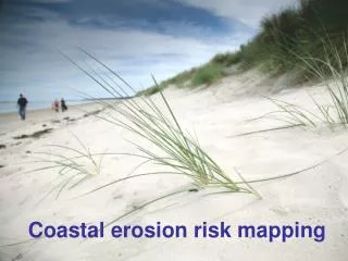
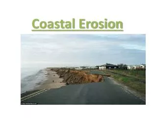
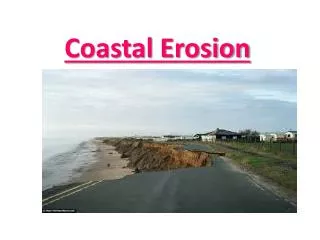
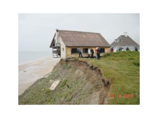
Coastal Erosion Mapping 84 km coastline (all but 7 km captured in 2013) Shoreline Reference Features -bluff edge -waterline -coastal engineering Long term monitoring sites on Elson Lagoon
Wetlands and Coastal Erosion Historic Imagery 1948
Coastal Erosion Analysis • Add new shorelines • analyze rates of erosion • Identify areas of greatest impact • NOAA Digital Shoreline Analysis System
Web Mapping Application Erosion Assessment Tool • Help assess vulnerability • Take advantage of digital shorelines and other data layers • land cover type, bathymetry, sea ice, etc. • Potentially with “widgets” to interactively customize analysis of erosion rates • Help enable sustained community development
New Web Mapping Application (Mock up) BAID Home Research Community Time Slider Ice Viewer Erosion Sustainable Development Zoom to… Barrow Peninsula Shoreline o Bluff Edgeo Waterline ToolsDraw Measure Plot XY Save Share Topography Distance from Shore Land Cover Show 2013 imagery Transportation Calculate Erosion (wizard) 1. Select Area 2. Select Years 3. View Results > Back Learn more
Web Mapping Application Community Development Tool • To assist with NSB and community tasks • coastal development, conservation priorities, endangered and subsistence species protection, oil spill response, planning and zoning for vulnerable areas, etc. • Visualize and synthesize from map layers and other input • existing development, infrastructure, land ownership, wetland types, habitat preference for endangered wildlife, height above sea level, etc. • Provide specific output for printing or saving maps, information, and reports • Help enable sustained community development
Kenai Decision Support Tool North Slope Decision Support System
Local Expertise & Capacity Handbook and Outreach • Advisory Council and community presentations • Training for implementation • Decision Support Tools Handbook • Build local capacity
Community Feedback Development of this resource is just beginning … Lars NelsonBarrow Office ManagerUmiaq • Feedback and expert guidance at this early stage is critical to ensure it will be helpful. • Useful? • How could this be applied in workflows for decision making? • Specific recommendations for the tools? • Where are the most important areas?
Next Steps • New website • Acquire/Orthorectify WorldView2 imagery • Create wetlands map • Analyze coastal surveys to determine erosion rates • Provide access to data from Met stations • Phased software development • iterative process • periodic opportunities for stakeholder feedback • a focus on tool development and refinement • Advisory Council meetings
Project Objectives BAID and NSSI different but complementary, synergistic efforts ...
Opportunities for collaboration? BAID contributions to NSSI Data Catalog: Wetlands Vegetation plots Erosion data GCPs Data collection sites Improved locations for project areas Tie into North Slope network of met stations 2013 WV2 partner for license uplift? = Better imagery coverage for Barrow Peninsula in the AlaskaMapped BDL
Additional Feedback Appreciated Visit: baid.utep.edu Email: nunatech@usa.net This study is funded with qualified outer continental shelf oil and gas revenues by the Coastal Impact Assistance Program, Fish and Wildlife Service, U.S. Department of the Interior and the National Science Foundation
High Res Imagery for Time Slider coverage (requested for community development tool) Orthorectified imagery of the Barrow Peninsula WorldView2 (pending) 2011 SPOT5 2002 Quickbird 2001 IKONOS 1997 Aerometric photography1984 Aerometric1979 AHAP1964 CRREL 1962 CRREL1955 USGS1948 NARL BAR Various Landsat scenes..Other?
ADIwg “Project” Metadata Common Fields • Project title • Project start date • Project end date • Current status • Last updated • Keywords • Place key words • Primary Contact • Information Contacts • Conducting Entity • Regions • Boundaries (N,S,E,W) • Abstract • Short Project Description • Web Links • Metadata Steward • Note • Data Availability • Access Limitations • Publications • Global Unique ID • Primary Agency Code • Primary Agency Project ID • Metadata Agency Code • Metadata Agency Project ID • Host Agency Code • Host Agency Project ID • Type of Site • Spatial Resolution • Timestamp ** Proposed additions to accommodate data collection sites