Download
1 / 17
170 likes | 312 Vues
Geostationary Coastal Waters Imaging as a Component of IOOS. Curtiss O. Davis College of Oceanic and Atmospheric Sciences Oregon State University, Corvallis, Oregon 97331 cdavis@coas.oregonstate.edu W. Paul Bissett Florida Environmental Research Institute Tampa, Florida.

E N D
Geostationary Coastal Waters Imaging as a Component of IOOS Curtiss O. Davis College of Oceanic and Atmospheric Sciences Oregon State University, Corvallis, Oregon 97331 cdavis@coas.oregonstate.edu W. Paul Bissett Florida Environmental Research Institute Tampa, Florida
Presentation Outline The coastal ocean is a complex and dynamic system. It will require continuous in situ sampling, frequent high resolution remote sensing data and high resolution coupled physical, bio-optical models to adequately describe coastal ecosystem dynamics. • Current and planned ocean color sensors in low earth orbit will not provide the required coverage. • Ocean color measurements from geostationary orbit can provide frequent imaging of coastal waters: • Sample frequently enough to resolve tidal dynamics, Track blooms, oil spills, etc. • Coastal Ocean Applications and Science Team (COAST) • Monterey Bay September 2006 experiment • Demonstration data set for algorithm development • Tracking a Harmful Algal Bloom (HAB) • Using Geostationary Ocean color data with IOOS data and coastal ocean models • Summary
What we expect to have in 2010 Visible Infrared Imaging Radiometer Suite (VIIRS) • Being built by Raytheon SBRS • SeaWiFS, MODIS heritage • First flight on NPOESS Preparatory Project (NPP) in 2008 then NPOESS satellites starting in 2011 • Seven ocean color channels and 2 SST channels • Approximately 1 km GSD ocean color • 742 m GSD and Nadir, 1092 m at +/- 850 km, 1597m at End of Scan (+/- 1500 km) • Designed to meet global ocean imaging requirements at 1 km GSD • Maximum revisit frequency of twice a day at 1030 and 1530
Why we need a Geostationary imager for coastal ocean dynamics • Tides, diel winds (such as the land/sea breeze), river runoff, upwelling and storm winds drive coastal currents that can reach several knots. Furthermore, currents driven by diurnal and semi-diurnal tides reverse approximately every 6 hours. • Daily sampling at the same time (e.g. MODIS and in the future VIIRS) cannot resolve tides, diurnal winds, etc. • Frequent sampling to resolve tides from a geostationary platform and will provide the management and science community with a unique capability to observe the dynamic coastal ocean environment. • Higher spatial resolution (300 m vs. 1000 m) • Additional channels to measure solar stimulated fluorescence, suspended sediments, CDOM and HABs. Example tidal cycle from Charleston, OR. Black arrows VIIRS sampling, red arrows HES-CW sampling. These improvements are critical for coastal waters.
Enhanced spatial resolution required to resolve coastal features 1 km MODIS Sept 9, 2006 - Chlorophyll 250m Monterey Bay, CA images from Bob Arnone, NRLSSC
COAST and Risk Reduction Activities • The Coastal Ocean Applications and Science Team (COAST) was created in August 2004 to support NOAA to develop coastal ocean applications using geostationary ocean color measurements: • Mark Abbott, Dean of the College of Oceanic and Atmospheric Sciences (COAS) at Oregon State University is the COAST team leader, • COAST activities are managed through the Cooperative Institute for Oceanographic Satellite Studies (CIOSS) a part of COAS, Ted Strub, Director • Curtiss Davis, Senior Research Professor at COAS, is the Executive Director of COAST. • Initial activity to evaluate geostationary ocean color requirements and suggest improvements • Beginning in 2006 conduct field experiments to collect example data that can be used for evaluating requirements and developing algorithms for the geostationary ocean color measurements for the coastal ocean. • COAST will support NOAA through GOES-R Risk Reduction activities and Algorithm Working Groups to develop requirements, algorithms and models for using geostationary ocean color data.
Monterey Bay September 3-16, 2006Experiment Plan • Monterey Bay has long-term physical, biological and optical monitoring • Links to data at http://www.cencoos.org • Intensive effort for 2 weeks to assure that all essential parameters are measured: • Supplement standard measurements at the site with shipboard and glider measurements of water-leaving radiance, optical properties and products expected from HES-CW algorithms, • Additional atmospheric measurements as needed to validate atmospheric correction parameters, • As needed, enhance modeling efforts to include bio-optical models that will utilize HES-CW data (NRL). • Aircraft overflights for at least three clear days and one partially cloudy day (to evaluate cloud clearing) during the two week period. • High altitude to include 90% or more of the atmosphere • 30 min repeat flight lines for up to 6 hours to provide a time series for models and to evaluate changes with time of day (illumination, phytoplankton physiology, etc.) • All data to be processed and then distributed over the Web for all users to test and evaluate algorithms and models.
SAMSONSpectroscopic Aerial Mapping System with On-board Navigation • The Florida Environmental Research Institute (FERI) has developed a low-cost, robust HyperSpectral Imager, the Spectroscopic Aerial Mapper with On-board Navigation (SAMSON). • SAMSON provides for a full HSI dataset 256 bands in the VNIR (3.5 nm resolution over 380 to 970 nm range) at 75 frames per second, with a SNR, stability, dynamic range, and calibration sufficient for dark target spectroscopy. • Data sampled at 5 m GSD and binned to 100, 300, 375 and 500 m to evaluate need for higher GSD. • Binned data will have SNR in excess of 1000:1 – noise will be added to simulate lower SNR data.
A red tide incubator in Monterey Bay? 2004 red tide Image from R. Kudela 2005 Red Tide 2002 red tide MERIS satellite imagery, 9/17 J. Gower, IOS, Sidney BC Image from P. Bissett • Physical, chemical and biological influences in this region: • In the upwelling shadow (stratification) • Downstream of Elkhorn Slough plume (stratification, nutrients, dinoflagellate seed populations)
709 nm is ideal channel for Monterey Bay HABs • Harmful Algal Bloom in Monterey Bay threatens beach areas. • Bloom near coast and on the order of 2 x 5 km would not be resolved in 1 km VIIRS data. • Additional channels on HES-CW aid bloom identification. • PHILLS-2 airborne hyperspectral data from Paul Bissett, Florida Environmental Research Institute. (October 2002 Ceratium spp. bloom)
September 12, 2006Grid 03: 10:07 - 10:32 709 nm channel used to identify HAB Primary species Akashiwo sanguinea FERI SAMSON data
Calibrated radiances at the sensor Raw sensor data Water Leaving Radiances Calibration Atmospheric Correction Optical properties Algorithms In-Water Optical Properties now-cast and forecast models Applications and products Data assimilation into models Product models and algorithms Education and outreach Users HES-CW Data flow and Risk Reduction Activities Connection to IOOS
COAST Risk Reduction Plans: Now-cast and forecast models • Now-cast and forecast models are currently under development for the coastal ocean; • Model development will be closely coupled with IOOS, • Current emphasis is on getting the physics right and on assimilating surface currents, wind data and other physical parameters, • Some bio-optical models that could make excellent use of HES-CW data have been demonstrated, • Work in this area will require the HES-CW demonstration data set to be collected in 2007-2008, • Plan to initiate COAST modeling efforts in 2009. • A second class of prognostic models for HABs are being developed for several coastal regions • Begin limited effort in 2006 to support those models specifically emphasizing the utility of HES-CW data to improve skill of those models • Utilize the HES-CW demonstration data set beginning in 2009.
Large diatoms July 31 SeaWiFS Chlor-a 3 (mg/m ) .5 2 39:30N 3 Node A 4 UCSB 5 Small diatoms 39:00N Geostationary ocean color needed to support the higher temporal and spatial resolution required for coastal models Satellite Measured ECOSIM run for July 31, 2001 with ROMS Physical model 15 minute time step and 300 m spatial resolution (Paul Bissett, Florida Environmental Research Institute)
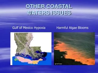
Harmful Algal Blooms in the Gulf of Mexico • In the Gulf of Mexico, blooms of the toxic algae Karenia brevis result in shellfish bed closures and lost tourism that cost the state of Florida millions of dollars each year. • Similar problems in other parts of the country with other toxic species. • Ship based monitoring very expensive and time consuming • Inadequate data frequently leads to unnecessary closings. • HABSOS system being developed to provide early warnings using SeaWiFS data and models • Geostationary ocean color data will greatly improve warning systems like HABSOS • More frequent data for cloud clearing • Higher spatial resolution to assess conditions closer to the shell fish beds and beaches
HABSOS can immediately utilize improved spatial resolution and frequency of coverage from HES-CW
Summary • Geostationary ocean color will provide an excellent new tool for the characterization and management of the coastal ocean. • COAST Risk Reduction activities focus on calibration, algorithm development and bio-optical models. • Completed initial field experiment in Monterey Bay, CA to develop simulated geostationary data set for algorithm development • Efforts coordinated with NOAA NESDIS/STAR, NMFS and NOS with a focus on meeting their operational needs. • Need a geostationary ocean color imager to provide hourly satellite data of the coastal ocean • Use in combination with IOOS in-situ data for the initiation and validation of coastal bio-optical models Special thanks to Ted Strub, Amy Vandehey and the COAST for their hard work getting this program started. Thanks to NOAA for funding and particularly to Stan Wilson, John Pereira, and Paul Menzel for their support and guidance.