Download
1 / 26
260 likes | 373 Vues
This project focuses on the comprehensive flood mapping scoping process in Eastern North Carolina, initiated after Hurricane Floyd in 1999 which exposed significant limitations in existing Flood Insurance Rate Maps (FIRMs). The North Carolina Division of Emergency Management, in collaboration with FEMA and Dewberry & Davis LLC, is developing high-resolution topographic data and engineering studies to produce accurate Digital FIRMs. This initiative seeks to enhance community floodplain management, ensuring effective site planning while reducing long-term flood losses through timely and precise data sharing.

E N D
Scoping theNorth Carolina Cooperating Technical State Project Ed Curtis, P.E., CFM, North Carolina Division of Emergency Management Jerry Sparks, P.E., CFMDewberry & Davis LLC
North Carolina CTS Flood Mapping Program • Hurricane Floyd in 1999 revealed limitations of outdated FIRMs in NC • NC General Assembly committed$25 million to flood mapping • CTS partnership between FEMA, State, and 16 other Federal Agencies • State ownership and responsibilityfor FIRMs
Project Components • High-resolution topographic data and accurate DEMs • Engineering studies of flood hazards • Countywide digital FIRMs • Online Information Management System
Project Benefits • Current, accurate data for sound siting and design decisions • Use of updated data for floodplain management will reduce long-term flood losses • Updated data will alert at-risk property owners of the need for flood insurance • Faster, cheaper FIRM updates
Project Benefits (Continued) • Digital format allows for more efficient, precise flood risk determinations • Digital format allows for use with GIS for analysis and planning • Digital Information System allows for online access 24 hours a day • DEMs will be useful for almost any engineering or planning applications
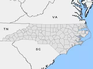
Eastern Six River Basins • NC General Assembly directed the State to first address the eastern six basins(Phase I) • Basins most affected by Hurricane Floyd • Approximately half of the State • > 50 counties and >330 municipalities(in whole or in part) • Encompass ~ 21,200 linear milesof streams and rivers
North Carolina River Basins—by Phase Phase I—bluePhase II—goldPhase III—green
Map Production Scoping The Flood Mapping Process
What Is Scoping? • Researching/inventorying available elevation, flood hazard, and digital base map data • Assessing adequacy existing flood hazard data • Outreach to, and input from, counties and communities • Identifying data to be developed or acquired • Determining proposed scales, paneling scheme, and format for DFIRM production • Developing schedule
Scoping the Six Eastern River Basins • Comprehensive scoping process • Tailored FEMA’s scoping process to meet the needs of North Carolina’s basin-wide approach and accelerated production schedule • NCDEM worked closely with FEMAand FEMA’s Map CoordinationContractor, Dewberry & Davis LLC (D&D) • Process involved 5 steps
SCOPING PRODUCTION Step 1 Step 2 Step 3 Step 4 Step 5 Initial Research and Community Coordination Initial Scoping Meeting Draft Basin Plans Final Scoping Meeting Final Basin Plans State KickoffMeeting with County/Local Floodplain Administrators Questionnaire State Prepare Delivery Orders& CTC Mapping Activity Agreements & Update CTS Mapping Agreement Develop Draft Basin Plans MappingNeeds Assessment Generate Initial Scoping Package NCScoping Database InitialScoping Meetings Final Scoping Meetings Finalize BasinPlans Analysis and Mapping FEMA EffectiveFIS & FIRM Research FEMA Process for Scoping Six River Basinsin Eastern North Carolina EvaluatePost-FloydData
Step 1: Initial Research and Community Coordination • Kick-off meeting with county and local floodplain administrators — August 31, 2000 • Objectives: • Overview State’s CTS Agreement with FEMA and the Statewide Flood Mapping Program • Inform about process that will be followed • Encourage active participation • Community questionnaire distributed
Step 1: Initial Research and Community Coordination (Continued) • State completed research of community mapping needs • September 1999, CTP “Assessment of Community Mapping Needs” agreementwith FEMA • FEMA and D&D researched FEMA Flood Mapping Archives and FEMA’s Mapping Needs Update Support System (MNUSS) database
Step 1: Initial Research and Community Coordination (Continued) • State and FEMA evaluatedpost-Hurricane Floyd data • Identified areas where flooding elevations and inundation limits did not match effective flood hazard data
Step 1: Initial Research and Community Coordination (Continued) • State and FEMA conducted detailed review of effective flood data for counties along the open coast and inland coastal areas • State met with county and community GIS staff to inventory local GIS data to identify potential base map data resources
Step 1: Initial Research and Community Coordination (Continued) • Results of initial research and community questionnaire responses entered into a GIS-enabled scoping database created especially for North Carolina project • Database used to generate “Initial Scoping Packages” for each community • Initial Scoping Packages used to conduct Initial Scoping Meetings (Step 2)
Step 2: Initial Scoping Meetings • Meetings in each county • Presented results of initial 1 research • Reviewed Initial Scoping Package with each community’s representatives • Asked for community input on proposed study priorities andanalysis methods • Identified available local data
Step 3: Draft Basin Plans • Synthesized research and community input • Draft basin plans include: • Comprehensive lists of flooding sources to be updated and methods to be used • Counties for which DFIRMs will be produced • Overall schedule
Step 4: Final Scoping Meeting • Draft Basin Plan sent to affected counties and communities • Meetings held in each county • Present Draft Basin Plans • Provide final opportunity for input • Individual meetings scheduled with community representatives
Step 5: Final Basin Plans • Draft Basin Plans revised to produce Final Basin Plans • Final Basin Plans state how the Draft Basin Plan was revisedand why
Step 5: Final Basin Plans (Continued) • Final basin plans used to: • Complete CTS Task Agreementwith FEMA • Develop Delivery Orders for State’s mapping contractor • Develop CTP Mapping Activity Agreements with any countiesor local communities
Scoping theNorth Carolina Cooperating Technical State Project QUESTIONS? ? ? ? ?