Download
1 / 19
190 likes | 209 Vues
Learn about the importance of having a standard for wetland mapping, what currently exists, proposed improvements, and how to get involved.

E N D
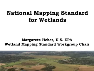
National Mapping Standard for Wetlands Margarete Heber, U.S. EPA Wetland Mapping Standard Workgroup Chair
Introduction • Why have a standard? • What exists now? • What we proposed in February 2006 to FGDC • Who has helped develop the standard? • Timeline • Next Steps After FGDC Approval • Contents of the Standard • Implementation • Polygon Lineage and Unique Identifiers • Your Participation/ Comments • How Can I Get More Information?
Why Have a Standard? Wetland Maps are Essential to… • Get a complete and accurate picture of wetland resources in the US • Calculate (not estimate) wetland loss and gain • See wetland geospatial distribution • Complete the watershed picture on the National Map – wetlands currently missing
Why Have a Standard? A Wetland Mapping Standard will: • Streamline mapping efforts for greater consistency and efficiency • Enable any entity to map using the standard and construct or update the National Wetlands Inventory (NWI) Geodatabase and the National Map • Facilitate consistent mapping layers that can be used across geopolitical and watershed boundaries.
What Exists Now? • An FGDC (Federal Geographic Data Committee) Wetland Classification Standard exists, but there is no current standard addressing its use in mapping...hence this "new” standard • USFWS (U.S. Fish & Wildlife Service) will never have the resources to undertake wetland mapping and updating alone, especially on a continual basis – a partnership (Fed, State, Tribal, Local and others) can accomplish this
What Was Proposed to and Approved by the FGDC in February 2006? • Base proposal of FGDC standards on existing FWS standards • Coordinate with other pertinent standards: NHD, NOAA classifications, FGDC classification standards, etc. • Coordinate stakeholders • Propose draft for comment in March 2007
Colleen Charles, USGS Bob Pierce, USGS Paul Wiese, USGS Larry Handley, USGS * Tom Dahl, FWS John Cooper, FWS Bill Pearson, FWS Ralph Tiner, FWS * Bill Wilen, FWS, NWI * Jo Ann Mills, FWS Margarete Heber, EPA* Palmer Hough, EPA Chanda Littles, EPA Christine Mazzarella, EPA Myra Price, EPA Kathy Mulder, EPA Jim Dick, NWI Norman Melvin, USDA Romell Nandi, EPA Edmund Miller, OSD * Pedro Flores, NACo * Norman Melvin, NRCS James Robb, IDEM* Mark Sudol, COE Andy Damasis DHS Jeanne Christie, ASWM* Dawn Browne, Ducks Unlimited* Marti McGuire, NOAA* Mark Gernes, MPCA Ky Ostergaard, Indus Corp Dave LaBranche, DOD Mark Zundel, US Bureau of Indian Affairs Stephen Getlein, Army Env. Center Jane Awl, TVA* Randall Gray, USDA Chris Berginnis, Ohio DPS John Christy, Oregon State University Vince Allen, Indus Corp Bold=Workgroup member * with Bold = very active workgroup member Who Has Helped Develop the Standard?
NACo TVA IDEM Ducks Unlimited NOAA EPA DOD, COE NRCS ESRI Conference Indus Corp Individual States in Regions 2, 4, & 5 ASWM USGS FWS/NWI Groups that have Reviewed or Discussed the Standard
Timeline • Feb 2006: Approval by FGDC to develop a proposal • Spring 2006: Present proposal idea to stakeholder groups (i.e. ASWM, NACo, NSGIC, etc.) • Summer 2006: Begin drafting standard-l year to proposal • Fall 2006/ Winter 2007: Interact with stakeholders • Fall 2006/ Winter 2007: Ensure that state and federal agencies and tribes are comfortable with proposal • March 2007: Present draft standard to FGDC Standards Workgroup for review • May 15 2007: Meet with FGDC Standards Workgroup for discussion and comments, and respond to issues/comments • May-July 2007:Propose for comments? • August 2007: Respond to comments • September/Octover 2007: Finalize proposal to FGDC
Proposed Next Steps After FGDC Approval of the Draft • Put a Notice of Availability in the Federal Register with a link to the FGDC website and the draftStandard • Send to GIS technical organizations (ASPRS, NSDI, etc.)
Objective Scope Applicability FGDC Standards and Other Related Practices Standard Development Procedures and Representation Maintenance Authority NSDI Requirements and Quality Components: Source Imagery Classification Accuracy TMU (Targeted Mapping Unit) and Producer’s Accuracy Horizontal Accuracy Data Verification Logical Consistency Edge Matching Attribute Validity Datum and Projection Metadata Workgroup Recommendations FGDC Riparian Standards Marine Benthic Standards Proposed Future Tools for Unique Wetland Identifiers Appendix A. Classification Keys Appendix B. Implementation Recommendations Appendix C. Known Issues with Existing Wetlands Mapping Data Appendix D. Polygon Lineage Concept Diagrams Appendix E. Q & A’s Appendix F. Definitions (Informative) Tables Spatial Resolution Requirements of Source Imagery Classification levels required based on habitat type TMU and Producer Accuracy Requirements Horizontal Accuracy (RMSE) Requirements Contents of the Standard
The Standard Applies to: • Any entity using federal funds to map wetlands
Implementation • Encourage states/tribes to establish wetlands mapping funding coalition • Any entity receiving federal money must use FGDC standard • Encourage others to adopt/use the standard • Interagency Funding workgroup to find seed money for states/tribes and raise visibility of need to map wetlands established April 2007 • Provide training workshops and materials for technical implementation – for example, online help.
Implementation (cont’d) • Implementation is separate from FGDC approval. • Implementation of the standard will include how wetlands data are collected and added to the wetlands geodatabase (NWI) • There is no “Implementation” section of the standard. Detailed guidelines for practical implementation of the standard will be generated after FGDC approval. This will include technical process specifications (attributes, polygon lineage, software compatibilities, data formats, etc.”
2010 101 603 2015 780 910 670 560 810 Polygon Lineage and Unique Stable Identifiers -- Ideal
Polygon Lineage – Scale Deviation 2010 101 603 2015 094 780 430 910 670 560 810 560 306
QUESTIONS? Contact Margarete Heber at: • Heber.margarete@epa.gov • 202-566-1189