Download
1 / 22
220 likes | 345 Vues
This segment explores the unique topography of the ocean floor, highlighting its diverse features, including higher mountains, deeper canyons, and extensive plains compared to continental terrains. We delve into continental margins, the significance of continental shelves, slopes, and rises, and the impact of turbidity currents on submarine canyons. Additionally, we discuss the ocean's abyssal plains, seamounts, trenches, mid-ocean ridges, and the formation of coral reefs. Understand the tools and methods used in oceanography to study these remarkable underwater landscapes.

E N D
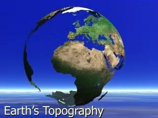
Earth’s Oceans Part 3: The Ocean Floor
Introduction Topography: The study or detailed description of the surface features of a region Compared to the continents, the ocean has: • Higher mountains, deeper canyons, and larger, flatter plains • More volcanoes and earthquakes • Different kinds of rock • A thinner underlying crust
Edges of the Continents Shoreline: • Boundary where land and water meet • Marks the average sea level • Not the edge of the continent Photo credit: 111 Emergency from New Zealand
Edges of the Continents Continental margin: • Where the continent and the ocean floor meet • Consists of a continental shelf, a continental slope, and a continental rise
Edges of the Continents Continental shelf: • Relatively flat • Covered by shallow water • Slopes gently downward • Width varies from almost none to over 1,200 km • Best area for fishing • Mineral, oil, and natural gas deposits may be found here 1 fathom = 6 feet
Edges of the Continents Continental slope: • Plunges steeply 4-5 km • Boundary between the continental crust and the ocean crust Continental rise: • Separates the continental slope from the ocean floor • Made of large amounts of sediment
Edges of the Continents Turbidity Current: • A flow of water that carries large amount of sediments • Similar to an avalanche but underwater
Submarine Canyons • Deep V-shaped valleys cut into the rock of the continental slope and rise • Possibly caused by turbidity currents and/or earthquakes (not sure) Continental slope and upper continental rise northeast of Hudson Canyon, showing the four newly named submarine canyons along the continental slope
Features of the Ocean Floor • Abyssal Plains • Seamounts and guyots (gee-OHZ) • Trenches • Mid ocean ridges • Rift valleys • Reefs
Abyssal Plains • Large flat areas on the ocean floor • Largest area occurs in Atlantic, less in the Indian, and rare in Pacific • At depth of 3,000-6,000m • Flattest places on Earth Sea Spider Credit: CSSF/NEPTUNE Canada Anemone Clouds of sediment stirred up from the ocean floor
Seamounts and Guyots Seamounts: • Volcanic mountains that rise more than 1,000 m above the surrounding ocean floor • Have steep sides and narrow summits • More than 1,000 known, most in Pacific • Seamounts that rise above the ocean’s surface form volcanic islands, including Azores and Ascension Islands in the Atlantic and Hawaiian Islands in the Pacific
Seamounts and Guyots Guyots (gee-OHZ): • Flat-topped seamounts • Result from wave erosion 3-D depiction of Bear Seamount, with Physalia Seamount in the background.
Trenches • Long, narrow crevices along the edges of the ocean floor • Can be more than 11,000 meters deep • Mariana Trench contains Challenger Deep, the deepest spot known on Earth Attribution: I, Kmusser
Mid Ocean Ridges • Some of the largest mountain ranges on Earth • An almost continuous mountain belt from the Artic Ocean through the middle of the Atlantic Ocean, around Africa into the Indian Ocean, then across the Pacific Ocean to North America Video: http://www.youtube.com/watch?v=GyMLlLxbfa4
Mid Ocean Ridges • Formed when molten rock flowed up to the crust’s surface and cooled
Rift Valleys • Form where the Earth’s crust, or outermost layer, is spreading or splitting apart. • Often narrow, with steep sides and a flat floor • Run along the middle of the mid ocean ridges • Regions of great earthquake and volcanic activity Great Rift Valley in Israel Attribution: איטה צנר
Coral Reefs • Large masses and ridges of limestone rocks • Contain shells of animals • Found in tropical water that are not too deep A Blue Starfish (Linckia laevigata) resting on hard Acropora coral. Attribution: Richard Ling
Coral Reefs Three types: • Fringing Reef – touches the shoreline of a volcanic island • Barrier Reef – separated from the shore by shallow water called a lagoon • Atoll – a ring of coral reefs where the island has worn away and sunk below sea level A fringing reef can take ten thousand years to form, and an atoll can take up to 30 million years. Animation from NOAA
Videos: http://www.youtube.com/watch?v=1aX61LzmeYA http://www.youtube.com/watch?v=wbNeIn3vVKM http://commons.wikimedia.org/wiki/File:Great_Barrier_Reef_4.JPG Atoll in the Maldives Location of coral reefs around the world
Oceanography Bathyscaphe • The branch of science dealing with the physical, chemical, geological, and biological features of the oceans and ocean basins Tools of an oceanographer include: • Underwater cameras • Corers to sample the ocean bottom • Bathyspheres, bathyscaphes, and other submersibles for deep water exploration Bathysphere NOAA’s Mir submersible
Mapping the Ocean Floor • 1872 –HMS Challenger sailed on the first expedition to map the ocean’s floor (3 ½ years) • Used a wire to measure ocean depth, netted animals and plants from the ocean bottom, and measured ocean temperatures
Mapping the Ocean Floor • Video: http://www.youtube.com/watch?v=-fAAxEIFeLU • Use indirect methods including echo sounding, radar, sonar, and seismographic surveys, but given the size of the oceans only a small portion can be surveyed this way. • Satellite altimeter data from Seasat (1978), Geosat (1985), ERS-1 (1995) has provided a more complete picture. • The ocean surface has bumps and dips that mimic the ocean floor beneath, so measuring the change in the surface gives a picture of the floor.