Download
1 / 13
130 likes | 243 Vues
Utilizing advanced IT tools such as Google Earth, ArcGIS, and custom software, SMSR's Map Room enhances SAR operations with detailed maps, GPS tracking, and field tech support. Explore our technology investments for improved efficiency and collaboration.

E N D
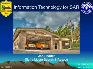
Information Technology for SAR Jon Pedder Sierra Madre Search & Rescue
SMSR Map Room 1000’s of USGS maps
Technology Investment • Map room • Dedicated map room computer • Google Earth etc. • Terrain Navigator • RedZone • ArcGIS Desktop suite • Custom “homegrown” waypoint manager • Custom ArcGIS toolbar • Large format map printer 42”
Dedicated GIS Hardware HP Designjet 800 Dell XPS quad core w/ Dual 24” Monitors
Custom Waypoint Program • Waypoint Manager • Select maps using lat/long coordinates • Navigate to adjacent maps • Show stored waypoints foreach map or add multiple maps to the selection
Custom SAR Toolbar • Worked with ESRI student to create custom SAR toolbar • Goal is to make it easier for SAR techs to use GIS
SAR Toolbar • Tracking ELT and PLB signals in ArcMap • Development incomplete
Technology in the Field • Mobile CP setup • We’re taking computersinto the field more thanever before • Panasonic Toughbook • Medium format printer 11”x17” • Propane generator
Station & Mobile CP • Assignments • ICS Forms • Crew maps • ELT projections • Using ArcMap to plot coordinates • Working with ESRI on custom toolbar • Plotting crew positions • Plotting clues, POA & POD etc.
SMSR’s Territory • Small area of immediate operations • Intimate knowledge of our immediate area • Not all our operations require us to use GIS or mapping software
Mutual Aid • Come ready to deploy with • Mobile technology • GPS plus cables etc. • Print custom maps (large scale) • For use by field teamsand CP • Personnel with skills inMapTech and basic ArcMap skills • USGS Maps • Remote support from our station
Where Are We Going? • Cloud computing? • Shared data • Collaboration? • Remote assistance processing information
SMSR Jon Pedder (IT committee): jpedder@me.com Larry Smith (president): westsmiths@yahoo.com Arnold Gaffrey (Operations) – arnoldg@mcsins.com Team web site: www.smsr.org SMSR Dispatch: (626) 355-1414 Technology & SAR