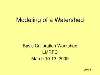
A WATERSHED VIEW
A WATERSHED VIEW. UNDERSTANDING WATERSHEDS. Water is a vital resource Understand how watersheds are defined Impacted by natural phenomena and human activities Importance of a watershed view Mapping your watershed. WATERSHED MAPPING ACTIVITY. Identify potential sources of pollution

A WATERSHED VIEW
E N D
Presentation Transcript
UNDERSTANDING WATERSHEDS • Water is a vital resource • Understand how watersheds are defined • Impacted by natural phenomena and human activities • Importance of a watershed view • Mapping your watershed
WATERSHED MAPPING ACTIVITY • Identify potential sources of pollution • Identify monitoring sites • Provide information to educate
WATERSHED MAPPING ACTIVITY (cont.) • Provide a list of potential community restoration efforts • Provide a sense of value • To make informed decisions
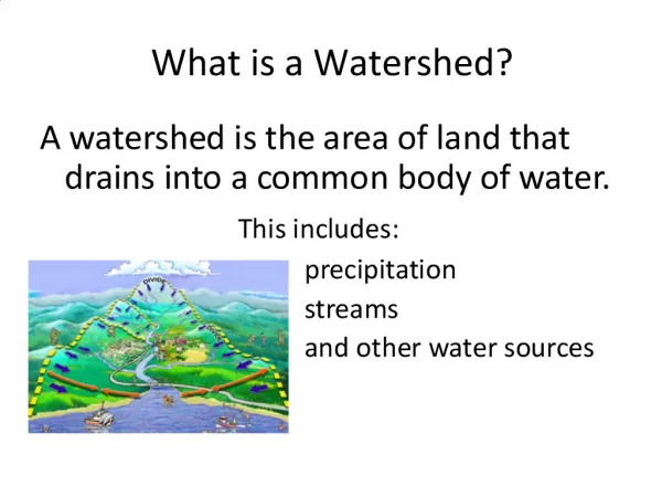
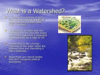
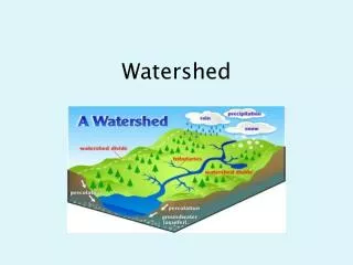
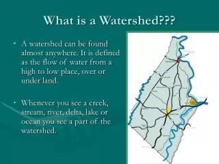
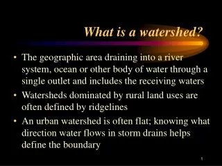
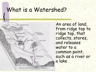
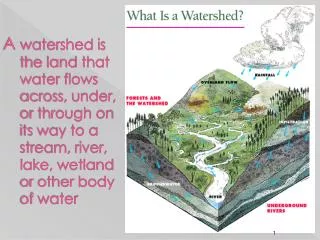
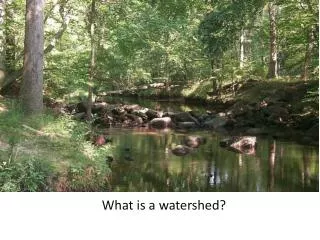
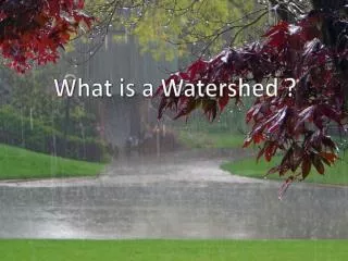
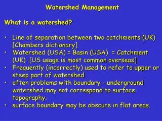
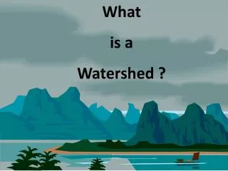
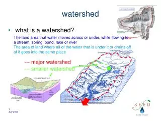
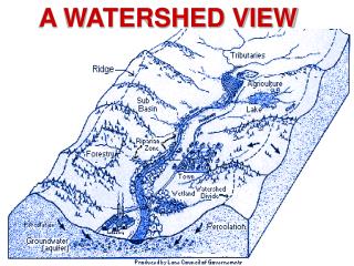
WHAT IS A WATERSHED? • A topographically-defined area of land that drains into a particular body of water • Drainage basin • Catchment area
MISSISSIPPI RIVER WATERSHED Drainage area of 1.2 million square miles Includes portions of 30 states and a small part of Canada 3rd largest watershed in the world
WATERSHED DYNAMICS • All parts of a watershed are interconnected • Water flows through a watershed • The most pervasive threat to water quality is siltation due to runoff and soil erosion • Slope, soil type, and land use influence runoff and erosion
WATERSHED DYNAMICS (cont.) • Disturbed areas without vegetation suffer from increased runoff and erosion • Impervious surfaces • Undisturbed areas, wetlands, uncompacted soils, and vegetation absorb water and slow runoff
TYPES OF POLLUTANTS • Point source pollution - like a pipe discharge • Nonpoint source pollution - from a number of diffuse sources • Harder to identify so more difficult to control
NONPOINT SOURCE POLLUTION Agricultural Sources • soil erosion • animal waste • fertilizer • pesticides
NONPOINT SOURCE POLLUTION (cont.) Urban Sources • runoff from impervious surfaces • fertilizers & pesticides from lawns, parks, golf courses • sediment from construction sites • cleaning products • pet wastes
KNOW YOUR WATERSHED • Understanding a watershed is essential to the interpretation of stream health and water quality • Everything that occurs within a watershed affects water resources • A STREAM IS A REFLECTION OF ITS WATERSHED
YOUR WATERSHED MAP • Choose a manageable size • Watershed boundaries • Topography • Land use
TOPOGRAPHIC MAPS • Represent a four-sided region called a quadrangle • Use Contour lines to illustrate relief • Symbolsshow boundaries, surface features, buildings, roads, railroads, and communication features • Scale represents distance
HOW DO YOU GET TOPO MAPS? • United States Geological Survey (USGS) publishes • Sources: • DNR’s Division of Geological Survey & Resource Assessment • Local outfitter/camping stores • Internet Web sites • Index Map of Topographic Sheets • Publication order form
TOPO MAP EXERCISE(Part 1) • What is the name of this particular quadrangle? Marble Hill • What quadrangle is SOUTH of this quad? Dongola • What quadrangle is SOUTHWEST of this quad? Zalma
RELIEF • Relief is the variation in elevation of the Earth’s surface • Illustrated by contour lines • Contour lines connect points of equal elevation
TOPO MAP EXERCISE (Part 2) • What is the contour interval on this quadrangle? 20 feet • Find the intersection of Highways 34 and 51 near the town of Marble Hill. • Follow Hwy. 34 east (right) to the junction of Hwy. B. • What is the elevation at the intersection of Highways 34 and B? Between 500 and 520 feet
SCALE • Represents distance or size • Expressed as a ratio • Different scales apply to different size quad maps • We use the most detailed USGS map series: 7.5-minute quads • Scale on these = 1:24,000 Where 1 inch = 24,000 inches (2,000 feet)
TOPO MAP EXERCISE (Part 3) • What is the scale for the Marble Hill quad (see bottom, center, above contour interval)? 1:24,000 • What is the distance between the Shell and Eaker Cemeteries, south of Marble Hill? About 1 mile • Cedar Branch is a tributary to what stream? Hurricane Creek
DRUNKEN CREEK WATERSHED EXERCISE • This exercise should take about 10 minutes • The previous Watershed Boundary map will be displayed to remind you of the process
WATERSHED BOUNDARY: UNNAMED TRIB TO CROOKED CREEK • ID downstream point • Mark stream and tribs in blue • Mark high points with an “X” • Connect “X’s”
Watershed map showing major land uses Legend: Forest Agricultural fields Pasture Town and park