Download
1 / 37
510 likes | 1.04k Vues
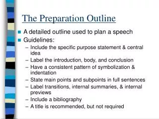
Suggestive Outline for DPR preparation of watershed Projects. Chapters. Executive summary Introduction and background General description of Project area Baseline Survey Institution building and project management Management/ Action plan Capacity Building Plan

E N D
Suggestive Outline for DPR preparation of watershed Projects
Chapters • Executive summary • Introduction and background • General description of Project area • Baseline Survey • Institution building and project management • Management/ Action plan • Capacity Building Plan • Phasing of Programme and budgeting • Consolidation/ Exit strategy • Expected outcome 3 4
Executive Summary • Brief about area • Institutional arrangements • Salient Project activities • Physical target and financial outlays • Treatment area and details • Fact sheet about bench mark indicators and action plan at a glance
Introduction and background • Project Background • Need and Scope for Watershed Development • Weightage for selection of Watershed • Watershed Information • Status of previous watershed programmes & other development projects in the area * (Ensure that information for MIS tables supplied by DoLR is reflected in relevant parts of DPR)
General description of Project Area • Location : longitude, latitude, state, District, Taluk, Block, Villages, Approach road/land mark (watershed location map) • Area : under major land uses for irrigated and rainfed • Physiography: Elevation range, Slope range, Order of watershed, Drainage map • Climate : Average monthly rainfall, temperature, wind velocity, evaporation, humidity • Watershed characteristics: Shape index, Length of main stream, drainage density, average slope, relief, perimeter of the watershed
Base Line Survey • Socio-Economic conditions • Soil and Land Use • Agriculture: crops, yields, horticulture etc • Production/farming systems • Livestock and Fisheries • Forests and Grass land, ago-forestry • Livelihood Status/pattern, sources, dependance • Hydrology and Water Resources • Resource conservation and water use • (May be collected from secondary sources, PRA exercise and if required by supplementing primary sources on sample basis)
Baseline Survey Baseline survey • Act as a bench mark of the Project for future evaluation and impact analysis. • Collection of socio-economic details with Household survey. • Bio-physical survey to collect details of natural resources HouseholdCensus
Bio-physical survey Baseline survey Bio-physical Survey • Geo-referenced data collection of particular natural resources. • Geo-referenced soil sample collection from representative area. • Survey number wise collection of land details about land acreage, ownership, crop cultivated(season), irrigation source and season details. Natural Resources Household Census
PRA Technique Bio-Physical Survey Baseline Survey PRA Techniques Local Knowledge Natural Resources Household Census
Institution Building and Project Management • About PIA • Indentify institutions along with their roles and responsibilities • Social Mobilization and Community organization • Formation of local level people Institutions WC, SHGs, UGS • Coordination and monitoring of implementation process including DPCs and other coordination mechanism. • Implementation plan • Convergence of watershed Programmes. • Identify and list Central/State sponsored schemes being implemented for convergence with their fund allocation • Prepare a matrix of major components of on-going and new schemes, which can be converged with watersheds. • Convergence mechanism at planning and implementation level
Problems to be addressed • Women • SC/ST • Landless/BPL • Natural Resources • Indigenous knowledge • Viability Profitability of agriculture knowledge Equity Sustainability • Livestock • Crops grown • Watershed Intervention • Conservation by NRM • Increase sustainable productivity of the system • Land & non land based income generating activities • Formation of local institutions Productivity
Management / Action Plan • Prepare based on problems, needs, land suitability class, priorities and technical feasibility in participatory process • Entry point activities • Ridge area treatment • Land development: private, waste, degraded, common • DLT measures • Water harvesting structures • Water, energy and resource conservation technologies • Pasture development, sericulture, common land development • Forests lands for fodder, fuel, water, etc. • Horticulture development • Livestock, dairying, fodder, fisheries development • Veterinary services • Livelihood interventions for landless, micro enterprises • Production / Farming System , crop improvement • Marketing Linkages
Entry Point Activity • Urgent demand of the local community • Should enrich the common natural resources or production system, or common needs like drinking water, etc. • An instrument of confidence and rapport building
Net Planning • Meeting with local community members • Understanding various schemes running in the project area for convergence. • Detail Budgeting for each activity to be undertaken under IWMP. • Institute Building like Watershed committee, SHG, User Group • Group Discussion of activities with -Watershed committee -Farmers(Small, Marginal) & Agricultural labours -Women group -BPL,SC/ST Population
Net Planning PRA Techniques Bio-Physical survey Baseline Survey Net Planning Activities Planning Local Knowledge Natural Resources Household Census
Detail of other activities • Productivity enhancement of important crops and farming systems • Introducing improved technology • Livelihood intervention strategy • Demand driven, Business model of Production System • Capacity Building Plans
Focal points for livelihood intervention • Poor productivity of cattle • Migration due to lack of fodder • Low productivity of land due to less use of organic content. • Lack of use of Farmyard manure • Lack of grading of farm product.
Livelihoods intervention • Feed & Fodder Bank, • seed bank Micro-enterprise model • Vermi- compost Unit • IGA eglac, etc
Capacity Building Plan • Develop Annual Action Plan for CB • Phase wise key programmes, activities and contents • Actors, required skills • Type, level and nos of CB Programmes • Core team • Budget • Approval of Action Plan with annual phasing • Consortium of Service Providers/Resource Organizations • Developing resource materials, training manuals etc. • Pool of resource persons • Field level hand-holding support details • Follow-up and monitoring
Capacity Building Plans • NRM concept • Soil and moisture conservation structure • SHG formation and community mobilization. • Improved and Scientific agriculture practices. • Dairy development and Management. • Rural handicraft. • Exposure visits for production systems
Phasing of Programme and Budgeting • Administrative cost • Monitoring and Evaluation • Physical and Financial - Targets & Out lays • Year wise Plan/Activities for development of watersheds • Year wise Financial requirements for developmental activities • Details of convergence with other schemes – Physical & Financial
Consolidation / Exit strategy Consolidation and completion of various works, Building the capacity of the community based organizations to carry out the new agenda items during post project period, Sustainable management of (developed) natural resources, up-scaling of successful experience regarding farm production systems/off-farm livelihoods.
Expected Outcome • Some quantifiable indicators for outcomes of the programme including those in PPR • Productivity and production of crops, horticulture, livestock, fodder, agro-forestry, fisheries products, farming systems, land use and commodity diversification. • Changes in water availability (surface storage and ground water table), irrigated area, per capita income, creation of livelihood opportunities, out migration, cropping intensity, feed and fodder availability etc. • Environmental impact: Change in soil loss enhancing the perenniality of flow and reducing peak flows, recharge of ground water enhancement of nutrients water quality. • Employment generation: casual and regular
Use of Village Planning Map Using Contour map to demarcate area for SCT and Contour trench
Identifying location for Check Dam • Potential site for check dam(Drainage point) • Calculate the catchment area