Download
1 / 70
710 likes | 805 Vues
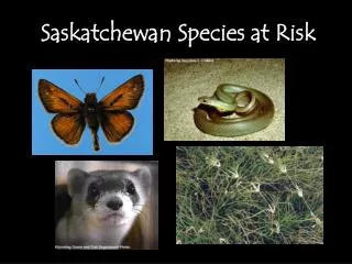
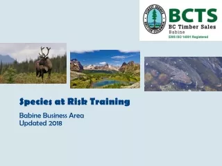
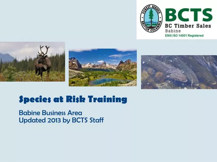
Species at Risk Training Babine Business Area Updated 2013 by BCTS Staff. Purpose. The purpose of this document is to provide basic information for each of the species at risk identified in the Bulkley, Morice, and Lakes Timber Supply Areas (TSA) within the BCTS, Babine Business Area.

E N D
Species at Risk Training Babine Business Area Updated 2013 by BCTS Staff
Purpose The purpose of this document is to provide basic information for each of the species at risk identified in the Bulkley, Morice, and Lakes Timber Supply Areas (TSA) within the BCTS, Babine Business Area. Species selection is based on the information provided by the Ministry of Environment’s “BC Species and Ecosystem’s Explorer” search engine which can be found @ http://a100.gov.bc.ca/pub/eswp/ The MoE’s “Explorer” uses the following data-sharing sites to verify the status of each species: • Provincial status, which is based on the “NatureServe Explorer” @ http://www.natureserve.org/visitLocal/index.jsp • BC List, which is based on the British Columbia Conservation Data Center (CDC) @ http://www.env.gov.bc.ca/cdc/ • COSEWIC (federal) – Committee On the Status of Endangered Species In Canada • SARA (federal) – Species At Risk Act @ http://www.sararegistry.gc.ca/ • Global (International) Conservation Status, which is also based on the “NatureServe Explorer” The “Explorer” is capable of running several different queries based on specific criteria such as plant vs. animal, geographic location, Conservation Status, Legal Designation, etc. The “Explorer” is useful in many ways but should be used only as a guide with some of the data being either out-of-date or inaccurate. Be sure to cross-reference certain information to confirm it’s validity. The MoE’s “Explorer”, which is managed by the BC Conservation Data Center (CDC), is the number one source for identifying species at risk in BC. The CDC’s goal is to assist in preserving the biodiversity of the province by providing accurate information on species and ecological communities at risk. Each of these species and ecological communities is a assigned a global and provincial status ranking according to a set of criteria established by the Nature Conservancy (United States). Provincially, each species is placed on either a Red, Blue, or Yellow list, as per the Provincial Conservation Status Rank. Red – includes any indigenous species, subspecies or ecological community that is Extirpated, Endangered, or Threatened; Blue – includes any indigenous species, subspecies or ecological community considered to be Vulnerable (= Special Concern); Yellow – list of ecological communities and indigenous species that are not at risk, some of which have management requirements.
Federal Level Species at Risk can be identified at both the federal and provincial level. At the federal level, the following data-sharing sites are used: • Committee On the Status of Endangered Wildlife In Canada (COSEWIC) - managed by Environment Canada; committee of experts that assess and designate which wildlife species are in some form of danger; uses the best available information relevant to determine a wildlife species’ risk of extinction or extirpation, which is obtained from a credible source; as a result, develops the prioritized COSEWIC Candidate List; http://www.cosewic.gc.ca/eng/sct5/index_e.cfm • Species at Risk Act (SARA) – federal government commitment to prevent wildlife species from becoming extinct and secure the necessary actions for their recovery; species designated by COSEWIC may qualify for legal protection and recovery under SARA; manages the “Species at Risk Public Registry” which is an online service accessible to the public; the “Species at Risk Act” is available through this website @ http://www.sararegistry.gc.ca/default_e.cfm • NatureServeCanada – non-profit organization; provides scientific basis for effective conservation action; includes network of natural heritage programs or data centers operating in the U.S., Canada, and central America; collect and manage data which is used by both the public and private sectors globally; http://www.natureserve-canada.ca/
Provincial Level At the provincial level, the following provincial data-sharing sites are used: • BC Conservation Data Centre (CDC) - established in 1991; managed by BC Ministry of Environment; collects and distributes information on species and ecosystems at risk in BC; manages the BC Species and Ecosystems Explorer search tool; http://www.env.gov.bc.ca/cdc/ • Identified Wildlife Management Strategy (IWMS) – initiative of the MoE in partnership with FLNRO; carried out under the Forest and Range Practices Act (FRPA); document was originally released in 1999; new volume released in May 2004; in 2006, 45 species were added to the list; as of August 2012, MoE staff are actively pursuing completing designations for the existing 82 species; webisite @ http://www.env.gov.bc.ca/wld/frpa/iwms/index.html • Ungulate Winter Range (UWR) – an area that contains habitat that is necessary to meet the winter habitat requirements of an ungulate species; based on interpretations by MoE staff using current scientific and management literature, local knowledge, and other expertise from the region; regulatory authority for establishing UWRs is outlined in Sections 9 and 12 of the Government Actions Regulation (GAR) of the Forest and Range Practices Act (FRPA); approved UWRs are found @ http://www.env.gov.bc.ca/wld/frpa/uwr/approved_uwr.html • Wildlife Act – managed provincially; legislative foundation for the interaction of people and wildlife in BC; allows for conservation and management of wildlife populations and habitat, issuing licenses and permits for fishing game hunting and trapping; guidelines for safe angling and trapping and outfitting policies; website @ http://www.bclaws.ca/EPLibraries/bclaws_new/document/ID/freeside/00_96488_01
Provincial Level Provincial sites continued…. • Conservation Framework – managed provincially by MoE; provides a set of decision support tools to enable collaboration between government and non-government resource managers and practitioners using clearly defined criteria to 1) prioritize species and ecosystems for conservation, and 2) determine the most appropriate and effective management actions; http://www.env.gov.bc.ca/conservationframework/ • Hectares BC - pilot project to test the concept of a new tool for geospatial data analysis in the natural resource sector; allows non-GIS users to work with geographic information without the need for GIS skills; assists in planning, assessment, reporting, and decision making functions; http://www.hectaresbc.org:22080/app/habc/HaBC.html
Additional Reference Material Additional reference material that can be used to obtain information on SAR include: • The Fish Protection Act –focuses on four major objectives: ensuring sufficient water for fish, protecting and restoring fish habitat, improved riparian protection and enhancement, and stronger local government powers in environmental planning; website found @ http://www.env.gov.bc.ca/habitat/fish_protection_act/#first • Forest and Range Practices Act (FRPA) – govern the activities of forest and range licensees in BC; sets the requirements for planning, road building, logging, reforestation, and grazing; maintains high levels of protection for forest values including watersheds and wildlife habitat; encourages innovation by skilled resource professionals and holds industry responsible for outcomes; includes Forest Stewardship Plans (FSP) • The Natural Resource Compliance Act – introduced in Fall 2011, authorizes ministry personnel to enforce a broader range of legislation (as described above) across the natural resource sector; helps streamline the inspection process and enforcement procedures. • Land and Resource Management Plans (LRMP) – directs the management of provincial Crown land in the Plan Area for the next ten years; provides direction in terms of maintaining and protecting resources within a designated land-use area; consistent with provincial government policy; reflects the Consensus Management Direction (CMD) established by the Bulkley Valley Community Resources Board (the Board) and a team of government representatives, and in consultation with First Nations and local government.
Coastal Tailed Frog Identification: • Tadpoles have large sucker-like mouth and white-tipped tail. • 2-5 cm long from nose to rump with a large head and long legs. • Skin has a “grainy” appearance, ranging in color from tan to brown to olive green. • Eyes have vertical pupils. • External tympanum (the round “ear” visible on other frogs) is absent. • Males have a tail which is the same colour and texture as the frog’s back. • Eggs are colourless and laid in a string. Habitat: • Characterized by year-round flow, non fish-bearing, intermediate gradient (>2.5%), coarse substrates (>6 cm), stable channel beds, wind-firm stands, and frequent side-pools. • Known to occur in the area immediately west of the Copper Forest Development Unit in the Bulkley TSA. Growth/Mating: • Grow very slowly, taking up to four years for the tadpoles to metamorphose into adults. • Possible to live for 15-20 years, making them one of the longest-lived frogs in the world. • Mating takes place in the fall; egg-laying the following summer; hatchlings overwinter in the calmer waters and then move to the stronger current once their oral suckers have developed to let them cling to rocks. Decline: • Harvesting activities can reduce the quality of their habitat by removing thermal cover (increased water temperature), deteriorating water quality (sedimentation possible), and destroying valuable overwintering habitat (machines chew up the forest floor, squishing the species).
Western Toad Identification: • Adults range in length from 5-15 cm. • Their skin appears dry and bumpy, ranging in colour from pale green to red. • They typically have pale-coloured bellies mottled with black, and a pale stripe down their back. • Their gold-flecked eyes have distinctive horizontal pupils. • Behind each eye is a parotoid gland (kindey-shaped swelling). • Tadpoles are either black or charcoal coloured with a dark, rounded fin along the length of their tail. • Juveniles are similar to adults but as small as 6mm long; • Eggs look like small black pearls laid single-file in the form of long strips; individual eggs are black above and white below. • Generally if you run into a toad in the bush, it’s a Western Toad.
Western Toad Habitat: • Preferred breeding sites include permanent or temporary water bodies that have shallow sandy bottoms. • After breeding, adults disperse into terrestrial habitats such as forests and grasslands. • Prefer damp conditions, spending much of their time underground (capable of digging their own burrows in loose soil). • They generally shelter in small mammal burrows, beneath logs, and within rock crevices. • Hibernate in burrows that are below the frostline (up to 1.3 m underground. Growth/Mating: • Adults migrate to communal breeding sites in early spring; • The eggs develop quickly into tadpoles which hatch in the warmest, shallowest water. • By the end of summer, the tadpoles transform into toadlets and leave the water. Decline: • Harvesting activities in and around wetlands can destroy or isolate populations; • Migrating toads are killed by traffic on roads; • Pollution from gas, oil and anti-freeze spills are considered a threat.
Bull Trout Identification: Long body (20-60cm) with enlarged head and jaws; similar to dolly varden but bull trout’s upper jaw curves downward, and the head is significantly larger and broader. Non-spawning colour is olive-green to bluish-grey with a white belly; spots cover the silvery sides; When in spawning condition, the pigmentation on the belly becomes bright red and lower jaw becomes distinctly hooked upwards. Habitat: Cool, fast-flowing water with a good mix of riffles and pools. Coldwater tributaries with deep lakes <15 degrees celsius are preferred. Streambeds with a wide range of medium to large coarse substrates are preferred. Large woody debris accumulations preferred. Adept at colonizing small, steep-gradient step-pool systems (>20% gradient in some cases).
Bull Trout Decline: • General trend for bull trout is stable to diminishing. • Fragmentation of populations through road building and timber removal near their habitat. • Obstructions to bull trout movement include perched culverts, stream channel instability, increasing water temperatures, sedimentation, debris loading and lack of cover. • Increased poaching and non-compliance with conservative regulations due to remote regions being developed. • Increased road building resulting in increased angling pressure.
Cutthroat Trout clarkii clarkii ssp. Identification: • Distinctive red, pink or orange stripe just below both sides of the lower jaw (where the name “cutthroat” originates from). • Generally dark green to greenish-blue on back; olive-green on upper flank; silvery on lower flank and belly. • Gill covers are pinkish. • Large mouth extends well past the eye; • Small irregular-shaped spots cover the head, sides of the body, dorsal fin, and often the belly and fins. • Sexually mature fish have a rose tint underneath; • Sea-run individuals are silvery; sometimes their bellies have a distinct lemon-colour, while freshwater fish are usually darker, with a coppery or brassy sheen; • Generally <50cm long.
Cutthroat Trout clarkii ssp. Habitat: • Known to occur in the headwaters of the Skeena River. • Freshwater habitats include lowland streams, rivers and lakes with gravelly substrates. • Small, clean, low-gradient streams are needed for spawning (young cutthroat spend up to three years rearing in these streams). • Well-shaded streams with water temperatures <18 degrees celsius. • Some resident trout spend their entire life in a one small pool. • Inhabit remote waters in mountainous terrain. • Spawning usually occurs in the spring but fall spawning is possible. • Decline: • Their dependence on small streams for spawning and rearing makes them especially vulnerable as small streams can be easily altered or destroyed by development. • Removing streamside vegetation and timber can increase the water temperature making the stream inhospitable for the fish. • Road building activities can lead to sedimentation (destroys eggs) and fragmentation. • Poorly placed culverts can prevent fish passage. • Harvesting strategies that reduce LWD input rates can lead to long-term reduction in habitat capacity as LWD in the channel decomposes without replacement.
American Bittern Identification: • Length: 60 cm; wingspan: 110 cm. • Yellowish-brown bird with brown streaking on the neck and breast. • Black stripe borders white throat and yellow bill. • Legs and feet are yellowish-green. • Similar appearance to immature Black-crowned Night-Heron, which lack the brown streaking and black stripe on their neck. Field Identification: • Platform nest, 30 cm in diameter, built on mud or stable waters in emergent vegetation. • Prefer marshes and wetlands with thick, extensive stands of bulrushes, cattails or sedges. • Arrive in early May and migrate south in the fall. • Breeding season extends from May to mid-August. • Eggs (usually 4-5) are laid in May through to July. • Diet includes small mammals, garter snakes, and voles when available (sufficient CWD). • Easily identified by it’s low, booming call, “pump-er-lunk, pump-er-lunk”, that can be heard hundred of meters away.
American Bittern Habitats: • Intimately tied to wetlands throughout the year. • Cattail marshes are the preferred habitat throughout its range, particularly during breeding season. • Sloughs, flooded fields with tall grass, lake edges, riparian willow thickets, swamps, riverbanks, sewage ponds, and occasionally agricultural fields. • Breeding birds typically inhabit large wetlands (>4 ha). • Known to forage in areas immediately adjacent to wetlands. Decline: • This species is sensitive to the extent and condition of wetland habitats and, as a result, is placed on the provincial “blue” list despite the species being relatively stable in Canada.
Great Blue Heron Identification: • Measures up to 60 cm in height with the neck relaxed, and up to 140 cm with the neck extended. • Wingspan averaging 1.5 m wide. • Blue-grey body with white head and black stripe above the eye. • The neck is mainly white with black streaks. • Bill is long and yellowish. • Immature herons are similar to the adults but have a black head instead of white. • Holds head in an “S” curve when in flight.
Great Blue Heron Habitat: • Large, stick nests (platform) up to one meter in diameter, lined with twigs, bark and/or rushes. • Nests are located 4-70 m high in mature trees adjacent to foraging/breeding grounds. Field Identification: • Occurs year-round on the Pacific Coast and occasionally inland to the Bulkley Valley. • Colonies range in size from 2-400 nests with some pairs nesting solitarily. • Foraging grounds include aquatic habitats such as wetlands, riverbanks and lakeshores. • Decline: • Forestry can impact heron habitat through the removal of active or potential nest trees. • Forest fragmentation can lead to windfall and may increase access to, or visibility of, breeding colonies for predators, thereby reducing the amount of suitable breeding habitat.
Northern Goshawk Identification • Approximately 50-70 cm tall; 1.1 m wide wingspan. • Blue-grey dorsal plumage with grey streaking (mottling) on the chest and belly. • Tail is dark-colored, long and narrow. • Short, rounded wings which allow for easy travel through interior forests. • The most noticeable feature is a white stripe over a yellow or red eye. • Juveniles are brown instead of grey and have a yellow eye. • Cooper’s Hawk is similar looking but mostly brown and lacking the white stripe above the eye.
Northern Goshawk Field Identification: • Large stick nests (platform) approximately one meter in diameter and 0.4 m deep; usually built on lateral branches against the tree trunk in the lower portion of the main canopy. • Avoid building nests within 100-200 m of a forest edge. Habitats: • Mature coniferous, deciduous, or mixed stands that are even-aged with a closed canopy and open understory (to allow for easy flying); • Prefer stands with thick-limbed trees whose branches are positioned on the lower portion of the bole. • Require relatively large tracts of contiguous forested stands. Decline: • Forest fragmentation through the reduction of mature forest is considered the biggest threat. • Road building and increased use by recreationalists and hunters can lead to nest abandonment. • Competition from more open-country species, such as Red-tailed Hawks, in response to logging. • Reduction in prey base due to loss of their habitat and stand structural diversity.
Peregrine Falcon Identification: • Crow size, 41-50 cm tall; wingspan up to 1.0 m wide. • Distinctive black head with wide “sideburns”. • Adults are dark grey above with light-colored barring below. • Juveniles are similar looking but brown-coloured. • Dark, narrow tail and tapered wings. • Prairie Falcon is similar in appearance but sandy-coloured instead of grey-coloured with a white stripe over the eye. Field Identification: • Nests are simple scrapes that range from 17-22 cm in diameter and 3-5 cm deep; no nest material is added, but debris may accumulate around the scrape. • Occasionally, peregrines will occupy abandoned bird nests (e.g. other raptors or cliff nesting birds). • Usually nest on rock ledges high on steep cliffs, mostly in undisturbed or inaccessible areas. • Eggs are laid in a “scrape” on a part of the ledge that is sheltered by a rock overhang.
Peregrine Falcon Habitats: • Prefers open habitats such as wetlands, agricultural land and clearcuts but will also hunt over open forest. • Directly linked to the availability of prey. Decline: • Loss of wetland and agricultural land threatens prey supply. • Harvesting activities near nesting or foraging sites can lead to abandonment. • Increased road access allows poachers to steal eggs or chicks or install traps for catching adults.
Short-eared Owl Identification: • Crow size, 30-40 cm in height, 85-110 cm wingspan. • Plumage is mottled tawny to brown with a barred tail and wings. • Dark areas (like mascara) surrounding yellow eyes. • Very round facial disk. • Chest is light-coloured with brown spots/stripes. • Ear “tufts” may or may not be visible. • Bill is short, strong, hooked and black. • Black patch near bend in wings (“wrist”). Field Identification: • Known to use nests or holes abandoned by other birds. • Nests are concealed by low vegetation, and may be lightly lined by weeds, grass, or feathers. • Approximately 4-14 white eggs are typical. • Usually seen just before dark in open habitats. Habitat: • Generally found in clearcuts where there is enough Coarse Woody Debris to support a healthy population of rodents and small mammals.
Short-eared Owl Decline: • Reproductive success is low due to predation. • Fragmentation of their habitat results in lower population numbers, which can be exacerbated by severe winters. • Vole species, a primary prey species, are also susceptible to harvesting activities. • As a ground nesting species, hazards such as grass fires, flooding, and road development can easily destroy their nests.
Swainson’s Hawk Identification • Approximately 45 cm in length; wingspan averaging 120-140 cm. • Easily identified by dark chest-band or “bib”. • Generally a dark-brown bird with white chest and face. Field Identification: • Nests are 1.0 m across and built out of twigs and grasses. • Typically nests in isolated trees or bushes and sometimes cliff edges. • Nests are located from 9-15 feet above the ground, often in the shaded part of the tree. • 2 white eggs with brown or purplish blotching. • Vocal: in spring makes distinctive oonk-a-lunk call
Swainson’s Hawk Habitats: • Known breeder in the Bulkley River basin. • Nest sites include forested habitat in close proximity to open (clearcuts) and semi-open country that support a sufficient supply of foraging opportunities including voles and mice. • Generally adjacent to farmlands, grasslands, and wetlands to allow for hunting opportunities. Decline: • Declining populations due to nest destruction from harvesting activities. • Birds are easily disturbed during the nesting phase, resulting in abandonment.
Caribou Identification: • Medium sized ungulate with long legs; shoulder height up to 1.6 m tall. • Body color varies from chocolate-brown to a lighter shade of brown during the late winter months (dark guard hairs fall out). • Neck, rump and underside of their tail are white. • Their ears, tail and snout are short to minimize the loss of body heat. • Both sexes have antlers, which are C-shaped. • Field Identification: • Look for signs of use in forests with abundant lichens. • Make a clicking sound with their feet when they walk. • Rounded tracks often with the impression of large dew-claws just behind hooves; same size as those of a moose but much more rounded. • Droppings are black, irregular in shape, and about as wide and long as a thumb nail (deer are longer than they are wide).
Caribou Habitats: • Complex movement patterns dictated by snow depths and availability of lichens. • During the late winter months, caribou congregate in open stands in the sub-alpine to feed on lichens. • In spring, they move to open stands or exposed areas where conditions are snow-free. • In summer, they move to exposed sites in the alpine or snow-free pine stands in the valley bottom. • As snow builds up in early winter, they shift down slope where the snow depths are reduced. • In mid to late winter, depending on snow depth, they are found either at high elevations on windswept slopes or at lower elevations in forested habitat; • Large patches of mature forest allow caribou to avoid predators. • Decline: • Forest fragmentation interrupts their movement, forcing them to travel a greater distance to find food; as well as attract ungulates species that feed in cutblocks which draws predators to the area. • Removal of mature forest that support terrestrial and arboreal lichens, which are essential for winter survival. • Increased road access resulting in an increased probability of poaching and predation from wolves. • Man-made barriers restricting seasonal movements may adversely affect their access to food, thermal cover, and refuge.
Caribou Management Strategies: • Maintain large tracts of habitat in a condition suitable for their needs – this means managing harvesting operations from a landscape level to prevent a “checkerboard” of cutblocks and reserves. • Attempt to mimic the natural disturbance pattern in old-growth forests by completing partial-cuts. • Do not construct roads, trails or recreational sites in caribou habitat. • Report caribou sightings or signs to the local Ministry. • Obey access and recreation regulations, and report violations of these regulations.
Fisher Identification • 80-120 cm long; long, slender body. • Long, bushy tail that comprises about one-third of their total body length. • Dense, dark brown to black fur coat. • White-tipped fur around the shoulders and back giving it a “grizzled” appearance. • Pointed face, rounded ears, legs short with heavy claws for climbing and digging. • Looks like a marten but two to three times bigger. Field Identification: • Track pattern – hind foot overlaps with the front, resulting in twin paw prints one slightly ahead of the other; prints are wider than long, 6-7 cm wide in snow, claws visible. • An agile climber, tracks may end abruptly at the base of a tree. • Often den in larger diameter (>90 cm in diameter), hollow cottonwood that are still alive; underground dens also used. • Use rust brooms for resting habitat.
Fisher Habitats: • Well-connected stands with an abundance of intact, structurally diverse mature forest components of coniferous and deciduous species (especially cottonwood). • Fisher will utilize newer second growth forests where there is sufficient canopy cover, structural components and prey. • Generally avoid areas with low canopy cover, including wetlands and recently harvested areas. Concerns: • Loss of forested habitat and critical features (dens) through harvesting activities is considered the biggest threat with fisher being forest-dependent. • Increased road access through harvesting activities increases the potential for targeted and incidental trapping. Management Strategies: • Contact the BC CDC with updates on sightings or signs. • Maintain large diameter spruce and cottonwood along riparian and riparian-associated areas. • Increase awareness about the sensitivity of the Fisher to disturbance. • Recommend partial cuts in known or suspected fisher habitat.
Grizzly Bear Identification • Sturdy with prominent shoulder hump (muscle mass covered with long guard hairs). • Massive head with upturned muzzle (dish-face profile). • Short round ears and longer front claws. • Shaggy coat, pale, yellowish brown to dark brown. • Silvery white tipped hairs give a frosted effect. Field Identification: • Look for rub-marking trees, well-used paths with tracks and droppings, and bedding areas. • Dens are generally found at high elevation with deep snowpacks on steep, north-facing slopes with soils suitable for digging; seldom use the same den. • Tracks include short, broad feet with five toes on both front and back feet; up to 15 cm long; claw imprint often difficult to see and well ahead of toe marks; toe imprints are aligned.
Grizzly Bear Habitat: • Wide variety of forested and non-forested sites occurring in valley bottoms up to alpine meadows. • Attracted to streams, seep areas, and lakeshore rich in succulent vegetation, salmon, and berry bushes. • Generally avoid areas where human activity is consistent. • Concerns: • Increased road access through harvesting activities can lead to better access for hunters and poachers, increased encounters with humans, and social disruption with other bears. • Extensive soil disturbance as a result of harvesting and site prep activities can reduce berry productivity in clearcuts. • Management Strategies: • Be aware of identified grizzly bear polygons and reference material. • Ensure documents such as the LRMP and FSP are up-to-date with current research and are effective in maintaining local populations. • Contact the BC CDC or your local ministry representative with any sightings or signs indicating grizzly activity.
Moose Identification • Coat is dark brown to black. • Horse-like face with humped nose. • Bell of skin or hair under the throat. • Large, overhanging upper lip. • Long legs; up to 2 m tall at the shoulder. Field identification: • Watch for tracks, scat, and beds along well-developed trails. • Browsing of balsam understory and woody stemmed shrubs such as red-osier dogwood, willow species, and aspen; • “Rub” trees, usually balsam. Habitat: • Prefers mosaic of second-growth forest, openings, swamps, lakes, and wetlands. • Requires riparian areas for foraging and deciduous forests for winter cover. • Depth and duration of snow cover determine their seasonal movements. • Avoid wolves in the winter by utilizing areas with deep snow packs.
Moose Concerns: • Removal of important foraging and wintering habitat through harvesting activities, as well as corridors which are vital in highly fragmented landscapes. • Increased road use, resulting in easier access for hunters/poachers, as well as collisions and social disruption where the calf and mom are separated. Management Strategies: • Be aware of identified moose polygons in your area and any harvesting restrictions within the polygon. • Contact BCTS upon discovery of high moose habitat; take photos and GPS field indicators. • Consult reference material such as the UWR and FSP for detailed management strategies. • Discuss operational strategies with the development contractor to identify the best approach for maintaining important habitat.
Mountain Goat Identification: • Blunt, squareish-looking body with a narrow head. • Shaggy, white coat. • Distinctive beard , short tails, and well-developed shoulder muscles. • Long black horns, 15-30 cm in length. Field Identification: • Hair, pellets, trails, and tracks (hoof prints). • Tracks – the toes spread giving the track a square shape with a “V” in front; tends to drag its feet creating a trough between prints. • Look for excavated snow down to the vegetative layer. • Mineral licks are frequented by goats (and moose). Habitat: • Steep, exposed slopes capable of shedding snow and providing escape routes (slopes >30 degrees) to prevent predation. • Rely heavily on mineral licks during the winter and early spring – generally found within 2 km of a lick. • Remain at lower elevations during the spring and early summer to take advantage of the new vegetation and smaller snow pack - move to higher elevations as new growth emerges and snow melts. • Mature and early (seral) forests are both used depending on the snow pack and foraging opportunities.
Mountain Goat Concerns: • The long-term impacts of forest canopy removal are of particular concern in relation to population viability, migration routes, travel corridors, use of and access to mineral licks, and habitat selection. • Improve access through harvesting activities can lead to increased snowmobile activity as well as pressure from poachers. • Newly constructed roads built in goat habitat can create movement barriers, resulting in the goats having to expend additional energy to move around them. Management Strategies: • Consult reference material such as the UWR and FSP for detailed management strategies. • Be aware of identified goat polygons in your area and any harvesting restrictions within the polygon. • Contact BCTS upon discovery of potential goat habitat – take photos and provide an accurate location and description.
Wolverine Identification • Largest member of the weasel family (80-130 cm long). • Broad head, short neck, short legs, and large feet. • Fur ranges from dark brown to sable with a light-coloured facial mask and throat patch. • Two yellowish stripes extending from the shoulders to the rump. • Fur is short on the head but lengthens along the body, ending in a bushy tail. • Field Identification: • Semi-retractable claws curve inward; the heel pad on the front foot often imprints resembling a thumb. • Belly drag marks are evident in deep snow. • Scat is dark in color, twisted at the ends, and long. • Dens include the base of a hollow tree, snow tunnel, or boulder field. • Excavated snow or dirt looking for buried kill.
Wolverine Habitats: • Preferred habitat is based on availability of prey, which include ungulates, small mammals, ground dwelling birds, and different types of fruit. • Large range from valley bottoms to alpine meadows. • Dens are associated with coarse wood debris, rock piles, deep snow cover, avalanche chutes, small-scale (<100 m wide) forest openings, all of which are within proximity to a sufficient food source. • Concerns: • Road building associated with harvesting activities may increase the potential for targeted and incidental trapping. • Loss of important habitat and prey through harvesting activities. • Sensitive to disturbance from motorized vehicles such as quads and snowmobiles;. • Direct mortality from increased traffic on roads.
Snails Identification: • Northern Tightcoil (see top right and middle) - creamy-colored shell with a pinkish sheen; shell is very glossy and smooth; up to 3.5 mm wide. • Black-footed Tightcoil (see bottom) - disc-shaped shell; color is yellow-brown, translucent and tightly coiled; up to 3.3 mm wide. Field Identification: • Northern Tightcoil - generally found on moist surfaces of green or decaying vegetation, rocks or wood; usually grouped together. • Black-footed Tightcoil – found under rocks, dead wood, and moss, at elevations of 1100-1600 m, in forested types and openings; Habitat: • Northern Tightcoil – inhabit wetter areas, such as meadows, seeps, bogs and wetland edges; known occurrences are in the Babines. • Black-footed Tightcoil – generally restricted to tree line (sub-alpine) or vegetated rockslides; known occurrences are in the Babines. Concerns: • Harvesting activities and associated road building can potentially degrade their habitat by altering water patterns, decreasing water quality, spilling pollutants such as oils and soaps into riparian areas, removing the overstory which can dry out the forest floor. • Heavy machinery can potentially “chew up” microhabitats such as old logs, leaf litter, and rocks.
Dragonflies Identification: • BeaverpondBaskettail (top right) – eyes turn deep green with increasing age; orange-yellow face with no T-spot on head; dark abdomen with pale spots on the sides; females fly with the end of the abdomen curled upwards (acts as a basket for carrying the eggs); 45 mm long. • Plains Forktail (bottom right) - male has blue sides and a black top with two pairs of pale dots; female is similiar to male but may have pale spots on top joined into stripes; abdomen tip is blue; 28 mm long. Field Identification: • Both species – long, gelatinous strands of eggs floating near the surface; females generally congregate when laying eggs; presence of nymphs (see below – damselfly far left, dragonfly on the right) in the water; nymph phase can take up to four years to complete; flight period is early May to mid-August in northern BC. Habitat: • BeaverpondBaskettail - pond or sluggish stream rich with aquatic vegetation in wooded areas; water bodies with floating plants such as water lilies are preferred. • Plains Forktail – typically found in warm springs both artificial and natural; non-heated lakes and ponds as well; known occurrence in the Kispiox.
Dragonflies Concerns: • Road building can increase cattle activity which can destroy or pollute valuable habitat. • Water temperatures can increase considerably through overstory removal. • Streams can be diverted and the flow increased through poor harvesting techniques. • Increased siltation in streams due to culvert or bridge installation. • Destruction of small ponds as a result of poor layout – Machine Free Zone or harvesting boundary not established resulting in machine traffic.
Moonworts Identification: • Type of fern; up to 20 cm tall; perennial with single, above-ground frond (leaf); the frond is 10 cm tall, yellow-green, and divided into two segments which share a common stalk; the most sterile segment is once pinnatifid (divided) with up to six pairs of ascending, narrowly triangular pinnae which have deeply lacerate margins; bears grape-like sporangia (see top right and bottom left); • Field Identification: • Elevation range is 640-1950 m; found with red baneberry, ladyfern, horsetail, false lily of the valley, rattlesnake fern, little grapefern; often grows alongside other moonwort species; grows in surface gravel, moist decayed litter, and rocky soils. Habitat/Range: • Known to occur in the western portion of the Bulkley TSA;. • old-growth cedar-hemlock forest where there is seepage present.
Back’s Sedge Identification: • Type of sedge; up to 40 cm tall; densely tufted grass-like plant from short, blackish fibrous roots; leaf blades 2-4 per stem and deep-green coloration; the clusters of flowers and fruits are completely concealed by leaf-like structures (scales); • Field Identification: • The whole plant seems somewhat flattened upon arrival; the best way to identify this plant is to look for the leafy scales at the tips of the leaves. Habitat/Range: • prefers moist to mesic grasslands and open coniferous forests, including pine plantations; also in open calcareous forests representing relatively sparse canopy or early successional stage; known occurrence in the SBS zone.
Montana Larkspur Identification: • Perennial herb from fibrous, many-branched roots; stems erect; 10-40 cm tall; base often reddish; leaves mostly on lower stem and glabrous to minutely-hairy; dark blue or purple flower with white or pale-blue middle; leaves 3- to 4- times dissected into linear segments – the ultimate segments 3 to 19. • Field Identification: • Toxic – known to cause livestock poisoning; very little information on this species. Habitat/Range: • Well-drained, mesic to sub-mesic sites with rocky soils; grasslands and open, coniferous forests with rocky soils are preferred; from mid to subalpine elevations.
Small-fruited Willowherb Identification: • Perennial herb from a taproot; stems erect or decumbent at base (sweeping); 5-30 cm tall; slender, simple or branched, often reddish; fleshy winter bublets at the base; leaves opposite, oblong or elliptic, finely toothed, hairy; flower is whitish to pink, 1-4 mm long, hairy, stigmas (receptive tip that receives pollen) are broadly shaped. • Field Identification: • Prefers sandy soils among boulders in proximity to large drainages; drainages provide moisture through mist and humidity. Habitat/Range: • Moist meadows and streambanks in the montane to alpine zones; known occurrences in the CWH, ESSF and SBSwk2 zones; elevation range from 430-1600 m;