Download
1 / 16
180 likes | 279 Vues
Explore GPS's critical role in global infrastructure, risk factors, mitigation strategies, and future roadmap for secure navigation and timing services. Learn about vulnerabilities, consequences of signal loss, spectrum protection, and backup system necessities.

E N D
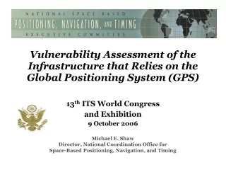
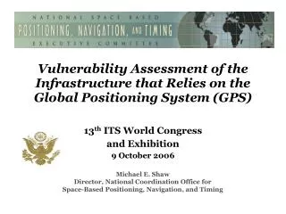
Vulnerability Assessment of the Infrastructure that Relies on the Global Positioning System (GPS) 13th ITS World Congress and Exhibition 9 October 2006 Michael E. Shaw Director, National Coordination Office for Space-Based Positioning, Navigation, and Timing
Overview • Background/Factors • Findings/Recommendations • Spectrum Protection
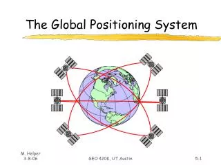
Background • The Global Positioning System (GPS) provides worldwide navigation, positioning, and timing services • Ever increasing applications across multiple critical infrastructures, both nationally and internationally • There is a growing awareness of the safety and economic risks associated with loss or degradation of the signals • Public policy must ensure safety and economic viability are maintained, even in the event of loss of GPS service
Background (cont’d) • 1998 - National Policy on Critical Infrastructure (PDD-63) tasked a GPS Vulnerability Study • To examine the potential impact of loss of GPS service • Safety, operational, environmental, and economic • 1999 - Department of Transportation initiated the study of potential vulnerabilities of GPS • Covered all modes of transportation, telecommunications, banking, and commerce • Focused on critical applications • Completed through Volpe National Transportation Center
1 Watt Jammer Factors of GPS Vulnerability • Unintentional interference • Radio Frequency Interference (RFI) • GPS testing • Ionospheric; solar max • Spectrum congestion • Intentional interference • Jamming – denial of use • Spoofing – counterfeit signals • System damage • GPS constellation, ground control segment • Inherent vulnerabilities in all systems that use radiofrequency spectrum Noise Jammer
Factors of GPS Vulnerability(cont’d) • Unique GPS characteristics • Very low signal power • Currently a single civil frequency • Known signal structure • Growing use of GPS encourage a disruption industry • Jamming techniques well known • Devices available, or easily built • Spectrum competition from non-radionavigation systems • Human factors • Errors, over-reliance, lack of knowledge/training
Consequences of Loss/Degradation of GPS • Situation dependent on … • Transportation mode involved • Duration of loss/degradation • Impact of loss can be • Minimal - Quick recovery • Operational - Reduced effectiveness and efficiency • Safety - Potentialfor loss of life, environmental, economic damage, or security risk • Timing and synchronization • Timing linked to transportation, commerce, and banking • Outage can disrupt communications/networks
Vulnerability Assessement • September 10, 2001 – Released Volpe Report on “A Vulnerability Assessment of the Transportation Infrastructure Relying on the GPS” • GPS users are subject to signal loss or degradation • Awareness and planning can mitigate worst vulnerabilities • Impossible to mitigate all vulnerabilities • 16 recommendations • 2002 – Secretary of Transportation formally accepted the Report and approved an action plan
Key Findings • GPS is subject to radiofrequency interference • GPS augmentations (e.g., WAAS, NDGPS) improve performance, but • Will not mitigate the loss of the basic GPS signal • Use of GPS-based timing synchronization must be assessed, as well as navigation and positioning • GPS will become an increasingly attractive target as applications proliferate
Vulnerability Mitigation Ensure adequate backup systems Continue GPS modernization Continue spectrum protection Enhance interference location capabilities GPS Receiver Enhancement Certify safety-critical GPS receivers Develop GPS receiver standards Facilitate transfer of DoD anti-jam technology Risk Awareness Emphasize education programs Conduct public outreach Send letters to industry, state/local Transportation Departments Work with GPS Industry Council Future Direction Intermodal radionavigation capabilities assessment Make decision on the future of Loran-C Develop Federal Radionavigation Plan Roadmap Recommendations
2005 Federal Radionavigation Plan (FRP) • Official USG source of radionavigation policy and planning • Enable safe transportation and encourage commerce • Prepared by Depts of Transportation, Defense, and Homeland Security • USG policy “not to rely on single system for positioning, navigation, and timing (PNT) for critical applications” • USG will maintain sufficient backup capabilities to meet: • Growing national, homeland, and economic security requirements • Civil transportation requirements (i.e. safety-of-life applications) • Commercial and scientific demands • Backups to GPS and other critical applications may be other systems, operational procedures, or combination of both
Additional Considerations • New GNSS signals will improve resistance to interference • GPS L5 and Galileo signals/services • GPS-Galileo interoperability/compatibility • But…Galileo is not robust backup to GPS; nor GPS for Galileo • Never totally eliminate threat of interference • Must determine minimum level of backup capability • Recognizing budgets are constrained • Acceptable from safety and economic impact points of view • Consider a “fail soft” versus “equivalent” backup capability • Acquiring an “insurance policy” that may never be used
Spectrum Protection • Protect spectrum for GNSS (GPS, Galileo, etc) and other current/future critical systems from interference • Degradation harms wide variety of plans and programs • Ultra Wideband, Mobile Satellite Venture, etc. • Focus areas: • Equitable spectrum management and coordination • U.S. National Spectrum Management legislation • Galileo cooperation for compatibility and interoperability • Requires vigilance and early action on emerging issues – World Radio Conference 2007 rapidly approaching
Conclusion • GPS and future GNSS systems, like Galileo, will provide • ever-growing benefits across many infrastructures • However, GNSS systems are subject to interference, • and other disruptions that can have harmful • consequences • Adequate independent backup systems and/or • procedures are in place and must be maintained for • critical applications in the future • Public policy must set the framework to ensure that • safety and economic viability are maintained, even with • a loss of GNSS service
Michael E. Shaw, Director National Coordination Office for Space-Based PNT Herbert C. Hoover Bldg., Rm. 6822 1401 Constitution Avenue, NW Washington, D.C. 20230 Ph: (202) 482-5809 Fax: (202) 482-4429 michael.shaw@PNT.gov Presentation and additional information available: PNT.gov Contact Information