The Global Positioning System
The Global Positioning System. Bart Krol / Jeroen Verplanke. INTERNATIONAL INSTITUTE FOR GEO-INFORMATION SCIENCE AND EARTH OBSERVATION. The Global Positioning System. The Global Positioning System. Acknowledgements GPS Overview by Peter H. Dana, Department of Geography,


The Global Positioning System
E N D
Presentation Transcript
The Global Positioning System Bart Krol / Jeroen Verplanke INTERNATIONAL INSTITUTE FOR GEO-INFORMATION SCIENCE AND EARTH OBSERVATION
The Global Positioning System Acknowledgements GPS Overview by Peter H. Dana, Department of Geography, University of Colorado, USA. http://www.colorado.edu/geography/gcraft/notes/gps/gps_f.html GPS Tutorial by Trimble Navigation Ltd. http://www.trimble.com
Why GPS ? Finding out where you are and where you’re going Positioning is crucial in handling geographical data A world wide system for positioning
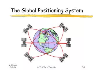
What is GPS ? A world wide radio-navigation system Uses satellites as reference points to calculate positions Three components: Space segment Control segment User segment
GPS components Spacesegment
GPS components Control segment User segment
How GPS works 1.The basis for GPS is resection from satellites 2.For resection a GPS receiver calculates distance to satellites using travel time of radio signals 3.To measure travel time, GPS needs exact timing 4.Along with distance you need to know the satellite position 5.For accurate positioning you must correct for errors
1. Resection from satellites 3 satellites for a position fix
2. Measuring distance to satellites Distance = velocity * travel time Calculating distance to satellite Using travel time of radio signal Travel time = ? Distance is about 22,000 km We cannot see satellites We cannot measure exact distance approx. 0.07 sec! Using radio signal to calculate distance This signal travels with speed of light Speed of light = 299,174 km/sec
3. Exact timing How to measure travel time satellite and receiver generate radio signal at the same time travel time = phase difference between signals 1 msec Satellite’s signal GPS receiver’s signal
3. Exact timing Very precise clocks for exact timing satellites : highly accurate ‘atomic’ clocks (about USD 100,000 each) receivers : moderately accurate quartz clocks Clock error due to difference in clock accuracy use a 4th satellite to correct for clock error
3. Exact timing Correcting for clock errors in 2D: At least: 3 satellites for 2D fix 4 satellites for 3D fix
4. The satellite position in space Using satellites as reference points for positioning also requires that you know the exact position in space of each satellite, at any place and at any time. The GPS control segment monitors the satellite position in space. All details of satellite orbits is available in an ‘almanac’ This satellite status information can be downloaded to the GPS receiver
5. Correcting for errors Main GPS error sources Clock errors Signal errors (noise) Interference in ionosphere and troposphere Multipath error Satellite position (“ephemeris”) error Geometrical error (Geometric Dilution of Precision - GDOP) Intentional errors (Selective Availability - SA) Human errors Receiver errors (hardware, software, antenna)
5. Correcting for errors Geometric Dilution Of Precision (GDOP) POOR GDOP (2-6) GOOD GDOP ( 2)
5. Correcting for errors GDOP, continued We’re somewhere in this box At close angles the box gets bigger
5. Correcting for errors GDOP, continued GOOD COMPUTED GDOP AND BAD VISIBILITY RESULTS IN POOR GDOP
5. Correcting for errors Selective Availability (SA) The US military can introduce intentional errors to limit accuracy for civil GPS users SA introduces an artificial clock error into the radio signal and writes an error in the satellite status information If SA is ‘on’ a potential horizontal accuracy of ± 30 meters will be reduced to ± 100 meters.
5. Correcting for errors • Some typical errors • Satellite clock error ± 2 meter • Receiver noise ± 0.5 meters • Interference in • ionosphere and troposphere ± 5 meters • Multipath error ± 1.4 meter • Satellite position (“ephemeris”) error ± 2 meters • poor GDOPup to 200 meters • Human errors up to hundreds of meters • Receiver errors • (hardware, software, antenna) any size possible
Using a handheld GPS receiver Typical accuracy: ±10 m Horizontal ( civilian use, good GDOP) Results of measurements over one month (Garmin 12XL) Horizontal Accuracy (50%) ± 3.9 meters Vertical Accuracy (50%) ± 9.6 meters Horizontal Accuracy (95%) ± 9.3 meters Vertical Accuracy (95%) ± 21.9 meters Source: GPS ACCURACY MONITOR by Dennis Milbert (http://mywebpages.comcast.net/dmilbert/handacc/accur.htm)
How GPS works To sumarize 3. Exact timing 1. Resection from satellites 2. Distance to satellites 5. errors 4. Position in space
How to operate the Garmin • Basic buttons: Next page change up/down Enter Power
How to operate the Garmin Mode Accuracy Units Expected sat position Horizon Battery level Skyline at 45º Known sat position Zenith (90º) Signal strength Satellite number • Navigation screen:
Set up the GPS and go outside • In the classroom • Familiarize yourself with the GPS • Set-up the GPS • Enter Waypoints • Outside the main entrance • Check position • Try using the compass in the GOTO function • Go and find the waypoints