Download
1 / 39
390 likes | 522 Vues
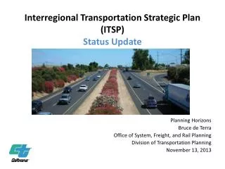
Interregional Transportation Strategic Plan (ITSP) Status Update. Planning Horizons Bruce de Terra Office of System, Freight, and Rail Planning Division of Transportation Planning November 13, 2013. Development Team. Paul Moore – principal author

E N D
Interregional Transportation Strategic Plan(ITSP)Status Update Planning Horizons Bruce de Terra Office of System, Freight, and Rail Planning Division of Transportation Planning November 13, 2013
Development Team • Paul Moore – principal author • Tammy Roberts – document design & production • Fay Meet – maps • Al Arana – project lists & status updates • District System Planning – information gathering and document review
In memory of Pat Weston A visionary who led the development of the first Interregional Transportation Strategic Plan and was instrumental in shaping the direction of Caltrans System Planning and the future of California
The Fine Print • The Interregional Transportation Strategic Plan (ITSP) has been developed for information purposes to articulate key interregional transportation project needs for consideration within Caltrans and partner agency project development and programming processes. • It is not a plan under the California Environmental Quality Act (CEQA) or National Environmental Policy Act (NEPA), does not program funds, and is not fiscally constrained. • Projects are subject to CEQA and NEPA at the programmatic level, as they’re included in a Regional Transportation Planning Agency’s Regional Transportation Plan and as the individual project produces the appropriate Environmental Document for that project.
Table of Contents • INTRODUCTION • CHAPTER 1 • Purpose of the 2013 ITSP Status Update • CHAPTER 2 • Vision for the Interregional Transportation System • CHAPTER 3 • State Highways Overview • Caltrans Primary Responsibilities • Fundamentals -- Background that Frames the ITSP • Interregional Road System (IRRS) • High-Emphasis and Focus Routes • Strategic Highway Network (STRAHNET) & Lifeline Routes • CHAPTER 4 • Priority Considerations for State Highways • IRRS Focus Route Corridors • North/South Focus Routes • East/West Focus • Interstates and other State Routes
CHAPTER 5 • Freight • CHAPTER 6 • Intercity Passenger Rail • 2013 California State Rail Plan • California High-Speed Passenger Rail • XpressWest High-Speed Rail • CHAPTER 7 • Mass Transit & Modal Linkages • Interregional Mass Transit Guideways • IRRS Modal Linkages • Freight Rail • Seaports • Airports • CHAPTER 8 • Planning Considerations • Senate Bills (SB) 391 and 375 • Consultation with Tribal Governments • Corridor System Management Plans • Sea-Level Rise • Smart Mobility • Complete Streets
CHAPTER 9 • Focus Route Improvements: Project Planning and Programming • U .S . Highway 101 • State Route 99 and 99/70 Corridor “Y” to State Route 149 • U .S . Highway 395 & SR 14 • State Routes, 7, 111, 78, 86 and 905 NAFTA (North American Free Trade Agreement) Gateway . • State Route 58 • State Route 198 • State Route 41 • State Route 46 • State Routes 152 and 156 • State Routes 20, 29, 53, and 49 • State Routes 299, 44, and 36 • CONCLUSION
Appendices • Appendix A -- Key State Legislation Since 1998 Affecting Transportation Planning : AB 32, SB 391, SB 375, Complete Streets Act of 2009, ISTEA, SAFTEA-LU, MAP-21 • Appendix B – Strategic Growth Pyramid • Appendix C -- Trade Corridor Improvement Fund (TCIF) Projects • Appendix D --Corridor System Management Plan (CSMP) Projects • Appendix E-- IRRS Routes Legislative Description • Appendix F – Acronyms • Appendix G – Website Information
75% / 25% Funding Split • California Streets and Highway Code Sections 163-164 .56 establishes legislative policy for the use of all transportation funds available to the State (implementing the provisions of SB 45, 1997) . • The ITSP provides guidance for transportation improvement projects for modes covered under part (d), Section 164 of the above mentioned Code .
Intercity Passenger Rail • Provide an attractive alternative to automobile and air travel in the major corridors by linking the urban centers of California (minimum 9 percent of ITIP funds) and by connecting California to the rest of the nation via national interstate trains . Continue to offer service that is frequent, direct, and reliable .
Mass Transit Guideways • Provide cost effective modal investments for the highest traveled and highest density guideway corridors that support interregional travel and have overriding statewide significance (no specific ITIP allotment) .
Grade Separations • Provide safe railroad grade crossings at State highways, and minimize disruptions and delay for the interregional movement of people and goods (no specific ITIP allotment).
State Highways • Provide a safe, dependable facility for the interregional movement of people and goods, accessibility into and through “gateways” and connectivity to intermodal transfer facilities (minimum 60 percent of ITIP funds) . Maximize operational capacity of highway system through efficient corridor management .
Context Sensitivity Though the goal of the Focus Route is to upgrade facilities to a higher concept level, it is essential that the upgrades are implemented in a context-sensitive manner that addresses community and environment needs .
State Route 58 - Kern State Route 58 - Mojave Construction
FOCUS ROUTE CONCEPT STATE ROUTE 58 • State Route 58 is a high-capacity, high level of service east/west facility that provides significant goods/freight movement connections between I-5 and SR 99 in the Central Valley, SR 14 linking, and I-15 and I-40 via Barstow . • Via SR 99 and I-5, it connects to other regions in Central and Northern California, (via SRs 14 and 395) to the Eastern Sierra region and the SR 395 gateway, via SR 14 and I-15 to urban Southern California, and (via I-15 and I-40) with Nevada, Arizona, and the southern United States .
FACILITY STANDARD TO MEET CONCEPT • Four-lane expressway/freeway from I-5 to SR 99 • Four- to six-lane freeway from SR 99 to SR 14 • Four-lane expressway from SR 14 east of Mojave to I-15
U.S. Highway 101 Monterey County
The straightening of curves on State Route 299 in Trinity County, along with the widening of shoulders, addition of passing lanes, and creation of wider median striping, enables full-size trucks to traverse the highway without crossing over the double yellow median stripe . Safety is improved as are travel times .
What’s Next? • Determine if the original set of Focus Routes are still appropriate, whether some should be dropped, whether additional routes should be added. • Engage a wide variety of stakeholders. • Prepare a full update that addresses MAP-21, climate change, and other issues.