Download
1 / 41
410 likes | 554 Vues
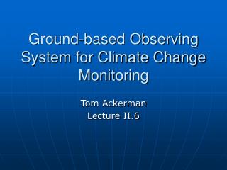
Ground-based Observing System for Climate Change Monitoring. Tom Ackerman Lecture II.6. Topics. Why do we need ground-based observations for climate and what would we do with them? What is measurement synergy all about?. To be added. Results from Monday discussion.

E N D
Ground-based Observing System for Climate Change Monitoring Tom Ackerman Lecture II.6
Topics • Why do we need ground-based observations for climate and what would we do with them? • What is measurement synergy all about?
To be added • Results from Monday discussion
GCOS Position on Ground-based Observations for Climate • Primary tool is satellite(s) • Surface and in situ observations only needed for • Calibration and validation • Measurement of parameters that cannot be measured by satellite (“biodiversity, groundwater, carbon sequestration, subsurface ocean”) • Long time series for diagnosis of global change (“surface temperature, precipitation and water resources, weather and other natural hazards, … pollutants”)
GCOS Position – Surface networks • GCOS surface network (GSN) • Measure in situ (surface) observations of surface temperature, humidity, wind speed and direction • Mention “surface radiation (e. g., sunshine duration)” • Approximately 1000 stations world wide • Over ocean – volunteer ships, buoys (fixed and floating) • Baseline Surface Radiation Network (BSRN) should be enhanced (currently a volunteer network of 39 stations
GCOS Position – Surface networks • GCOS surface network (GSN) • GCOS Upper Air Network (GUAN) • Radiosonde T, q, wind (~150 stations) • Cloud properties from surface observer • Commercial aviation • Global Atmospheric Watch (GAW) • CO2, CH4, O3, other GHGs, aerosol • ~33 stations, some ship measurements
So, what’s wrong with this picture?A Minority Report and ProposalAcknowledgements to Jim Coakley (OSU) and Chuck Long (PNNL)
Two underlying premises • Understanding and addressing climate change will be a critical societal problem for the next several decades • The most important issues will be water availability and energy production and use • Climate change is a global problem and must be attacked with globally integrated models and observations
Some Limitations of Satellite Observations • Surface fluxes of energy and moisture • Properties of low-level clouds in multi-layered systems • Aerosols below and mixed with cloud layers • Absorption of solar energy by aerosols • More?
Role of ground-based observations • Continuous observations of cloud, aerosol and radiative properties at high temporal resolution that facilitate the understanding of cloud and aerosol processes (Improvement of atmospheric physics) • Alternative climatologies of radiation, cloud, and aerosol quantities crucial to climate change science (Model and satellite comparison) • Critical datasets to test the surface and cloud properties retrieved from satellite observations (Evaluation) • A means for evaluating the performance of satellite instruments over the lifetime of the satellite (Calibration)
Level 1 stations • Basic surface observation site – BSRN type • Measurements of • Surface energy fluxes • Surface state variables • Column aerosol properties • Co-located with sonde sites • Order of 1000 to 2000 sites globally • Site capital cost $75K • Site operational costs: $16K/year
Level 2 Sites • Includes Level 1 site instruments • Incorporates highly reliable remote sensing instruments to measure • Column water vapor • Cloud base height • Aerosol backscatter profile • Cloud fraction and occurrence • Order of 100 to 200 sites globally • Additional capital cost: $200K • Additional site operational cost: $4K
Level 3 Sites • Includes Level 2 site instruments • Like US ARM and European sites • High end remote sensing sites to measure • Surface properties • Vertical profiles of aerosol and cloud properties and thermodynamic variables • Spectrally-resolved radiances and fluxes • Focus on high spatial and temporal resolution • Order of 10 to 20 sites globally • Additional capital cost: $1.5M • Additional site operational cost: Undetermined
Increasing Instrument Complexity Data volume Cost Operator training
Strategy • Integrate concept into climate observing system plans such as GCOS • Build on existing networks • Sustained support for current sites • Funding to expand observations to under-represented areas (oceans, southern hemisphere) => need much better geographical representation • Enable science • Shared and accessible data => archive! • Algorithm development and operational application
From observations to science … • Three level plan implies a progression of understanding and interpretation • More sophisticated measurements clarify what we can learn from less sophisticated measurements • Multiple measurements provide additional data that allow us to do more detailed comparisons with models • Top level sites are the key to making the entire scheme work!
The Atmospheric Radiation Measurement Program • Sites are prototypes of the Level 3 sites • What have we learned from ARM? Note: Sites in Europe (e. g., Cabauw, Lindenberg, Palaiseau, Chilbolton) are as well instrumented and scientifically useful as the ARM sites. ARM is a more operational program, so it offers the best model for us to consider here.
Atmospheric Radiation Measurement Program Goal Improve the treatment of cloud and radiation physics in global climate models in order to improve the climate simulation capabilities of these models
Two fundamental science questions • If we can specify the properties of a cloud field, can we compute the radiative fluxes? Requires knowledge of cloud properties (3D structure, water path, phase, size, etc.)
Two fundamental science questions • If we can specify the large-scale atmospheric fields, can we predict the cloud field properties? Requires 3D field of state properties and cloud field properties
Infrastructure Science ARM Program Components • Development of ground-based remote sensing facilities • Continuous data acquisition and archival • Data analysis • Physical modeling • Parameterization development and testing
ARM History • Program initiated in 1990 • initial science grants • Site planning and instrument selection • USA facility (SGP) data available since 1994 Full instrumentation in 1996 • Tropical western Pacific site • Manus 1996 • Nauru 1998 • Darwin 2003 • North Slope of Alaska (Pt. Barrow) since 1998 • ARM Mobile Facility first deployment in 2005
Southern Great Plains Central Facility
Tropical Western Pacific Darwin
Tropical Western Pacific Sites Manus, PNG Nauru Darwin
Operating ground-based sites • Continuous measurements • Can be done but difficult in remote locations • Measurement synergy is key to science success • Instrument improvement and development • Interaction with science community is critical • Expensive • But not when compared with science return
Data acquisition and archiving • Science success depends on a good archive • Good => reliable, easy to use, responsive • Best metric is user satisfaction • Second best metric is data outflow
Data analysis • Data must be calibrated and quality-controlled • Continuous data • Multiple instruments • Multiple sites • Multiple seasons and years • Scientists will find more things to do with the data than you ever imagined
High-resolution atmospheric modeling • Most profitable area of scientific investigation • GEWEX Cloud System Studies (GCSS) link • Weather forecasting centers (ECMWF, NCEP, etc.) • Data used for • Model initialization • Model evaluation • Model development • Classification studies
Evaluating and improving climate models • Most difficult problem • Requires a lot of data • Dependent on clever data analysis and understanding • Critical issues of spatial and temporal sampling • We are making significant progress! • Model evaluation • Cloud and convection parameterizations (more about this later!)
Retrievals, Synergy and Redundancy • In the beginning, there was one measurement and one retrieved property • Lidar backscatter => Cirrus optical depth Required closure assumptions!
Retrievals, Synergy and Redundancy • Then we added a measurement of Window Radiance • Lidar + I(10 mic) => and IWP Synergy!
Retrievals, Synergy and Redundancy • Then we added an Interferometer • Lidar + I() => , IWP, Deff Synergy! Redundancy!
Retrievals, Synergy and Redundancy • Then we added a mm radar • Radar + Lidar + I() => multiple values of , IWP, Deff Synergy! Redundancy! Choice!
Retrievals, Synergy and Redundancy • Multiple measurements allow us to retrieve more pieces of information • Observational redundancy allows us to address issues of instrument noise • Multiple measurements allow us to perform complex retrievals that optimize information based on instrument operational characteristics • A priori information based on our knowledge of atmospheric phenomena can also be folded into the retrieval process