Download
1 / 27
270 likes | 405 Vues
Tsunamis and Coastal Hazards Warning System for the Caribbean and Adjacent Regions. Dr Lorna V. Inniss Deputy Director, CZMU BARBADOS Chair, Coastal Hazards Standing Committee.

E N D
Tsunamis and Coastal Hazards Warning System for the Caribbean and Adjacent Regions Dr Lorna V. Inniss Deputy Director, CZMU BARBADOS Chair, Coastal Hazards Standing Committee
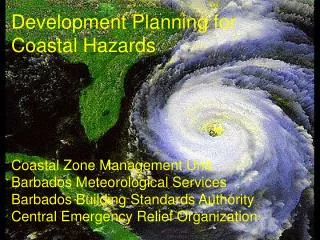
The January 12, 2010 event and the tragedy of our Haitian brothers and sisters was a grim reminder to us all that much more effort is needed to construct earthquake resilient societies, protecting lives, property and livelihood …
Anatomy of my Presentation • Why a Tsunamis and Coastal Hazards Warning System? Real events, history and risks • Response to the Risk and Progress of the ICG CARIBE EWS • Institutional and Technical Components of the EWS • CARIBE WAVE/LANTEX 2011
January 12th Haiti Event 7.0 Magnitude Struck in the early hours of the evening Significant loss of life due to earthquake A local tsunami was generated – 3m run-up Triggered the CARIBE EWS and allowed for a comprehensive evaluation of the system’s performance 4
January 12th Haiti Event Secretariat distributed a Post Event Assessment Questionnaire Twenty-two of 28 responses received Timely bulletins were received by most countries Sea level was scarcely monitored during the event 5
Haiti Earthquake and Tsunami January 12, 2010, Mw 7.0, > 200,000 victims (EQ) At least 7 people lost their lives from the tsunami. Tsunami runup in Haiti
Historical Tsunami Runups in the Caribbean 40 definite tsunamis, 10 probable tsunamis, 33 questionable tsunamis, 14 very doubtful tsunamis and 1seiche.
Date Place Fatalities 1842 Haiti 300+ 1853 Venezuela 600+ 1867 Virgin Islands 23 1882 Panama 75+ 1906 Jamaica 500 1918 Puerto Rico 140 1946 Dominican Republic(1) 1790 1946 Dominican Republic(2) 75 2010 Haiti 7 TOTAL3510 Ref: Caribbean Tsunamis, A 500-Year History from 1498-1998 by Karen Fay O'Loughlin and James F. Lander (2003: ISBN 1-4020-1717-0); Tsunamis of the Eastern US, NGDC, 2002 Science of Tsunami Hazards, vol 20, #3, pg 120; PRSN on Haiti,2010
Since 1842, at least 3510 people have lost their lives to tsunamis, this is more than in the Northeastern Pacific…The Caribbean basin - only 1/5 the area had nearly 6x more deaths ! 1842-2010: 3510+ deaths 1842-2006: 579 deaths http://www.srh.noaa.gov
The Caribbean Situation • Last major tsunami event(s): Dominican Republic: 1790 +75 = 1865* deaths in August, 1946. • Since 1946, explosive population growth across Caribbean from residents and tourists at the coasts • Therefore, the Caribbean’s historical deaths from tsunamis greatly understates its current 21st century potential loss of life! • If we just take into consideration the number of people that can be on the beach, 50,000 people are exposed daily to tsunamis in the region. The Basin has many tsunami-genic areas: tectonic zones & faults, shelves-trenches, volcanoes *Statistics fromCaribbean Tsunamis, A 500-Year History from 1498-1998 by Karen Fay O'Loughlin and James F. Lander (ISBN 1-4020-1717-0 2003 edition)
The risk to life from tsunamis has increased dramatically due to coastal population and tourism growth. Here we see the port at Charlotte Amalie Bay, St. Thomas 20 Foot tsunami, November 18, 1867 Same bay in St. Thomas today with 25,000 lives at risk ! 30 people lost their lives on November 18, 1867 in a 20 ft tsunami. Today there can upwards of 15,000 to 25,000 people at risk because of cruise ships. Many more people in tsunami inundation zone
The regional response… UNESCO/IOC Intergovernmental Coordination Group for Tsunamis and Other Coastal Hazards Warning System for the Caribbean and Adjacent Regions
ICG CARIBE EWS Executive Chair Dr Lorna V. Inniss - BARBADOS Vice Chairs Dr Frederique Martini - France Mrs Christa von Hillebrandt-Andrade - USA Mr Francisco Garces - VENEZUELA 14
Main Components of CARIBE EWSPer recommendation of the Member States • Working Groups: • Monitoring and Tsunami Warning Guidance • Tsunami Hazard, Risk and Vulnerability Assessments • Communications • Preparedness, Readiness and Resilience • Permanent Bodies • Caribbean Tsunami Warning Center-CTWP potential first step • Caribbean Tsunami Information Center – to be established in Barbados with funding by the Govt. of Italy • Secretariat-Interim location in Paris, France at UNESCO HQ • National Stakeholders • National Tsunami Contacts • Tsunami Warning Focal Points 15
ICG Secretariat The Tsunami Unit within the IOC continues to function as the interim Secretariat for the CARIBE EWS Technical Secretary - Bernardo Aliaga 16
Caribbean Tsunami Warning Center (CTWC) NOAA NWS established in February 1, 2010 the Caribbean Tsunami Warning Program, jointly located at the Puerto Rico Seismic Network at the University of Puerto Rico at Mayagüez as a first step of the U.S. phased contribution to the establishment of a Caribbean Tsunami Warning Centre Christa G. von Hillebrandt CTWP Manager, with Harold Irizarry, Data Analyst, PRSN
Caribbean Tsunami Information Center (CTIC) • The Italian-funded project has experienced some delays in start-up • The programme is expected to be launched very soon • Barbados has already allocated office space and financial resources in preparation for the center’s establishment 18
Seismic Data Availability in the Caribbean77% (95/124) of Core CARIBE EWS Stations are contributing in real time
Sea Level Data Availability in the Caribbean100% (6/6) of the DART stations are installed20% (19/94) of coastal sea level gauges are operational and transmitting at least every 15 minutesIOC Sea Level Facility Limón, Costa Rica station, upgraded 2009
CARIBE Wave/LANTEX Exercise 2011 • The ICG decided to conduct a joint CARIBE Wave 2011 and LANTEX 2011 exercise in the Western Atlantic, Caribbean and Adjacent Regions on March 23rd, 2011 • Endorsed the establishment of a Task Teamto oversee the exercise