Download
1 / 17
180 likes | 351 Vues
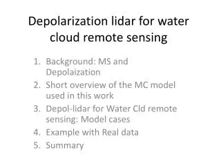
Depolarization lidar for water cloud remote sensing. Background MS and MC Short overview of the MC model used in this work Depol -lidar for Water Cld remote sensing: Model cases Example with Real data Summary. Lidar+clouds Multiple Scattering : MS. MS gives rise to:

E N D
Depolarization lidar for water cloud remote sensing Background MS and MC Short overview of the MC model used in this work Depol-lidar for Water Cld remote sensing: Model cases Example with Real data Summary
Lidar+clouds Multiple Scattering : MS • MS gives rise to: • Increase in lidar signal compared to SS • Cross-polarized signal even for spherical targets. • Depends on: • Wavelength • Size Dist. • Extinction profile • FOV • Distance from Lidar
ECSIM lidar MC model • Fast MC lidar model developed originally for EarthCARE simulations. • Capable of simulations at large range of wavelengths and viewing geometries including ground-based. • Recently used in a component of COST Blind-Test algorithm intercomparision activities.
Val: Against other MC models andObservations ECSIM vs other MC results Validation (vs other models): Cases presented in Roy and Roy, Appl. Opts. (2km from a C1 cumulus cloud OD=5) Circ lin ECSIM MC results Carswell and Pal 1980: Field Obs. Roy et al. 2008: Lab results
Connection for water cloud remote sensing…. Not too long ago, motivated by the observations of highly depolarizing volcanic ash I was looking for a way to verify the depol. calibration of a lidar system I operate. Motivated by Hu’s results for Calipso, I wondered if strato-cu could be a good target So I setup a script to run my MC code on several hundred cases using a simple water cloud model (Fixed LWC slope and Constant N) The results were initially disappointing…..the resulting depol and backscatter relationships depended too much on the LWC slope and N ! …… Hmmm….. maybe I should look at this in some more detail from the other side.
D_LWC/dz = 0.5 gm-3 D_LWC/dz = 1.0 gm-3 Para Profiles normalize so that the peak is 1.0 MC look-up-tables made for several cloud bases and different size-dist widths and receiver fovs.
Depol and `Shape’ largely a function of extinction profile but exploitable differences exist, especialy at small particle sizes (depends somewhat of fov).
Trial using one of the `blind-test’ LES scenes WITH DRIZZLE !
Since effectively only information from the lowest 100 meters of the clouds is used. Departures from “good behavior” particularly near cloud top are problematic.
A case using real data A real case: Cabauw: Leosphere ALS-450 355nm, 2.3 mradfov
Comparison with uwave radiometer observations and sensitivity to size-dist width assumptions , fov and depol calibration uncertainties Ran out of time… ….but preliminary findings are encouraging.
Summary • Lidar Depolarization measurements are an underutilized source of information on water clouds. • Fundamental Idea is not new…Sassen, Carswell, Pal, Bissonette, Roy, etc… have done a lot of work stretching back to the 80’s and likely earlier. • But now with better Rad-transfer codes and much faster computers a re-visit is in order.
The general problem (i.e. the inversion of backscatter+depol measurements to get lwc profile and Reff under general circumstances ) is complex and likely requires multiple fov measurements. However… • Constraining the problem to adiabatic(-like) clouds simplifies things and enables one to construct a simple and fast inversion procedure. Still early days but the idea looks worth pursuing. There is A LOT of existing lidar observations it could be applied to. • Results are insensitive to presence of drizzle drops ! • Lots of opportunities for synergy with radars, uwave radiometers and other instruments. • Will require some thinking on how to integrate within an Ipt-like scheme.