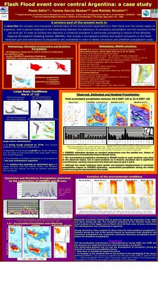
WFO Binghamton Maddox Synoptic Type Flash Flood Classification Study
320 likes | 461 Vues
WFO Binghamton Maddox Synoptic Type Flash Flood Classification Study. By Christopher Gitro NWS Binghamton, NY. Motivation. Flash flooding remains the number 1 weather killer across the US 29 flash flood related fatalities in BGM’s CWA since Jan 1996 Most Recent: 01 Oct 10

WFO Binghamton Maddox Synoptic Type Flash Flood Classification Study
E N D
Presentation Transcript
WFO Binghamton Maddox Synoptic Type Flash Flood Classification Study By Christopher Gitro NWS Binghamton, NY
Motivation • Flash flooding remains the number 1 weather killer across the US • 29 flash flood related fatalities in BGM’s CWA since Jan 1996 • Most Recent: 01 Oct 10 • Knowledge of favorable synoptic patterns responsible for significant flash flooding → higher situational awareness →Pattern Recognition • First local attempt to classify large scale flash flood episodes based on large scale synoptic patterns
Methodology • Main Goal: Classify historically significant past flash flood episodes by the Maddox Synoptic classification scheme • Flash flood events from the winter of 1996 through present were examined • 42 total Events • An event was classified if any of the following three occurred: • 1) 5 or more flash flood reports from a single event • 2) $500K crop/property damage • 3) Fatality(ies) occurred • For synoptic environments in which the synoptic pattern did not reflect the traditional patterns as described by Maddox et al. (1979), the events were labeled as “Unclassified” • If a flash flood event resulted from a remnant tropical circulation moving across the area, the event was classified as “Tropical”
Methodology Cont. • Archived H50 (SPC, HPC) 00Z/12Z Maps • Archived HPC analyzed surface maps • Radar animations analyzed through GR Analyst • NAM BUFKIT Proximity Soundings • Sounding was selected by picking the hour from closest NAM forecast point to time of initial flash flood report • (LLJ winds (BUFKIT defined), Cloud Layer Winds, MBE Speeds, Warm Cloud Depth, etc)
Review Synoptic Frontal All images from Maddox et al. (1979) Meso High
Results 42 Total Events
Possible New East Coast Hybrid Flood Pattern?
Current Maddox Classification Types Synoptic Frontal All images courtesy of COMET
Hybrid Surface/Upper-Level Patterns • Large scale flash flood situations • Deep upper troughing • Well developed mid-latitude cyclone (most) • Warm frontal boundary (developing across the Mid-Atlantic or prepositioned off the East Coast) • Hybrid events display both Frontal and Synoptic type characteristics • Upper pattern resembles Maddox Synoptic (deep upper troughing) • Surface pattern more characteristic of Maddox Frontal (overrunning LLJ/strong isentropic ascent)
26-28 June 06 Record Flood Event
26-28 June 06 Flood Event 06z HPC Sfc Analysis 500 hPa, 00z 28 June MPE Precip Estimates, 28 June
26-28 June 06 Flood Event Surface Theta-E (contoured/image) 300K Winds (black) MSLP (yellow) 300K Pressure (White contours) 300K Winds (orange) Mixed Layer Cape (contoured/image)
26-28 June 06 Flood Event • Strong isentropic ascent along/north of developing warm front (Frontal) • HYSPLIT parcel trajectories indicated low-level parcels overran front • Upper pattern displayed Synoptic type characteristics • Strong isentropic ascent coupled with a moist and unstable airmass • Heavy rainfall and record flooding across the Mid-Atlantic and Northeast 06Z EDAS HYSPLIT Backward Parcel Trajectory Analysis
30 September 10 Flood Event
30 Sep 10 Flood Event 15z HPC Sfc Analysis 500 hPa, 12z 30 Sep MPE Precip Estimates, 01 Oct
30 Sep 10 Flood Event Surface Theta-E (contoured/image) 300K Winds (white) MSLP (yellow) 300K Pressure (White contours) 300K Winds (green) Mixed Layer Cape (contoured/image)
30 Sep 10 Flood Event • Initial shot of moderate to heavy rainfall overran westward moving frontal boundary • HYSPLIT parcel trajectories indicated low-level parcels of western Atlantic origin overran retrograding front (Maddox Frontal) • Upper pattern characterized by • broad upper trouging to the • west (Maddox Synoptic) • Characteristics of both Frontal and Synoptic setups were displayed • Hybrid 15Z GDAS HYSPLIT Backward Parcel Trajectory Analysis
Central Plains ComparisonJune 2008 Upper Midwest Record Flood Setup 500 hPa, 00z 08 Jun 00z HPC Sfc Analysis 0045 UTC IR Satellite Imagery Image courtesy of Grumm et al. (2008)
June 08, 2008 Upper Midwest From: Grummet al. (2008) June 28, 2006 East Coast From: Grumm and Holmes (2007) 1000 MB Anomaly Comparison Sept 30, 2010 East Coast From: Grumm and Kozar (2010)
June 08, 2008 Upper Midwest June 28, 2006 East Coast FromGrummet al. (2008) 500 MB Anomaly Comparison Sept 30, 2010 East Coast From: Grumm and Kozar (2010)
June 08, 2008 Upper Midwest From: Grummet al. (2008) June 28, 2006 East Coast From: Grumm and Holmes (2007) 850 MB Winds and V-wind Anomaly Comparison Sept 30, 2010 East Coast From: Grumm and Kozar (2010)
June 08, 2008 Upper Midwest June 28, 2006 East Coast Sept 30, 2010 East Coast • East Coast events displayed strong SSE low-level winds → Western Atlantic major source region for low-level moisture • Low-level parcels overrunning developing frontal boundaries along the coast or Mid-Atlantic • Similar forcing to Frontal type FF events common across the central US
Conclusions • The BGM HSA is susceptible to all 3 eastern US Maddox Flash Flood types • Synoptic type flash flood producing environments most common (20 cases) • Frontal/Meso High less common but potentially devastating considering BGM’s highly variable terrain (terrain anchoring) • Both Meso High cases had fatalities • Not all synoptic patterns cleanly fit into the Maddox classification scheme (10 unclassified, 3 tropical) →Hybrid Synoptic/Frontal
Conclusions cont. • Hybrid Synoptic/Frontal FF setups; a common theme along East Coast? • Upper-level patterns display Maddox Synoptic type characteristics →Meridional flow / Longwave trough approaching from west • Sfc patterns often display Maddox Frontal type characteristics → strong isentropic ascent along/north of developing warm front or stalled front along East Coast • Anomaly data suggests East Coast setups are similar to Great Plains Frontal events • East Coast events 1000/500 MB anomaly patterns (axes) highly meridional • Main moisture source: western Atlantic • Plains / upper Midwest frontal events rotated 45° to the right → Positive Tilt • Main moisture source: Gulf of Mexico • N/S anomaly setup for East Coast events allows front responsible for central Plains FF events to rotate to a more N/S orientation near the coast - Similar low-level forcing mechanism
References Grumm, R.H., and R. Holmes, 2007a: Patterns of heavy rainfall in the mid-Atlantic. Pre-prints, Conference on Weather Analysis and Forecasting, Park City, UT, Amer. Meteor. Soc., 5A.2. Grumm, R.H., N.W. Junker, and M. Bodner 2008: Heavy rain and flood event of 8-9 June 2008. [Available online at http://nws.met.psu.edu/severe/2008/08JUN2008.pdf] Grumm, R.H., and M. Kozar, 2010: The historic synoptic-hybrid rainfall event 30 September 2010. [Available online at http://cms.met.psu.edu/sref/severe/2010/30Sep2010Flood.pdf] Maddox, R. A., C. F. Chappell and L. R. Hoxit, 1979: Synoptic and meso-α scale aspects of flash flood events. Bull. Amer. Meteor. Soc., 60, 115-123.