Tectonic Activity and Hazards
490 likes | 833 Vues
Tectonic Activity and Hazards. Cameron Dunn Chief Examiner. 1.The specification. There are four themes to cover in the spec*: 1.1.Tectonic activity and causes 1.2.Tectonic hazard physical impacts 1.3.Tectonic hazard human impacts 1.4.Response to tectonic hazards.

Tectonic Activity and Hazards
E N D
Presentation Transcript
Tectonic Activity and Hazards Cameron Dunn Chief Examiner
1.The specification There are four themes to cover in the spec*: • 1.1.Tectonic activity and causes • 1.2.Tectonic hazard physical impacts • 1.3.Tectonic hazard human impacts • 1.4.Response to tectonic hazards
2.Key differences compared to Legacy Spec B • The spec is narrower than Spec B Unit 5 Hazard – this is just tectonics • There is a strong focus on causes and understanding plate motion and boundaries • The tectonic landscapes element (1.2) is new • Human impacts (1.3) and responses (1.4) are similar to what many of you are used to • A further important point is that students have studied the distribution of hazards in Unit 1 at AS level.
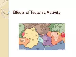
1.The Geography of volcanoes: Active volcanoes recorded since October 2004
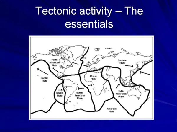
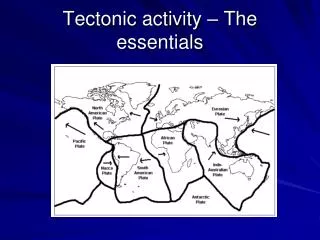
Tectonic settings & plate margins: Constructive: oceanic continental Destructive: oceanic continental Conservative: Hotspots: oceanic continental
MAGMA Geography: PARTIAL MELTING • Well known locations. • 50% of eruptions occur around the Pacific Rim of Fire. • A common hazard; 82 eruptions in the last year. • Areas of increasing human settlement. • Very variable hazards and impacts. • Key to understanding them is to understand the generation of magma: HEAT SOURCE
2.The range of volcanic hazards: • Huge variation in hazard from merely spectacular to devastating. • Some volcanoes generate a single hazard, such as a lava flow. • The most dangerous volcanoes are multiple hazard areas. • This presents a series of management challenges.
Measuring explosivity: • Volcanic Explosivity Index (VEI) is used to measure volcanic power. • VEI measures: Volume of ejecta Height of the eruption column Duration of the eruption. • Modern humans have never experienced a VEI 7 or 8
Magma type & volcano morphology • Basaltic – huge, low relief shield volcanoes plus small scoria cones and fissure vents. • Andesitic – steep sided strato-volcanoes; layers of lava, ash and tephra. • Rhyolitic – central craters with lava plugs / domes, due to high viscosity of the lava.
3.Some case studies: KILAUEA, Hawaii • Mantle convection plume (hot spot) = heat source. • Partial melting of the upper mantle material (peridotite) occurs. • This yields basaltic lava • Low gas content, low silica content, low viscosity, high temperature. • The hot spot is stationary, oceanic plate moves over it, forming an island chain.
NYIRAGONGO, Democratic Republic of Congo • Unusual tectonic setting; a continental CPM • Erupting basaltic magma • Unusually high sulphur emissions and very high temperature, low silica lava. Flows move at 60 km/h + • Erupted in 1977(100-1000 deaths) and again in 2002 (45 deaths; possibly 100,000 homeless) • Up to 500,000 potentially at risk.
SOUFRIERE HILLS, Montserrat • An island arc DPM. • Two oceanic plates in collision. • Subduction of one tectonic plate occurs • Note that both plates are made of basalt. • Explosive eruption characterised by pyroclastic flows. • The 1995-97 eruption caused over half of the island to be abandoned due to pyroclastic flow risk
Why is Soufriere Hills explosive? • Water within the oceanic plate, lowers the melting temperature of some minerals in the subducting plate. • These minerals rise away from the unmelted part – a wet partial melt. • The melted portion has a high silica and high gas content. • As the magma nears the surface, confining pressure drops, the dissolved gas in the magma expands (decompression). This blasts material out of the vent.
YELLOWSTONE CALDERA, USA • Tectonic setting is a continental hot spot in north-west USA. • Hot spot causes in situ melting of the continental plate. • As this is granitic, very viscous, low temperature, high gas content rhyolitic magma is produced. • The North American continental plate moves over the hot spot at 2-4cm/yr.
Ash and tephra could cover an area of 30,000 km2 • Short-term climate change likely • Huge potential impacts on ecosystems, people and economies
Summary: • Volcanic impacts are linked to tectonic setting • Understanding the generation of magma is key to understanding the hazards • Impacts are a result of magma viscosity (gas & silica content, temperature) • Fortunately, the more viscous the magma, the rarer the eruption.
See notes Using models and concepts
A useful structure U.N. emergency response Tsunami warning • The Disaster Risk Management Cycle, or Hazard Management Cycle • Useful concept for students Aseismic Design
MITIGATION – building in earthquake zones • Hazard resistant design • Long term policy • High cost • Requires legal codes, inspection and review
Tuned mass damper reduces sway / vibration The hi-tech solution: • Costly • 50-80% of new-build cost to retrofit • Adds 10-25% to new-build cost Cross-bracing resists lateral forces Laminated or similarly strengthened glass Fluid dampers (shock absorbers) can be installed Pile foundations extend to rockhead Base isolation allows foundation movement, not building failure
Taipei 101 • World’s tallest building, and world’s largest tuned mass damper at 730 tons. • 8 massive vertical columns add rigidity, whilst an external steel frame allows flex. • 380, 80m concrete piles support the structure from below
This 6 storey new-build in Pakistan breaks every rule in the book: • No cross bracing • Brick in-fill walls not tied to the frame • Complex masses • Low quality materials
Options for the developing world: • Up to 50% of people in the developing world live in adobe brick homes • The failure rate during earthquakes is up to 90% • Intermediate technology and education can save lives. http://www.world-housing.net/
Visual instructions for reinforcing adobe buildings using ground-plans, concrete ring foundations, and flexible vertical supports See also guidelines for rebuilding in Kashmir from http://www.erra.gov.pk
PREDICTION & EVACUATION • Response to the tsunami hazard, Okushiri Island, Japan • Devastating tsunami struck in 1993, killing 198 and destroying 30% of homes • Cause was a 7.8 earthquake, generating waves of up to 25m • Warning was at most 2-3 minutes from the earthquake
Japan has spent US$1.3 billion rebuilding the island (population 3700), and renewing its tsunami defences: Tsunami evacuation platforms Nine mile long, 12m high sea wall Each house and business on Okushiri has an automated tsunami alarm, linked to the ocean detection system. Sluice gates close over river mouths
Can the developing world benefit from the technological fix? • Probably not, in terms of coastal defences due to high costs • Warning systems are being developed, but will depend on effective information dissemination and evacuation systems if they are to be successful • The technology to warn of tsunami is well-developed. • The PTWC (Pacific Tsunami Warning Centre) did issue a tsunami warning 15 minutes after the first fault motion off Sumatra in 2004, 1 minute before the first waves struck the island.
(See the flyer in your pack for further details) www.gitews.org, and the BBC website has a good explanation of how tsunami warning systems work.
Co-ordinated by UNESCO Aid from MEDCs The system went ‘live’ in June 2006 3 DART buoys currently in place, plus over 20 seismic stations, with more planned. Indian Ocean Tsunami Warning and Mitigation System (IOTWS) http://ioc3.unesco.org/indotsunami/
US$200 million cost $25 million annually to run. Political co-operation needed. Technical expertise. Dissemination system Warning system Evacuation routes and safe-havens Education of population Planning / Zoning to reduce economic loss “A timely 100 percent accurate and precise warning will not provide any protection, if people do not know how to respond to the emergency” (UNESCO D-G, 2006) The easy bit? The hard part?
Why was the Kashmir death toll so high? • 74,500 fatalities *, including 18,000 children • 106,000 people injured • 780,000 buildings destroyed or uninhabitable • 10,000 of 11,500 schools collapsed • 3.5 million people rendered homeless Deadliest earthquakes since 1900 1976 Tangshan, China 255,000. 2004 Sumatra, Indonesia 230,000 1920 Ningxia-Gansu, China 200,000 1927 Tsinghai, China 200,000 1923 Kanto, Japan 143,000 1948 Ashgabat, Turkmenistan 110,000 2005 Kashmir, Pakistan 80,000 *The official figure is 80,000, but some experts suggest 100,000
Kashmir was a classic ‘seismic gap’ Lack of experience and expectation Virtually all buildings were destroyed; almost none were EQ proof. Around 2400 landslides occurred; killing perhaps 24,000 Most children were at school (Saturday morning) Landslides hampered relief efforts, as did terrain and remoteness Source: Prof David Petley, University of Durham
The historic town of Balakot has been effectively obliterated by the earthquake. The city of Muzaffarabad Source: Prof David Petley, University of Durham
Kashmir fits the saying ‘earthquakes don’t kill, buildings do’ • Up to 50% of people in the developing world live in adobe brick homes: the failure rate during earthquakes is up to 90% • This 6 storey new-build in Pakistan breaks every rule in the book: • No cross bracing • Brick in-fill walls not tied to the frame • Complex masses • Low quality materials
The rebuilding effort in Kashmir is co-ordinated by the ERRA * http://www.erra.gov.pk It has a number of key aims: 1- Zoning the re-build area to identify RISK 2- Micro-zoning urban areas, such as Muzaffarabad, to further identify risk 3- Education on building reconstruction to ensure rebuilds are safe (see example) *Earthquake Reconstruction and Rehabilitation Authority)