Download
1 / 20
200 likes | 374 Vues
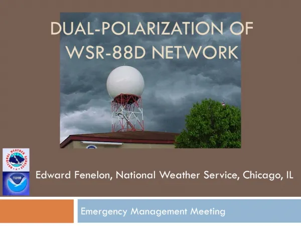
WSR-88D Data Status and Plans Michael Istok NWS Radar Focal Point for NEXRAD NWS Office of Science & Technology 6 February 2014 National Weather Service Family Of Services/Partners Meeting Silver Spring, MD. Outline. Recent Major WSR-88D Milestones WSR-88D Program Plans

E N D
WSR-88D Data Status and Plans Michael Istok NWS Radar Focal Point for NEXRAD NWS Office of Science & Technology 6 February 2014 National Weather Service Family Of Services/Partners Meeting Silver Spring, MD
Outline • Recent Major WSR-88D Milestones • WSR-88D Program Plans • Builds 14-16 Software Release Plans • Build 14 Impacts • Level II Data Collection Status and Plans • Level 3 Product Collection Status and Plans • Product User Support and Additional Information • User Feedback and Q&A 2/6/2014 FOS Meeting 2
Recent Major WSR-88D Milestones • Dual Polarization deployment completed in June 2013 • Software Builds 13.0-13.3 deployed (13.3 in November) • Build 13.3 is installed at 133 sites and 25 remain on Build 13.2 • Re-enables CMD and AVSET algorithms (default on) • Volume-based products report AVSET top elevation angle • CR/35-38, CRE/98, ET/41, VIL/57, APR/67, LRM/65-66 & 90 • Hybrid Spectrum Width Estimate • Enhanced VAD Wind Profile Algorithm • Reduces data gaps in VWP product by performing VADs for each height at multiple elevation/range pairs • 2D Velocity Dealiasing Algorithm • Used for all VCPs except VCP 121, or when the velocity increment is 1 m/s, or when PRF Sectors are defined with multiple PRFs • Affects Level III products, but no change to Level II data • Dual Pol software • Weather-based RPG estimates of Zdr Bias and Initial PhiDPwhich are included in the WSR-88D RPG System Status Log Product (RSL/152) 2/6/2014 FOS Meeting 3
Build 14 Release Plans • Beta test and deployment scheduled for February and May of 2014 • Beta sites and estimated install dates: Pueblo, CO (2/26); South Kauai, HI (3/12); Yuma, AZ (3/19); Altus AFB, OK (3/25); Wichita, KS (3/26) • Content • Supplemental adaptive intra-volume low-level scans (SAILS) • Repeats the lowest elevation mid-way through the volume scan of VCP 12 and 212 • Shortens low level scan update to <3 minutes (to <2 min with AVSET) • Storm-based auto PRF selection • Minimizes range folding for operator selected or top 3 (cell-based VIL) storms • Manual & automatic PRF selection for SZ-2 VCPs (211, 212, 221) • Adjusts range where range folding causes the ground clutter returns to obscure data at the beginning of the second trip • Will cause volume scan duration to vary by +/- 15 seconds • Radial-by-radial noise estimation (RxRN) • Increases data coverage of weak signal data, since noise is often overestimated • Improves estimates of Dual Pol variables and Spectrum Width • Coherency-based thresholding (CBT) • Recovers some of the data lost from the sensitivity reduction of dual pol • Enable site modification of DP QPE rain rate coefficients for dry snow and ice crystals 2/6/2014 FOS Meeting 4
Build 14 Impacts (Reference TINs 13-4, 13-37) • Supplemental Adaptive Intra-volume Low-level Scans (SAILS) • Additional N0Q/94/R and N0U/99/V products will report a volume scan time/date from the start time/date of the added split cut • Reduces single-site Level 3 product central collection by 10% • Increases single-site Level II data central collection by 5% • Elevation index may be thought of as changing since it’s a sequential scan number • Manual & automatic PRF selection for SZ-2 VCPs (211, 212, 221) • To maintain 64 pulses/radial on SZ-2 cuts, VCP time will vary by +/- 15 seconds • Radial-by-radial noise estimation (RxRN) • Horizontal and vertical channel dBZ0 values to be added to the Radial Data Block within Message Type 31 and resulting in a Major Version change from 1 to 2 • RxRNstate (enabled/disabled) reported in the Volume Data Block within Message 31 (see “Signal Processing States”, which were formerly spare bytes) • Coherency-based Thresholding (CBT) • CBT state (enabled/disabled) also reported in Message 31 “Signal Processing States” • Expansion of General Status Message and Added Information • Increased length to 200 bytes (was 104 bytes) and added status and spares • Halfword 58 will report VCP Supplemental Data (AVSET, SAILS, Site Specific VCP) 2/6/2014 FOS Meeting 5
WSR-88D Software Release Plans • Build 15 Software • Beta test and deployment start August and November 2014 • RDA hardware installed with the software might stretch out deployment • Content (reduced scope to accommodate hardware refresh) • Tune RPG Initial PhiDP estimate and optionally use in RPG algorithms • Enable site modification of R(Z,Zdr) QPE rain rate coefficients to address tropical vs. continental drop size distributions • SAILS scan will be added to GSM to relate Elevation Index to angle sequence • Build 16 Software • Beta test and deployment start January and April of 2015 • RPG hardware installs might stretch deployment • Content • Add model data message to Level II data • Improved 2D velocity dealiasing (PRF sectors, 1 m/s mode, tuning) • Tune RPG Dual Pol algorithms to address performance issues • Extend SAILS to result in 2, 3, or 4 low-elevation scans per volume • Assumes successful internal and field testing with Build 15 2/6/2014 FOS Meeting 6
Level II network sites and content Add remaining 8 CONUS DoD sites (Completed in May 2013) Bandwidth supports transmitting full resolution and Dual Pol data (Version 6) Alaska sites (Version 6) Kenai, Middleton Island, King Salmon, and Bethel began in September 2013 Sitka, and Fairbanks/Nome to begin in February, and March 2014 Guam (Version 6) Will begin in February Version 7 sites (~9 CONUS DoD and 4 Hawaii FAA) Change to send Version 6: DOD with Build 15 (or sooner), and Hawaii FAA (tbd) Level II throughput (Build 14 estimate) Single site throughput 50 to 480 kilo bits/second (hourly avg) Network throughput 2 to 23 mega bits/second (hourly avg) Throughput spread depends on weather coverage, VCP, season, and number of sites simultaneously in a VCP and/or with AVSET/SAILS enabled Level II Status and Plans 2/6/2014 FOS Meeting 7 7
Dual Pol products not yet available from Fairbanks, Nome Install OpsNet for AWIPS WAN at Fairbanks WFO’s (March 2014) Incomplete product suite from Paducah (KPAH, KVWX, KHPX) From May-Sept 2013, when these radars were in VCP 11, 12, 211, 212, dropped Dual Pol elevation based products: Zdr, CC, Kdp, HCA, ML above 0.5 degrees Dual Pol 24 hour rainfall and QPE difference (one-hour and storm total) Base Velocity above 1.8 degrees and Storm Relative Velocity above 2.5 degrees Add OpsNet bandwidth for AWIPS WAN at Paducah WFO (completed 9/26) RPCCDS product latency during peak summer hours Observed while loads >133K products/hr and >2.5 G bytes/hour. TOC plans to move the RPCCDS to a faster virtual server Level 3 Status and Plans 2/6/2014 FOS Meeting 8 8
Other Program Plans • Retirement of 3 base products from NOAAport and RPCCDS moved back • Lowest elevation 4-bit base reflectivity (19/R, 20/R) and velocity (27/V) • Reference NWS TIN 09-41 (Amended), Turn Off Date for WSR-88D Low- Resolution Products Extended to 12/3/14 • TDWR – SPG • GSM expansion to 200 bytes (SPG Build 6.0, Deploy July 2014) • FAA installed new signal processor at all 45 TDWRs • Users may notice better data quality and increased sensitivity • FAA’s Build 2 (~9+ months away) to provide improved range/velocity aliasing • No SPG Level II distribution changes planned • NOAAport and RPCCDS distribution of VCP80 rapid scan update products • TIN 12-13 notified of an evaluation that started April 12, 2012 with 11 radars and TIN 13-3 notified that 7 radars were added February 27, 2013 • 1 minute surface elevation base products • 3 minute storm products and 3rd elevation base products • Increases since single site max throughput by 2.5X to around 42 kbps • Evaluating impacts on affected systems, will announce next steps in 2014 2/6/2014 FOS Meeting 9
WSR-88D Data and ProductUser Support • Many changes in Level II Data, Level III products, Dual Pol, higher-resolution data, etc. underway: • Please keep checking for NWS TINs and PNSs • ROC web site contains TINs, PNSs, additional information • http://www.roc.noaa.gov/WSR88D/ • Level II and Level III products and Interface Control Documents • http://www.roc.noaa.gov/WSR88D/Level_III/Level3Info.aspx 2/6/2014 FOS Meeting 10
Training Initial Dual-Polarization Training for NWS Partners http://www.wdtb.noaa.gov/courses/dualpol/Outreach/index.html Courses for meteorologists and non-meteorologists Follow-on Dual Polarization Radar Training http://www.wdtb.noaa.gov/courses/dualpol/SOTM/index.html WDTB Storm of the Month and Q&A interchange webinars were terminated Sessions were “post processed” into “Dual Pol Best Practices” modules Additional information Project information, Dual Pol sample data/products, and Interface Control Document http://www.roc.noaa.gov/WSR88D/DualPol/Default.aspx Dual Pol Information 2/6/2014 FOS Meeting 11 11
Additional Information • Project Information: WSR-88D New Radar Technologies • http://www.roc.noaa.gov/WSR88D/NewRadarTechnology/NewTechDefault.aspx • Project updates and other Level II information: • http://www.roc.noaa.gov/WSR88D/Level_II/Level2Info.aspx • NWS Real-Time Level II Data Monitoring Site: • http://weather.noaa.gov/monitor/radar2/ • NWS Real-Time Level III Product Site Status: • http://weather.noaa.gov/monitor/radar/ • NWS RPCCDS Information for product users: • http://www.nws.noaa.gov/tg/rpccds.html • Build specific training materials: • http://www.wdtb.noaa.gov/ 2/6/2014 FOS Meeting 12
Additional Information • NCDC Radar Resources: Order Level II and Level III Archive Data Via FTP, Use NCDC Java Viewer to View Level II and Level III Archive Data, etc. • http://www.ncdc.noaa.gov/oa/radar/radarresources.html • Run RPG Software, LINUX Platform: The Common Operations and Development Environment (CODE) • http://www.weather.gov/CODE88D • Federal Meteorological Handbook No. 11 (FMH-11) Part A Updated for Build 12.1 available electronically at: • http://www.roc.noaa.gov/WSR88D/ under “WSR-88D Program” • Follow-up questions to: Michael.Istok@noaa.gov 2/6/2014 FOS Meeting 13
Backup Slides 2/6/2014 FOS Meeting 14
Current Level 3 ThroughputSingle Site NEXRAD Dual Pol and TDWR SPG 2/6/2014 FOS Meeting
Current Level 3 ThroughputNetwork Total (156 WSR-88D and 45 TDWR SPG) 2/6/2014 FOS Meeting
Elevation and Volume Scan TimingVCP 212 with SAILS, AVSET, and Auto-PRF 2/6/2014 FOS Meeting
Versions of Level II Data • Starting in RPG Build 12.1, RDA will always provide • Reflectivity data at 250 meter range resolution • Velocity and Spectrum Width to 300 km max range (< 70 kft altitude) • Version numbers indicate type of data • Meaning of Version 3 changed with RPG Build 12.1 • Plan for Dual Pol • NWS and CONUS DoD WSR-88Ds to provide version 6 • FAA WSR-88Ds will provide version 6, but Hawaii will be version 7 • Other Versions in special cases • Degraded data characteristics driven by NWS comms funding availability 2/6/2014 FOS Meeting 18
WSR-88D Dual Pol Level III 2/6/2014 FOS Meeting
WSR-88D Dual Pol Level III 2/6/2014 FOS Meeting
![NEXRAD or WSR-88D [Next Generation Radar] [ W eather S urveillance R adar, 19 88 , D oppler]](https://cdn0.slideserve.com/954313/slide1-dt.jpg)