Download
1 / 22
230 likes | 427 Vues
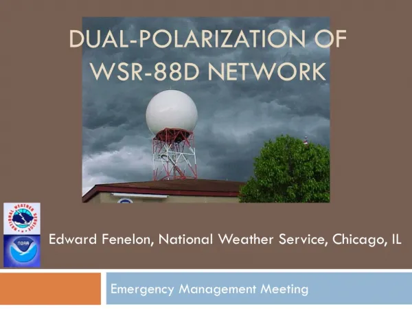
WSR-88D Data Status and Plans Michael Istok Radar Improvement Manager NWS Office of Science & Technology Jessica Schultz NWS Radar Focal Point for NEXRAD Radar Operations Center 5 August 2014 National Weather Service Family Of Services/Partners Meeting Silver Spring, MD. Outline.

E N D
WSR-88D Data Status and Plans Michael Istok Radar Improvement Manager NWS Office of Science & Technology Jessica Schultz NWS Radar Focal Point for NEXRAD Radar Operations Center 5 August 2014 National Weather Service Family Of Services/Partners Meeting Silver Spring, MD
Outline • Recent Major WSR-88D Milestones • Build 14 Impacts • WSR-88D Program Plans • Builds 15-17 Software Release Plans • Level II Data Collection Status and Plans • Level III Product Collection Status and Plans • Product User Support and Additional Information • User Feedback and Q&A 8/5/2014 FOS Meeting 2
Recent Major WSR-88D Milestones • Build 14 and RPG Build 14.1 Deployed in May 2014 • As of July 29th, 143 sites have installed Build 14 • Build 14 Content affecting users • Supplemental adaptive intra-volume low-level scans (SAILS) • Repeats the lowest elevation mid-way through the volume scan of VCP 12 and 212 • Shortens low level scan update to <3 minutes (to <2 min with AVSET) • Default setting for AVSET is ON • Storm-based auto PRF selection • Minimizes range folding for operator selected or top 3 (cell-based VIL) storms • Manual & automatic PRF selection for SZ-2 VCPs (211, 212, 221) • Adjusts range where range folding causes the ground clutter returns to obscure data at the beginning of the second trip • Will cause volume scan duration to vary by +/- 15 seconds • Radial-by-radial noise estimation (RxRN) • Increases data coverage of weak signal data, since noise is often overestimated • Improves estimates of Dual Pol variables and Spectrum Width • Coherency-based thresholding (CBT) • If enabled, recovers some of the data lost from the sensitivity reduction of dual pol • Enable site modification of DP QPE rain rate coefficients for dry snow and ice crystals 8/5/2014 FOS Meeting 3
Build 14 Impacts (Reference TINs 13-4, 13-37) • Supplemental Adaptive Intra-volume Low-level Scans (SAILS) • Additional N0Q/94/R and N0U/99/V products will report a volume scan time/date from the start time/date of the added split cut • Reduces single-site Level 3 product central collection by 10% • Increases single-site Level II data central collection by 5% • Elevation index may be thought of as changing since it’s a sequential scan number • Manual & automatic PRF selection for SZ-2 VCPs (211, 212, 221) • To maintain 64 pulses/radial on SZ-2 cuts, VCP time will vary by +/- 15 seconds • Radial-by-radial noise estimation (RxRN) • Horizontal and vertical channel dBZ0 values to be added to the Radial Data Block within Message Type 31 and result in a Major Version change from 1 to 2 • RxRN state (enabled/disabled) reported in the Volume Data Block within Message 31 (see “Signal Processing States”, which were formerly spare bytes) • Coherency-based Thresholding (CBT) • CBT state (enabled/disabled) also reported in Message 31 “Signal Processing States” • Expansion of General Status Message and Added Information • Increased length to 200 bytes (was 104 bytes) and added status and spares • Halfword 58 will report VCP Supplemental Data (AVSET, SAILS, Site Specific VCP) 8/5/2014 FOS Meeting 4
WSR-88D Software Release Plans • Build 15 Software • Beta test and deployment start September and November 2014 • RDA hardware installed with the software might stretch deployment • Content affecting users (limited to accommodate hardware refresh) • Tune RPG Initial PhiDP estimate and optionally use in RPG algorithms • Enable site modification of R(Z,Zdr) QPE rain rate coefficients to address tropical vs. continental drop size distributions • SAILS scan will be added to GSM to relate Elevation Index to angle sequence • Build 16 Software • Beta test and deployment start January and April of 2015 • RPG hardware installs might stretch deployment • Content affecting users • SAILS support and central collection of dual pol elevation products • DZD/159, DCC/161, DKD/163, DHC/165, ML/166 (RPCCDS issue dependency) • Add CBT and RxRN status to General Status Message • If enabled, bits 11 (CBT) and 12 (RxRN) in “VCP Supplemental Data” will be set 8/5/2014 FOS Meeting 5
WSR-88D Software Release Plans • Build 16 Software (cont.) • Content (cont.) • Improved 2D velocity dealiasing (PRF sectors, 1 m/s mode, tuning) • Tune RPG Dual Pol algorithms to address performance issues • Extend SAILS to provide up to 4 low-elevation scans per volume • Not operational. Possible field test depending on outcome of internal testing and capacity of central collection infrastructure • Build 17 Software • Beta test and deployment start February and June of 2016 • RDA hardware installs (June 2016 - May 2017) will stretch deployment • Content affecting users • Add large and giant hail hydrometeor categories to HCA products • Depends on outcome of performance testing • Distribute ASP product every 3 hours instead of every 8 hours • Add model data message to Level II data 8/5/2014 FOS Meeting 6
Level II network sites and content Alaska sites (Version 6) Kenai, Middleton Island, King Salmon, and Bethel began in September 2013 Sitka and Fairbanks/Nome began in February and March 2014 Guam (Version 6) Began in February 2014 Version 7 sites 9 DOD CONUS sites (KBBX, KFDX, KGWX, KDOX, KTYX, KHDX, KDFX, KJGX, KVNX) will transition to Version 6 by early 2015 Hawaii sites (TBD) Level II throughput (Build 14 estimate) Single site throughput 50 to 480 kilo bits/second (hourly avg) Network throughput 2 to 23 mega bits/second (hourly avg) Throughput spread depends on weather coverage, VCP, season, and number of sites simultaneously in a VCP and/or with AVSET/SAILS enabled Level II Status and Plans 8/5/2014 FOS Meeting 7 7
RPCCDS product latency/loss during peak summer hours Observed when throughput was > 133K products/hr and > 2.5 G bytes/hour TOC migrated the RPCCDS to a faster virtual server, but still having problems Products are now shed when internal backlog queues reach thresholds Loss of products to RPCCDS users and NCDC Archive (up to 20%) Product shedding is a temporary measure to prevent excessive latencies and will be eliminated as soon as the RPCCDS problem is resolved. TOC considering software rewrite – should know more later this month Level 3 Status and Plans 8/5/2014 FOS Meeting 8 8
Other Program Plans • Retirement of 3 base products from NOAAport and RPCCDS moved back • Lowest elevation 4-bit base reflectivity (19/R, 20/R) and velocity (27/V) • Reference NWS TIN 09-41 (Amended), Turn Off Date for WSR-88D Low- Resolution Products Extended to 12/3/14 • TDWR – SPG • GSM expansion to 200 bytes (SPG Build 6.0, Deploy July 2014) • FAA installed new signal processor at all 45 TDWRs • Users may notice better data quality and increased sensitivity • FAA’s Build 2 (~9+ months away) - improved range/velocity ambiguity mitigation • No SPG Level II distribution changes planned • NOAAport and RPCCDS distribution of VCP80 rapid scan update products • TIN 12-13 notified of an evaluation that started April 12, 2012 with 11 radars and TIN 13-3 notified that 7 radars were added February 27, 2013 • 1 minute surface elevation base products • 3 minute storm products and 3rd elevation base products • Increases since single site max throughput by 2.5X to around 42 kbps • Adding the remaining 27 sites would increase peak throughput by 5% • Evaluating impacts on affected systems -- depends on resolving RPCCDS issue 8/5/2014 FOS Meeting 9
WSR-88D Data and ProductUser Support • Many changes in Level II Data, Level III products, Dual Pol, higher-resolution data, etc. underway: • Please keep checking for NWS TINs and PNSs • ROC web site contains TINs, PNSs, additional information • http://www.roc.noaa.gov/WSR88D/ • Level II and Level III products and Interface Control Documents • http://www.roc.noaa.gov/WSR88D/Level_III/Level3Info.aspx 8/5/2014 FOS Meeting 10
Training Initial Dual-Polarization Training for NWS Partners http://www.wdtb.noaa.gov/courses/dualpol/Outreach/index.html Courses for meteorologists and non-meteorologists Follow-on Dual Polarization Radar Training http://www.wdtb.noaa.gov/courses/dualpol/SOTM/index.html WDTB Storm of the Month and Q&A interchange webinars were terminated Sessions were “post processed” into “Dual Pol Best Practices” modules Additional information Project information, Dual Pol sample data/products, and Interface Control Document http://www.roc.noaa.gov/WSR88D/DualPol/Default.aspx Dual Pol Information 8/5/2014 FOS Meeting 11 11
Additional Information • Project Information: WSR-88D New Radar Technologies • http://www.roc.noaa.gov/WSR88D/NewRadarTechnology/NewTechDefault.aspx • Project updates and other Level II information: • http://www.roc.noaa.gov/WSR88D/Level_II/Level2Info.aspx • NWS Real-Time Level II Data Monitoring Site: • http://weather.noaa.gov/monitor/radar2/ • NWS Real-Time Level III Product Site Status: • http://weather.noaa.gov/monitor/radar/ • NWS RPCCDS Information for product users: • http://www.nws.noaa.gov/tg/rpccds.html • Build specific training materials: • http://www.wdtb.noaa.gov/ 8/5/2014 FOS Meeting 12
Additional Information • NCDC Radar Resources: Order Level II and Level III Archive Data Via FTP, Use NCDC Java Viewer to View Level II and Level III Archive Data, etc. • http://www.ncdc.noaa.gov/oa/radar/radarresources.html • Run RPG Software, LINUX Platform: The Common Operations and Development Environment (CODE) • http://www.weather.gov/CODE88D • Federal Meteorological Handbook No. 11 (FMH-11) Part A Updated for Build 12.1 available electronically at: • http://www.roc.noaa.gov/WSR88D/ under “WSR-88D Program” • Follow-up questions to: Michael.Istok@noaa.gov 8/5/2014 FOS Meeting 13
Backup Slides 8/5/2014 FOS Meeting 14
Current Level 3 ThroughputNetwork Total (156 WSR-88D and 45 TDWR SPG) 8/5/2014 FOS Meeting
2013 Level 3 ThroughputNetwork Total (156 WSR-88D and 45 TDWR SPG) 8/5/2014 FOS Meeting
Current Level 3 ThroughputSingle Site NEXRAD Dual Pol and TDWR SPG 8/5/2014 FOS Meeting
2013 Level 3 ThroughputSingle Site NEXRAD Dual Pol and TDWR SPG 8/5/2014 FOS Meeting
Elevation and Volume Scan TimingVCP 212 with SAILS, AVSET, and Auto-PRF 8/5/2014 FOS Meeting
Versions of Level II Data • Starting in RPG Build 12.1, RDA will always provide • Reflectivity data at 250 meter range resolution • Velocity and Spectrum Width to 300 km max range (< 70 kft altitude) • Version numbers indicate type of data • Meaning of Version 3 changed with RPG Build 12.1 • Plan for Dual Pol • NWS and CONUS DoD WSR-88Ds to provide version 6 • FAA WSR-88Ds will provide version 6, but Hawaii will be version 7 • Other Versions in special cases • Degraded data characteristics driven by NWS comms funding availability 8/5/2014 FOS Meeting 20
WSR-88D Dual Pol Level III 8/5/2014 FOS Meeting
WSR-88D Dual Pol Level III 8/5/2014 FOS Meeting