Download
1 / 17
170 likes | 346 Vues
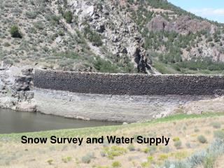
Snow Survey, Water Supply Forecasting and SCAN Programs. Michael Strobel Director National Water and Climate Center Natural Resources Conservation Service Portland, OR michael.strobel@por.usda.gov. Snow Survey and Water Supply Forecasting Program.

E N D
Snow Survey, Water Supply Forecasting and SCANPrograms Michael Strobel Director National Water and Climate Center Natural Resources Conservation Service Portland, OR michael.strobel@por.usda.gov
Snow Survey and Water Supply Forecasting Program • The program provides agricultural water users and other water management groups in the Western States with water supply forecasts to enable them to plan for efficient water management • The program also provides the public and the scientific community with a database that can be used to accurately determine the extent of the snow resource
Snow Survey and Water Supply Forecasting Program • 12 Western States and Alaska • 60 FTE(36 Field, 24 NWCC) • $10.760 M FY-08 funding • ~25.5M acres of irrigated agriculture • ~ $51.1B in annual market value(Ag. Census, 2002) • Water Supply Forecast Economic study to be released during 2008
NRCS SNOTEL Network • SNOTEL network • 12 Western States and Alaska • ~760 sites • About 16 million observations each year • About 16.1 million downloads each year • Over 1,200 manual snow courses • www.wcc.nrcs.usda.gov/snow/
SNOTEL Site - Augmented Data Array • Snow water content • Precipitation • Temperature • Snow depth • Relative humidity • Wind speed / direction • Solar radiation • Soil moisture / temperature
Soil Climate Analysis Network • SCAN (Soil Climate Analysis Network) • 146 sites in 39 States • Soil-climate monitoring • ~ 816K downloads in 2007 • Critical for drought monitoring • Precision agriculture • www.wcc.nrcs.usda.gov/scan/
Water Supply Forecasts • Water Year 2007 • 740 locations forecast Jan-Jun with NWS • Over 12,141 forecasts issued by States to users • Over 1.9M visits to WSF pages • www.wcc.nrcs.usda.gov/wsf
Snow School is a week long and held each January. This year, 53 students completed the course.
Current Status of Program • Requests for new sites • Limitations of existing workforce – critical mass • Declining number of personnel • Increasing costs – salaries, equipment, travel • SCAN funding • 2010 Budget Initiative - SNOTEL – automation of 1,000 SNOTEL sites and conversion of snow courses to SNOTEL • 2010 Budget Initiative – SCAN – expansion of present network by 2,000 sites • Dugway Master Station • Failover for continuity of operations and data access
Further information Michael Strobel Director NRCS National Water and Climate Center 503-414-3055 michael.strobel@por.usda.gov Webpage www.wcc.nrcs.usda.gov