Download

1 / 26
260 likes | 285 Vues
Learn about Wisconsin's innovative Surface Water Monitoring System (SWMS), its features, data included, goals, and development process. Find out how SWMS improves data management and public information tools.

E N D
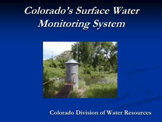
Wisconsin’s Surface Water Monitoring System (SWMS) Jennifer Filbert and Lisa Helmuth Wisconsin Department of Natural Resources
Wisconsin’s Surface Water Monitoring System (SWMS) • What ? • Why? • How? • Data? • Station Module • eLT and integrated tabular and spatial data • revolutionizing surface water monitoring, data management and public information tools
What is SWMS? An internet-based GIS-enabled surface water data repository accessed through a data portal for use by staff, volunteers and partner agencies. Features: • Station Module which includes GIS component tool which geo-locates stations on 1:24K hydrolayer • Oracle tables, Java UI, ESRI ArcObjects • Embeddable locator tool “eLT” - GIS component Allows interactive edits of station location geolocating data enhances storage and retrieval of surface water monitoring data • Internet Data Portal (Wisconsin Web Access Management System - WAMS), Security Roles • Allows volunteers, internal staff and partner agencies access to the system • Connection to STORET via batch data loads • STORET Reporting & Querying functionality
Data to be included in SWMS: • Macroinvertebrates • Satellite water clarity • Plants • Lake Volunteer Data • River Volunteer Data • Special Project data (TMDLs, phosphorus, pathogen, Cladophora, etc.) • Sediments • Exotics • Automonitoring (DO, Temp) • Thermal Standards Data • Long Term Trend Data • rivers, lakes • Historical Datasets • habitat, field parameters
Why SWMS? • 1996 WDNR Reorganization, Budget Cuts, Attrition • STORET file manager position reduced • STORET location management decentralized • Multiple datasets for Surface Water Monitoring • Each with unique ID, some STORET, some not • STORET station is required for loading data into STORET • 1 with stations geolocated, most not • 1 internet accessible, rest client-side systems • Initiation of TMDLs and related work • need system to support chemistry data • take advantage of new technologies • budget cuts: need greater efficiencies • USEPA/DNR discussing biocriteria and biological monitoring, need way to help integrate this info with traditional WQ standards data
SWMS Goals: 1. To assure that appropriate data gets into the US EPA's STORET database in a timely fashion with minimal human intervention 2. To provide an internet-based GIS-enabled surface water data repository for use by staff, volunteers and partner agencies that can enter, store and query: • chemistry, habitat, macroinvertebrate, plant, toxicity, and field data for: • sediment, rivers, inland lakes, and Great Lakes
How is WI developing SWMS? • Watershed program funds • Analyze existing systems and integration areas • Develop SWMS Station Module - March 2005 • station locations, lab slips, bar codes • surface water data viewer (web mapping app) • Clean Water Act Section 104(b)(3) Grant • internet portal system (SWMS) • migrate monitoring data (lakes, rivers, sediment) • USEPA Contractor Support - SIMS batch migration • LTE data cleanup, data entry • Exchange Network Grant • XML schema…OR…SIMS batch data loads
SWMS Station Module New systems provide: • Visual Display and required verification of station locations • Reduces errors, enhances efficiency, quality • Improves state & federal reporting • Geo-located data in host applications • Integrates data systems, maximizes utility • Compatible with ArcView, ArcMap & ArcIMS technology • Spatial applications can use data, adds value • Increases accessibility to public • Allows cumulative impact analyses, better planning, integrated queries
SWMS Station Module The Need: • Decentralized STORET station assignment from 1996-2004 via spreadsheets • incorrect stations • no station, no lat/long, description, etc. • Delay in getting data into STORET due to incomplete records • 50% rejection rate for data uploads to STORET
Station Module • Elements • Station look up • tabular by station #, location, waterbody ID code • Spatial queries in mapping application (Surface Water Data Viewer or embeddable locator tool “eLT”) • Request new station (point, line, polygon) • Print lab slip with bar code (embedded data) • Verification of station location before data release • Enhancements • batch upload of station and sample location points • linkage of station and multiple sample points
Station Data Cleanup • Station data from 5 applications blended, cleaned • tabular cleaning of 12,000 records • storet modernized • storet legacy • lakes WQ database • sediment database • rivers chemistry • visual cleaning of data in spatial context • duplicate locations • lat/long problems • waterbody ID code mismatch
Station Data Cleanup Once STORET stations have been “cleaned”, monitoring locations from the following datasets will need to be geolocated and integrated into the station application: • toxicity test data locations (State Lab of Hygiene) • beach program sites (at USGS) • baseline monitoring stations (at USGS) • plant dataset (UW Madison) • exotics monitoring sites (PC-based files) • historical monitoring sites (PC-based datasets)
The eLT allows spatial editing of points, lines and polygons using the 1:24,000 hydrography datalayer. As a point is digitized, the eLT conducts interactive spatial intersections with coincidental location spatial data and sends that data back to oracle tables, which are then populated. This allows both tabular and spatial queries.
Linear Feature Edits SWMS will use line and polygon features to represent stations such as transect surveys, composite samples or satellite surveys which have multiple sample points.
Polygonal Feature Edits The eLT edits features using the state’s 1:24K hydrography datalayer as a backdrop, which provides spatial data that conforms to existing spatial features for and river flowages and lakes. Once the stations are spatially represented, intersections of datalayers and complex queries can be conducted.
Data integration: Viewable Data in the eLT Users will be able to conduct “identify” in the eLT to read attributes for related data sets. This spatial display and oracle database linkage can help inform users in their monitoring station location decision.
Monitoring stations and data will be made available via an external mapping application
SWMS Project Timeline • March 2005 • Station Application via Intranet • June 2005 • WAMS Security Portal Implemented • Station Module Launched on External Portal • with Surface Water Data Viewer • Phase I SWMS tables, UI screens, Data • lakes, rivers, exotics • Implement SIMS batch upload (USEPA?) • December 2005 • Phase II SWMS tables, UI screens, Data • sediment, habitat, plant data, macroinverts, toxicity • January - September 2006 • Phase III - SWMS reports, queries, .xml schema?
Conclusion • SWMS will provide access to data in an interactive, editable spatial/tabular display using the embeddable locator tool (eLT). • Geolocating station data will facilitate access to monitoring data through spatial/tabular “views” in ArcIMS applications • The eLT and integrated application will revolutionize the way surface water monitoring data is managed, understood, and provided internally and to the public and our partners.