Enhancing the "Topo.Quad" Topographic Maps: A National Map Initiative
Explore the evolution of topographic mapping with The National Map initiative. Learn about the enhanced "Topo.Quad" maps, improved accessibility, feature currency, and USGS's commitments. Discover future enhancements, upcoming improvements, and user involvement opportunities. Join the conversation with Michael Cooley and Stafford Binder.

Enhancing the "Topo.Quad" Topographic Maps: A National Map Initiative
E N D
Presentation Transcript
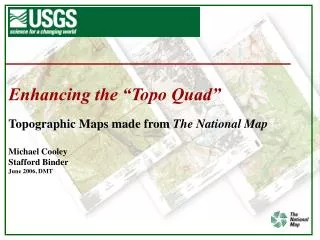
Enhancing the “Topo Quad” Topographic Maps made from The National Map Michael Cooley Stafford Binder June 2006, DMT
Background of the “Topo Quad” • History of the Topographic Map • 56K Maps Published using Analog Production Methods • Lack of Funding to Maintain and Revise Maps • The National Map – • Building and Maintaining a Seamless, Integrated Dataset Through Partnerships using State and Local Data • Publishing Maps Using The National Map • Building The National Map • http://nationalmap.gov/
Background of the “Topo Quad” • Building Geospatial One-Stop • www.geodata.gov • Providing a Single Portal to Bring Multiple Datasets Together from Other Agencies • Create Enhanced or Custom Graphics
The Enhanced “Topo Quad” • Commissioning the Products and Services Team • Guidance from the Products and Services Team • Web-based, Completely Automated, Topographic Mapping from The National Map’s Geospatial Data • Enhance the “Topo Quad” • Improved User Accessibility • Improved Feature Currency • Improved Productivity • Improved Utility
The Enhanced “Topo Quad” • USGS’s Commitments to Enhancing the “Topo Quad” • Commitment to Geospatial One-Stop • Data Discovery • Commitment to The National Map • Base Cartographic Data Improved by Partners • Commitment to Enhancing the “Topo Quad” • Commitment to Customer Satisfaction
The Enhanced “Topo Quad” • The National Map’s Graphics Concepts • Rapid-Response Map Production • 1:24K-Scale using the traditional 7.5’ tile • Currency of Map Content • Partnerships and Partners’ Data • Web Accessible Maps • Downloadable Digital Copies • Multiple Formats • Paper Copies Though Business Partners • Full-size Print-On-Demand Replacing Lithographic Printing • Enhancing the Future of the “Topo Quads”
Implementing the Program • Delaware (DataMIL - http://datamil.delaware.gov/ ) • First Area to be Implemented • Data-Rich Area • Pre-Made Maps • Available through The National Map • Available as PDF or Plotted Maps
The Enhanced “Topo Quad” • The New Map Design • Differences / Similarities Between the New Maps and the Standard Topographic Map • Similarities • Standardized Portrayal from Quad to Quad • Transportation & Hydrography Features • Contours • Accuracy • GNIS Names • Differences • Vegetation • Structures • Urban Tint • Names • Automated Name Placement • Contours • Automated from 1/3-ArcSecond ( Approx. 10-Meter) or Better National Elevation Dataset • Improved Currency of Content
Dover, DE Graphic from TNM Dover, De Published Map (DRG) Contours New Roads Veg Tint Urban Tint GNIS Buildings GNIS Names DLG-3 Buildings BetterNames New Roads Name Placement
The Enhanced “Topo Quad” • The National Map’s Graphic Content • Based on Internet Functionality • The National Map • Geospatial One-Stop • Based on Available and Suitable Data • Partners’ and USGS’s Data • Based on Technological Capabilities • Based on a Draft Minimum Content Specification • Based on Evolving Enhancements • Based on USGS’s Organizational Streamlining
The Enhanced “Topo Quad” • Forthcoming Improvements • Expanded Geographic Coverage of Suitable Data in The National Map • Additional Data Themes • Examples - Imagery, Structures, Landcover for Urban Tint and Vegetation • Additional Map Scales • Intermediate Map Scales, or Larger-Scale Urban Maps • Text Placement • Cartographic Presentation • Customization • Maps Over a User-Specified Center Point • Maps filling a User-Defined Area of Interest • User Specified Content
The Enhanced “Topo Quad” • USGS Invites “Topo Quad” Users’ Help • Pilot these Concepts in Delaware • A Few Quadrangles • Partners’ Suitable Data • Print on Demand • Public Review • Improving the Product and the Process
Anticipated Schedule • Delaware Implementation – Fall 2006 • Texas Implementation – 2007 • Other States – Depending Upon Data • Statewide Coverage • Suitable Data from States • Suitable Data from USGS • Suitable Data from Other Agencies
The Enhanced “Topo Quad” • USGS’ Commitment to Enhancing the “Topo Quad” • Commitment to Geospatial One-Stop • Data Discovery • Commitment to The National Map • Base Cartographic Data Improved by Partners’ • Commitment to Enhancing the “Topo Quad” • Commitment to Customer Satisfaction
The Enhanced “Topo Quad” Questions and Discussion Michael Cooley – mjcooley@usgs.gov Stafford Binder – sgbinder@usgs.gov
The Enhanced “Topo Quad” Thank You Enjoy Your Maps