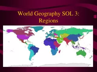
Understanding Geographic Information: Sources, Concepts, and Mental Maps
210 likes | 375 Vues
Geographic information can be sourced from diverse tools such as GIS, satellite images, and maps. These resources support the inquiry into the nature of countries, cities, and environments. Key concepts include absolute location defined by latitude and longitude, relative location, and map distortions. Mental maps reflect individuals’ perceptions and personal experiences, helping them navigate daily activities and understand world events. This knowledge evolves as people refine their understanding of spatial characteristics using various sources and representations.

Understanding Geographic Information: Sources, Concepts, and Mental Maps
E N D
Presentation Transcript
Geographic information maybe acquired from a variety of sources. • Geographic information supports the process of inquiry into the nature of countries, cities & environments. • Using a variety of sources supports the process of geographic inquiry.
Variety of Sources • GIS (Geographic Information Systems) • Field work • Satellite images • Photographs • Maps, globes • Databases • Primary sources • Diagrams
Latitude and longitude define absolute location. • Relative location describes the spatial relationships between and among places.
Areas can be represented using a variety of scales. • The amount of detail shown on a map is dependent on the scale used.
Concepts • Scale • Absolute location - latitude - longitude • Relative location • Orientation • Map distortion
Concepts continued • Map projections • Mercator • Robinson • Polar
Mental Maps • Mental maps are based on objective knowledge and subjective perceptions. • People develop and refine their mental maps through both personal experience and learning. • Mental maps serve as indicators of how well people know the spatial characteristics of certain places.
Uses of Mental Maps • Carry out daily activities (e.g., route to school, for shopping) • Give directions to others • Understand world events
Ways that mental maps can be developed & refined • Comparing sketch maps to maps in atlases or other resources • Describing the location of places in terms of reference points • Describing the location of places in terms of geographic features & forms • Describing the location of places in terms of human characteristics of a place
A Map Defined • A map is a visual representation of geographic information.
Standard ways that maps show information • Symbols • Color • Lines • Boundaries • Contours
Types of Thematic Maps • Population • Economic Activity • Resource • Language • Ethnicity • Climate • Precipitation • Vegetation • Physical • Political
Knowledge • Map of Columbus’ time • Map of the world today • GIS (Geographic Information Systems)
Place Names • Formosa, Taiwan, Republic of China • Palestine, Israel, West Bank, Gaza
Boundaries • Africa: In 1914, in the 1990’s • Europe: Before WWII, after WWII; since the 1990 • Russia & the former Soviet Union • Middle East: Before 1948; after 1967
Perspective of Place Names • Arabian Gulf vs. Persian Gulf • Sea of Japan vs. East Sea • Middle East vs. North Africa & Southwest Asia
Disputed Areas • Korea • Western Sahara • Former Yugoslavia • Kashmir