GNSS Workflow & TerraSync Basics for Trimble Hardware
Learn about Trimble hardware, software, mission planning, TerraSync interface basics, and field practice using TerraSync. Understand GNSS mission planning, data collection, and post-processing with hands-on demos. Utilize online tools for mission planning and GPS data processing with Trimble software.

GNSS Workflow & TerraSync Basics for Trimble Hardware
E N D
Presentation Transcript
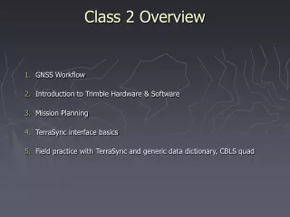
Class 2 Overview • GNSS Workflow • Introduction to Trimble Hardware & Software • Mission Planning • TerraSync interface basics • Field practice with TerraSync and generic data dictionary, CBLS quad
1. Overview of GPS Field Preparation, Data Collection and Post-Processing
Class 2 Overview • GNSS Workflow • Introduction to Trimble Hardware & Software • Mission Planning • TerraSync interface basics • Field practice with TerraSync and generic data dictionary, CBLS quad
2. Trimble Hardware & Software Hardware: Trimble GeoExplorer (2005 XT example)
2. Trimble Hardware & Software Communications between computer and GNSS unit Windows Mobile Device Center 6.16965 (Microsoft) – communications between 64 bit computer and GPS unit http://www.microsoft.com/downloads/details.aspx?FamilyId=4F68EB56-7825-43B2-AC89-2030ED98ED95&displaylang=en
2. Trimble Hardware & Software Mission Planning • Trimble’s online mission planning tool (“GNSS Planning Tool”)– forecast satellite availability for a specific location prior to fieldwork. http://www.trimble.com/GNSSPlanningOnline/ • Navmatrix mission planninghttp://gnssmissionplanning.com/ • Navcom Starfire Satellite Predictorhttp://satpredictor2.deere.com/
2. Trimble Hardware & Software GNSS Field Data Collection TerraSync (Standard / Pro). Trimble software, various versions 5.1 and higher. Field software for GPS/GNSS rover units, currently installed and operating on all units used in class http://www.trimble.com/mappingGIS/TerraSync.aspx?dtID=applications& Terrasync user guides can be found at: http://www.trimble.com/globalTRLTAB.asp?Nav=Collection-4573
2. Trimble Hardware & Software GNSS Data Processing GPS Pathfinder Office. Trimble software – create data dictionary, upload/download data files, post-process rover data (including differential correction), export data to GIS. http://www.trimble.com/mappingGIS/PathfinderOffice.aspx?dtID=applications&
2. Trimble Hardware & Software Geographic Information System ArcGIS 10.x (ESRI). Data analysis, visualization, metadata creation. http://www.esri.com/software/arcgis/arcgis-for-desktop/index.html
Class 2 Overview • GNSS Workflow • Introduction to Trimble Hardware & Software • Mission Planning • TerraSync interface basics • Field practice with TerraSync and generic data dictionary, CBLS quad
3. GNSS Mission Planning What is Mission Planning? Visualizing and understanding predicted GPS satellite movements and availability for specific times and locations. Why do mission planning? Plan fieldwork for the periods of best satellite visibility and attend to other activities (lunch?) when satellite visibility is low and data collection is more difficult or time consuming (or impossible?). Four Things To Remember: • Check the time zone. • Check the almanac date. • Print charts or make note of high PDOPs for field use. • Nothing beats field reconnaissance!
3. GNSS Mission Planning Demo using Trimble’s Online Mission Planning Tool http://www.trimble.com/GNSSPlanningOnline/ Assignment, due 2/8: Determine satellite availability for Kingston, RI for Thursday, February 8. Bring a graph showing PDOP for all or any portion of the day, so long as it includes 1-3 p.m.
Class 2 Overview • GNSS Workflow • Introduction to Trimble Hardware & Software • Mission Planning • TerraSync interface basics • Field practice with TerraSync and generic data dictionary, CBLS quad
4. Intro to TerraSync Demo Main Menu items Applying Critical Settings (see handout)
Class 2 Overview • GNSS Workflow • Introduction to Trimble Hardware & Software • Mission Planning • TerraSync interface basics • Field practice with TerraSync and generic data dictionary, CBLS quad Assignment, due 2/8: Determine satellite availability for Kingston, RI for Thursday, February 8. Bring a graph showing PDOP for all or any portion of the day, so long as it includes 1-3 p.m.