Flood Taskforce
Flood Taskforce. Flood risk in Sumner and Moncks Bay. Outline. Flood Taskforce purpose Storm events Vulnerability levels Areas assessed Temporary flood defence toolbox Next steps Questions. Eastern Terrace - April 2014. Squire Street - June 2013. Flood Taskforce purpose.

Flood Taskforce
E N D
Presentation Transcript
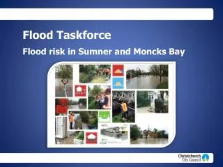
Flood Taskforce Flood risk in Sumner and Moncks Bay
Outline • Flood Taskforce purpose • Storm events • Vulnerability levels • Areas assessed • Temporary flood defence toolbox • Next steps • Questions Eastern Terrace - April 2014 Squire Street - June 2013
Flood Taskforce purpose “ Assisting the most vulnerable homes to cope with the frequent flooding caused by the earthquakes”. Slater Street – June 2013
Which areas were covered by the Flood Taskforce? • Lower Avon River • Dudley Creek (including Flockton) • Lower Heathcote (including Woolston/Opawa) • Upper Heathcote • Heathcote Valley • Southshore • Sumner (including Redcliffs) • Little River • Lyttelton
Vulnerability Levels • Three vulnerability Levels for multiple flooding occurrences since the earthquakes
Findings * Properties identified in the May 2014 Taskforce Report by Customer Service Requests; flood modelling confirmed by visual inspections. Note: 7 properties recorded as flooded above floor level once since earthquakes
Wakefield Ave / Paisley St Scheme Phase 1 Recommendations • Removal of sediment from Sumner Stream • Increase inlet and pipe capacity of sumps outside 125 Wakefield Ave • Liaise with CERA to mitigate both short and long term sediment and runoff issues from Red Zone • Van Asch St bridge being replaced by SCIRT
Mariner Street Area Cave Rock Outfall Cave Rock Drain Outfall Burgess Street Outfall
Richmond Hill Drain / Mariner St Area Phase 1 Recommendations • Investigate options for improved outfalls at Cave Rock and Burgess St to to mitigate operational issues related to sand • Formalisation of the secondary flow path from Cave Rock Drain outfall (surf club) • Prepare specific operational and emergency response plan to document critical requirements for operation of the system
Other Recommendations • Undertake immediate maintenance on SFRP flap gate to ensure fully operational • Investigate options for providing ability to manually open SFRP flap gate • Reinstate bolts on SFRP manholes
Other Recommendations • Assess sediment levels and programme removal sediment and other constrictions from Sumner Main Drain between Truro and Colenso streets • Monitor sediment levels in SFRP once flap gate operational and programme cleaning if required • Cleaning out road side swale on Heberden Ave / Arnold St intersection to reduce runoff across road, possible footpath improvements same area to minimise runoff into private property (36a Heberden Ave)
Next steps Flood Taskforce • Ongoing maintenance activities • Further investigations for solutions • Flooding recommendations delivered to Council and government Residents • Complete a survey • On-going contact • One-on-one meetings with engineers if a solution affects your property
Questions? Call Centre: 03 941 8999 Website: www.ccc.govt.nz Email: floodmitigation@ccc.govt.nz