Download
1 / 12
130 likes | 305 Vues
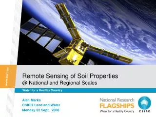
Remote Sensing of Soil Properties @ National and Regional Scales. Water for a Healthy Country. Alan Marks CSIRO Land and Water Monday 22 Sept., 2008. Modellers’ Wish List …. Spatially-varying maps of: Ksat Wilting point and field capacity SMC Soil Porosity Soil Layer Depth

E N D
Remote Sensing of Soil Properties@ National and Regional Scales Water for a Healthy Country Alan Marks CSIRO Land and Water Monday 22 Sept., 2008
Modellers’ Wish List ….. • Spatially-varying maps of: • Ksat • Wilting point and field capacity SMC • Soil Porosity • Soil Layer Depth • Soil Bulk Density • % Clay, % Sand Insert presentation title
Modelled LST for field capacity SMC NOAA-18 AVHRR LST 2005-10-02 Problems associated with polygon soil properties LST(K) Insert presentation title
10 Sandy soil 1 Sandy-loam soil 0.50 Clay-loam soil 0.34 Unknown, set to loam 0.05 Clay or silty-clay soil Tree Shrub Grass Water body 7.0 3.5 0.0 Soil texture classification Soil Properties Hydrological parameters Saturation hydraulic conductivity, Min/max soil moisture content, … Composition porosity, %clay & % sand, … Physical properties layer depth, … Land cover classification Vegetation Properties Physical parameters canopy height, leaf width, … Micrometeorological parameters reference height, zero plane displacement, roughness length, … Physiological parameters maximum stomatal conductance, fraction root biomass, … LAI Insert presentation title
Current Approach • Active/Passive microwave, dry-down curve analysis • MTSAT thermal inertia and dry-down curves • Optical Remote Sensing for clay/sand mapping • Airborne Gamma-Ray Spectrometry (Radiometrics) • Cal/Val. NAFE, PGNA …… Insert presentation title
Collaboration with Mario Ferri, Landgate eeeeeeeeeeeeeeeeeeeweek 1eeeeeeeeeeeeeeeeweek 2eeeeeeeeeeeeeeeeweek 3eeeeeeeeeeeeeweek 4e222222 Insert presentation title
Decay Curve Values Insert presentation title
MTSAT – Thermal Inertia – Mario Ferri • Monitoring soil moisture at 4km spatial resolution or better • Based on Apparent Thermal Inertia (ATI): based on logic that water bodies have higher thermal inertia than dry soils • Interested in looking at dry-down curve approach with this data Insert presentation title
Soil Moisture Saturation Index (MTSAT) Insert presentation title
Optical Remote Sensing – Clay/Sand Cudahy/Hewson CSIRO Insert presentation title
Radiometrics & DEM Analysis Radiometric image of NSW with ASRIS soil polygons Insert presentation title
Calibration/Validation ... Scaling • Cal/Val is a necessity for these products • Possible data fusion of higher resolution data and attributes • Ground truthing and scaling • NAFE/OzNet data • From point to transect - PGNA Insert presentation title