Download
1 / 30
310 likes | 588 Vues
Distributor-Seminar Oceanology International 2008, London. Autonomous Remote Sensing of Water Level and Waves The LOG_aLevel ® - Systems. LOG_aLevel ® - The Robust, Economic and Accurate Water Level Gauge and Wave Measurement System via Ultrasound Technology

E N D
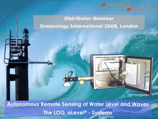
Distributor-Seminar Oceanology International 2008, London Autonomous Remote Sensing of Water Level and Waves The LOG_aLevel® - Systems
LOG_aLevel® - The Robust, Economic and Accurate Water Level Gauge and Wave Measurement System via Ultrasound Technology What kind of Systems does the Market need? • Robust, Low Maintenance, Economic and Accurate Measurement Systems • Redundancy of Sensing Technology • Wave Measurements Universal Selling Properties and Advantages of the LOG_aLevel®: • Robust, Maintenance Free, Cost Effective, Low Installation Effort, Portable • Calibration Free due to Outstanding Sound Velocity Compensation • Due to low Installation Effort and cost effective systems new measuring locations / aplications are possible • Accurate Level Measurement also at Wavy Surface • Accurate and High Resolution Wave Measurements • Solely Approved Remote Sensing Level Gage in Germany as an Alternate or Complement to Radar
Applications: Water level monitoring Wave measurement and analysis, determination of Wave Parameters Event Alerting System for a fast detection of Storm Tides, Floods or Tsunamis Water reservoir management to measure highly accurate the water level Mobile Operating Level Gauge Complete hydrological and metrological monitoring station Monitoring Discharger of e.g. Power Stations Clients: Harbour-, River- and Coastal Authorities, EPAs Research Institutes and Universities Water Resources Authorities Energy Producers Dredging and Surveying Industry Oil and Gas Industry Commercial shipping Tourist Industry LOG_aLevel® - Applications, Clients and Examples
Nienstedten Strandkai Billwerder Sperrwerk Harburger Schleuse Storm Tide Network at Port of Hamburg • Network consists of: • 4 LOG_aLevel Stations • Integration of wind sensor • Autonomous power supply (wind and solar) • Remote data transfer via GPRS
The Storm-Tide-Network in the Port of Hamburg(Location: Strandkai)
Antenna Ultrasound- Sensor Controller The Storm-Tide-Network in the Port of Hamburg(Location: Nienstedten)
BfG (Federal Institute of Hydrology) Test in Gnevsdorf, River Havel(Germany)
Antenna Controller housing River Vienne, France Ultrasound-Sensor
The Mobile LOG_aLevel® • Light weight • No Calibration • Easy to deploy and set-up • Robust and reliable
Selected LOG_aLevel® Customer Applications • Reliable water level measurement for keel- and/or bridge clearance • Hydrographical Survey support with precise water level, data transmission via radio to the survey vessel • Dredging operation support with precise water level, data transmission via radio to the survey vessel • Reliable Stormtide- and flood warning via SMS and level data access via VPN • Reliable and redundant water level measurement for sluice control • Long term water level monitoring on river for tourist management • Integrated water/wave level- and meteorological station • Monitoring of torrents (snow melting/heavy rain fall) • Increasing the density of water level station in a local inland water level network • Measurement of waves for evaluation of wave energy and estimation of loads for quay design • Wave measurement for a local wave model - Input and Validation • Wave and tidal monitoring for coastal protection • Measuring of ship induced waves for estimation of loads on shores • Reconstrucion of damages and causer identification based on level and wave measurement
Modular design of the LOG_aLevel Optional Equipment Standard Equipment Telemetry Modules: - Radio/GSM/GPRS/-LAN, 0-20 mA, etc. Ultrasound-Sensor(s) PCMCIA Data Logger Controller Module RS 232/485 Output - AC Power Supply - Wind Generator - Solar Panel - Buffer-Battery Sound velocity probe 12 V DC Power Supply Module External Sensors -Wind, Pressure, -Radar, Weather, etc. Stainless steel housing GPS synchronised RTC (integrated in Controller) LOG_aLevel Software Display Module
LOG_aLevel® in big housing • Modular Construction • Controller • Data Logger • Power Supply 12 V • Power Supply 230 V • GSM/GPRS • 80 Ah Buffer Battery
LOG_aLevel® - The Ultrasound-Sensor The Innovation: Fast, precise and remote detection of waves and water levels Sensor characteristics • Narrow sound beam ensures small footprint on water surface • Free of disturbing minor sound beams • Extraordinary high transmitting power and receiving sensitivity • Technical resolution: 0.360 mm • Accuracy in field operation: 1 cm • Sampling rate up to 5 Hz • Only 250 g weight • 6 m, 8 m and 10 m range available • Operating temperature: of -20 ° C to +70 ° C Easy installation at any place • jetties, wharfs, sluices, embankment • beacons, dolphins, poles, bridges • buildings, platforms, etc.
LOG_aLevel® compared to common systems Common Ultra-sound Sensors or Radar Sensor
LOG_aLevel® Controller and Power Supply Power ON/OFF switch Power test button Input: 12 V Output: Controller Power 12 V for e.g. Radio 5 V for Data Logger 24 V for e.g. Wind Gauge Controller module for signal processing and sensor control/data acquisition (incl. Timer), Digital data transfer via interface RS 232 or RS 485 and Data Logger output
LOG_aLevel® Reference-Sensor Sound Velocity measurement due to the possible change of temperature, air pressure and humidity By using the directly measured ultrasound velocity in air and the measured travel time it is possible to accurately compute the water level due to the continuously calibration.
LOG_aLevel®, additional Power Supply Input: 100 V - 240 VAC /50/60 Hz Output: 12 VDC; 3,5 A Standard Lead-Gel-Buffer Battery 80 Ah will support the LOG_aLevel system with a current consumption of 500 mA for more than 6 days with power Standard Wind Generator 200 Watts at 20 Knots Standard Solar Panel 85 Wp = 340Wh/day
LOG_aLevel® Data Logger Module • Standard card size 1 GB CF Industrial Grade, up to 2 GB cards supplied • In continuous mode at 5 Hz sample rate a 1 GB card has space for 6 months of data IMPORTANT: The file with the level data is ALWAYS called "PEGEL.LOG" and MUST ALWAYS be in the directory of the data medium. It must be available on the data medium before the measuring campaign. The data logger is not able to create this file by itself. The Compact Flash-Card may not be pulled out during operation. In such case, the level LOG_aLevel station must be turned off and then set again in operation.
LOG_aLevel® GSM/GPRS and Radio Module GSM/GPRS transmission to dynamic DNS or fixed IP-Address via the internet • Licence or Licence-Free Versions available • Up to 50 Km range depending on Antenna, Power and Environment
LOG_aLevel® additional Modules and Sensors Display Module to show the direct water level in the office, on a dredger or survey ship RS232/485 converterto LAN Analogue output Module Anemometer to measure wind speed and direction and the virtual temperature Multi-parameter weather station with the 6 most essential weather data
The LOG_aLevel® - Software for data logging and control Real-Time visualizing of Water Level and the Wave Parameter (H1/3)
How to set the LOG_aLevel® Adjustment Level • Execute a LOG_aLevel measurment with Adjustment level=0 • The result is the distance between sensor and water surface in a negative value • Subtract from the actual local datum this value and use the result as Adjustment level for this station. So you get the exact tide level measured with the LOG_aLevel Example: Zero measurment= - 3 m (adj. Level=0) Actual local datum: 4.5 m 4.5 m – (-3 m)= 7.5 m With 7.5 m adjustment level, the LOG_aLevel will show the result 4.5 m actual tide level LOG_aLevel
When starting LOG_aLevel® Software, you receive “System Error, Code: 2”. Reason: You have chosen the wrong COM Port in the LOG_alevel.ini. Solution: Find out the right COM Port in your Windows Device Manager and change then in the LOG_aLevel.ini in row COMParams= port=X (1 is standard) 2. LOG_aLevel® does not start to measure Reason: Battery has a too low voltage Solution: Charge battery (without load about 13.5 V) LOG_aLevel® does not start to measure and battery has been already charged Check if sensor is “pinging” by listening at the sensor. If no, check cables and connectors. Press button at power supply to check voltage with blue light. Check fuse. If sensor pings, check if RS232 cable is the original crossed cable (pin 2 and 3 crossed). 4. LOG_aLevel® just starts for some seconds to measure, indicated by blue LED in SW Reason: Controller was set by the software to “sleep mode” Solution: Connect Laptop to controller, start software and change to continuous mode or periodic mode 5. LOG_aLevel® results only show value of adjustment level value Reason: LOG_aLevel® sensor is not connected Solution: check cables and connectors LOG_aLevel® results show values too high Reason: reference track is not working or connected Solution: check in the data LOG-file if value for sound velocity is around c=33000. If c=22900, reference sensor does not work. Check reference sensor, cables and connectors. LOG_aLevel® Questions and Answers
LOG_aLevel® General Advantages • Calibration and maintenance free • Robust, precise, economical and compact • Modular system to fulfil different customer requirements and easy upgrade and maintenance due to simple exchange of modules • Reliable even under extreme conditions: flood, ice, storms, debris, fog, etc. • Low installation effort as stationary or mobile version • Accurate level measurements even with wavy surface • Redundancy or alternative to conventional level measurement techniques • Completely autonomous operation possible • Worldwide approved, tested and in operation • Easy to use Windows-Software for data logging and control
LOG_aLevel® around the World LOG_aLevel is used on all continents in more than 28 countries under all possible environmental conditions
LOG_aLevel® Selected References • Rijkswaterstaat: Ministry of Transport + Watermanagement, (RIZA), The Netherlands • Port of Hamburg (Hamburg Port Authority), Germany • US-Army Corps of Engineers San Francisco District (USACE), USA • Project: North Sea Monitoring System: Government Schleswig-Holstein, Germany • Bundesanstalt für Gewässerkunde (BfG), Koblenz (Federal Institute of Hydrology), Germany • National Institute of Ocean technology (NIOT), India • Port of Le Havre (Port Autonome du Havre), France; Port of Seoul, Korea • MRTS, Varanday-Oil and Gas Terminal, Russia • Geofísica y Posicionamiento Satelital GPSCA, Maracaibo Lake, Venezuela • Ecologia, Vouneuil-sur-Vienne, River Vienne, France • Wasser- und Schifffahrtsamt Brandenburg (Waterways and Shipping Board), Germany • Bayer. Landesamt für Wasserwirtschaft (Bavarian Ministry of Environment), Germany • Leibniz-Institute of Freshwater Ecology and Inland Fisheries (IGB-Berlin), Germany • Agency for Water Management, Coast and Nature Protection of Lower Saxony), NLWKN – Norderney, Germany and NLWKN – Brake, Germany • University of Moscow, Russia, University of Tallinn, Estonia • Flinders Ports, Australia • Proudman Oceanographic Laboratory, United Kingdom • Saudi Aramco, Saudi Arabia