Download
1 / 25
270 likes | 447 Vues
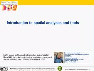
Introduction to spatial analyses and tools. Mrs Diana Makarenko-Piirsalu MSc in Landscape Ecology and Environmental Protection Geolytics OÜ Mere tee 15, Saviranna, Jõelähtme vald, Harjumaa, ESTONIA diana.m.piirsalu @g mx.ch Mob. +372 556 19 636.

E N D
Introduction to spatial analyses and tools Mrs Diana Makarenko-Piirsalu MSc in Landscape Ecology and Environmental Protection Geolytics OÜ Mere tee 15, Saviranna, Jõelähtme vald, Harjumaa, ESTONIA diana.m.piirsalu@gmx.ch Mob. +372 556 19 636 ESTP course on Geographic Information Systems (GIS): Use of GIS for making statistics in a production environment Statistics Norway, Oslo, 26th to 30th of March 2012 Attribution (by) Licensees may copy, distribute, display and perform the work and make derivative works based on it only if they give the author or licensor the credits in the manner specified by these. http://creativecommons.org/licenses/by/3.0/
Topics • What is spatial analyses? • What are important and fundamental issues in spatial statistics? • Examplesofthe spatial analysestypes • gvSIG incorporated spatial analyses and introduction SEXTANTE
What is spatial analyses? • In statistics, spatial analysis or spatial statistics includes any of the formal techniques which study entities using their topological, geometric, or geographic properties. (Source: http://wiki.gis.com/wiki/index.php/Spatial_analysis) • The process of examining the locations, attributes, and relationships of features in spatial data through overlay and other analytical techniques in order to address a question or gain useful knowledge. Spatial analysis extracts or creates new information from spatial data. GIS Dictionary (Source:http://support.esri.com/en/knowledgebase/GISDictionary/term/spatial%20analysis ) • In a very broad sense: answering to the question : „What happens where? “
Main steps of analysing reality spatially Reality Raw Data Results Data Model Conceptualize Spatial analyses Data collection • The aim is to create new knowledge • Extracting or creating new information from spatial data
What is important in spatial analyses? • How geographic phenomena are arranged in the real world? • We should consider the arrangement of geographic phenomena along discrete – continuous and abrupt – smooth continua • Discrete phenomena • occur at distinct locations with space in between • Example: individual person in a city . Location can be specified for each person, with space between individuals • Continuous phenomena • occur throughout a geographic region of interest • Example: elevation, every longitude and latitude position has a value above or below sea level. • Discrete and continuous phenomena can also be considered as either abrupt or smooth. • Example: Number of votes in local municipalities is abrupt phenomena and precipitations in a humid region are smooth.
Continuos- discrete – abrupt – smooth phenomena • Considering the distribution of geographic phenomena is important in selecting proper spatial analyses or appropriate method of symbolisation in visualising data in thematic mapping Source: Thematic cartography and geovisualization, T A. Solcum et al, 2009
Fundamental issues in spatial analyses • A fundamental concept in geography is that nearby entities often share more similarities than entities which are far apart. • This idea is known as „Tobler´s first law of geography„ - everything is related to everything else, but near things are more related than distant things„.Source: Tobler, W. (1970). A computer movie simulating urban growth in the Detroit region. Economic Geography, 46, • Spatial auto-correlation – correlation of variables with itself through the space • Possible causes: • Simple correlation- whatever is causing an observation in one location also causes similar observations in nearby locations • Causality - something at a given location directly influences the characteristics of nearby locations Source: http://wiki.gis.com/wiki/index.php/Spatial_analysis
Fundamental issues in spatial analyses • Spatial dependency or auto-correlation – correlation of variables with itself though the space • Standard statistical techniques assume independence among observations • Standard regression analyses may result in unreliable significance tests. • Spatial regression models (for example - Geographically weighted regression - GWR ) capture these relationships and do not suffer from these weaknesses. • It is also appropriate to view spatial dependency as a source of information rather than something to be corrected. Source: http://wiki.gis.com/wiki/index.php/Spatial_analysis
Spatial autocorrelation statistics • Measure the strength of spatial autocorrelation • Test the assumption of independence or randomness • Classic spatial autocorrelation statistics are: • Moran´s I - compares the value of the variable at any one location with the variable at all other locations . The value of Moran´s I lies between 1 and +1. The higher the coeficient the stronger the aotocorrelation is. A random arrangement of square colors would give Moran's I a value that is close to 0. • Geary ´s C – Geary's C is inversely related to Moran´s I, but it is not identical. The value of Geary's C lies between 0 and 2. 1 means no spatial autocorrelation. Smaller than 1 means positive spatial autocorrelation • Moran's I is a measure of global spatial autocorrelation, while Geary's C is more sensitive to local spatial autocorrelation. Negative None Positive Source:http://en.wikipedia.org
Fundamental issues in spatial statistics – MAUP • Modifiable areal unit problem MAUP • is an issue in the analysis of spatial data arranged in zones, where the conclusion depends on the particular shape or size of the zones used in the analysis. • spatial units are therefore arbitrary or modifiable and contain artifacts related to the degree of spatial aggregation or the placement of boundaries • Example : Statisticalunitsas NUTS, LAU etc • MAUP can cause random variables to appear as if there is a significant association, when there is not. Multivariate regression parameters are more sensitive to MAUP than correlation coefficients • http://wiki.gis.com/wiki/index.php/Modifiable_areal_unit_problem#MAUP_sensitivity_analysis
Fundamental issues in spatial statistics • Scale • Spatial and temporalscale are stillundertheresearchin spatial analysis. • ensuring that the conclusion of the analysis does not depend on any arbitrary scale. • Using quantitativemetrics which donotdepended on the scale at which they were measuredare thesolution
What components of spatial dimensionscan be analysed? • Geometry • Topology • Pattern • Proximity • Accesibilty • Dynamics Source: GITTA, 2012
Steps in spatial analyses Source:http://www.spatialanalysisonline.com/output/
Examples of spatial analyses types • Oneofthe GIS poweristocobinespatialdata • Overlayanalyses– „Whatis on abovewhat?“ • Joiningand viewing together separate data sets that share all or part of the same area • The result of overlayanalysesis a new data set that identifies the spatial relationships
Overlay analyse tools available in gvSIG: Clip Difference Union Intersection Spatial selection
Examples of spatial analyses types • Proximityanalyses– „Whatiscloseto ? „ Howfaris ..?“ • ProximityanalysetoolsavailableingvSIG Buffer Spatial join
Examples of spatial analyses types • Network analyses – the spatial analysis of linear (line) features • analyzing structure (connectivity pattern) of networks • analyzing movement (flow) over the network system • Costs (weights) can be analysed • Network analyse tools available in gvSIG Shortest path Closest facility Service area
Examples of spatial analyses types • Interpolation • Spatial interpolation - estimating the value of properties at unsampled sites within the area covered by existing observations • can be thought of as the reverse of the process used to select the few points from a DEM which accurately represent the surface • rationale behind spatial interpolationTobler´s first law of geography Source:http://www.geog.ubc.ca/courses/klink/gis.notes/ncgia/u40.html#SEC40.2
Examples of spatial analyses types • Point pattern analyses • The spatial pattern of distribution of point featrues • Valid measure of the distribution are the number of occurances in the pattern and respective geographic location • Spatial pattern of all points in the study area
Examples of spatial analyses types • Neighbourhood analyses • analyzes the relationship between an object and similar surrounding objects in a surface • is based on local or neighborhood characteristics of the data • computes an output grid where the value at each location is a function of the input cells within a specified neighborhood of the location • computes an output grid where the value at each location is a function of the input cells within a specified neighborhood of the Source of pictures:http://www.esri.com
Examples of spatial analyses types • NeighbourhoodanalysesalgorithmsingvSIGcanbefoundfrom SEXTANTE – Focalstatistics
SEXTANTE • http://www.sextantegis.com/ • Developed by Victor Olaya
THANK YOU! Mrs Diana Makarenko-Piirsalu MSc in Landscape Ecology and Environmental Protection Geolytics OÜ Mere tee 15, Saviranna, Jõelähtme vald, Harjumaa, ESTONIA diana.m.piirsalu@gmx.ch Mob. +372 556 19 636 ESTP course on Geographic Information Systems (GIS): Use of GIS for making statistics in a production environment Statistics Norway, Oslo, 26th to 30th of March 2012