Case Study Well Permit Decision Tool
80 likes | 104 Vues
Develop an online tool for Local Health Departments to identify well sites needing notice, inform owners about risks, and recommend sampling. Enhance communication and data access for improved contamination management.

Case Study Well Permit Decision Tool
E N D
Presentation Transcript
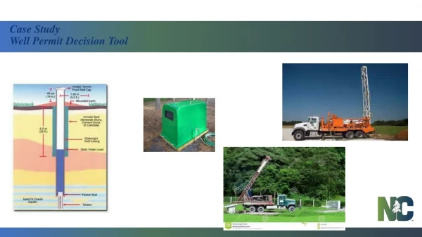
Origins • 2C rules prohibit constructing a well in an aquifer or water bearing zone known to be contaminated • Local Health Departments have some knowledge of where past releases have occurred • Local Health Departments don’t have access to all details of where the contamination has spread • Applicants simply want a permit!
Goal • Create a simple online tool to allow Local Health Departments to: • Identify well sites that need notice under G.S. 87-97(e1) • Inform well owner about potential risks • Recommend additional sampling to well owner • A conversation starter • NOT a map of potential sources of contamination • NOT a definitive map of all contaminated groundwater
“Known Source of Release of Contamination” • Known to whom? • to DEQ or the County • What is a release of contamination? • defined by programs for management of contamination • What is the location or boundary of the source? • Discrete Locations (x,y coordinates), Areas? • How do we determine this • Metadata / Contact Information
Contamination incidents arising from routine agricultural operations, including application of agricultural chemicals (not including unlawful discharges, spills or disposal of such chemicals) pursuant to 15A NCAC 02L .0106(p) • Contamination associated with the construction or operation of injection, monitoring, and other wells subject to permitting under the Well Construction Act (G.S. 87-88) and 15A NCAC 02L .0106(d). • Contamination associated with the operation of non- discharge, discharge (NPDES) facilities, land application of animal waste, and other activities subject to permitting under G.S. 143-215.1 and 15A NCAC 02L .0106(d). • Releases of hazardous waste or constituentsthat currently exceed the 15A NCAC 2L .0202 standards at facilities governed under G.S. 130A-294; • Dry-Cleaning Solvent Cleanup sites regulated under G.S. 143-215.104; • Pre-regulatory landfills and Inactive hazardous substance or waste disposal sites governed under the Inactive Hazardous Sites Act of 1987 (North Carolina General Statute 130A-310 et seq); • Solid waste facilities subject to 15A NCAC 13B that have monitoring wells with exceedances of the 15A NCAC 2L .0202 standards; • Releases of petroleum and hazardous substances subject to G.S. 143-215.75 through 215.98; • Sites that fall within the authority of the Brownfields Programas defined by NC General Statute 130A, Article 9 Part 5; or • Contamination associated with pollution sources in soils under 15A NCAC 2L .0106(f) or other sites known or suspected to have exceeded 15A NCAC 2L .0202
Known Source of Release of Contamination Available Data DHHS / Local Environmental Health Departments Known Releases of Contamination Site ID Site Name Site Address Site Type Acreage Latitude Longitude DWM DWR
Known Source of Release of Contamination Available Data • Locations of known sources to the Department of Environmental Quality, Waste Management and Water Resource Divisions • Basic identifying information • Incident / Site number • Regulatory program/site category • Agency contact information • Major groups of contaminants (metals, VOCs, CVOCs, pesticides, etc.)
Known Source of Release of Contamination Project Deliverables / Products • Web Based Application • Easy to use for non-GIS users • Quick access to data, both Geographically and Digital Documents • Ability to document findings • Contact Information • Distribution Requirements • Data Service • Allow use of the compiled data in other, agency developed applications • Metadata • Security • Contact Information • Distribution Requirements • Tool Demo