Download
1 / 28
280 likes | 396 Vues
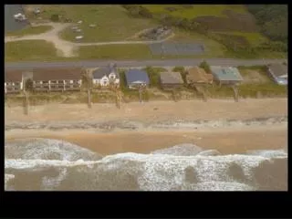
Storm surge, a dangerous phenomenon caused by hurricanes, leads to significant sea level rise, often 4-8 feet, making it the most destructive aspect of these storms. Most structures struggle to withstand moving water, resulting in widespread damage, particularly to coastal communities. Historical events like the 1970 Bangladesh cyclone and the 1900 Galveston disaster illustrate the potential for catastrophic loss of life. Understanding the factors that contribute to storm surge, including wind patterns and coastal geography, is crucial for disaster preparedness and risk management.

E N D
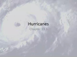
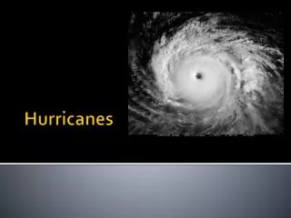
Hurricanes, part 3 ATS 553
Storm Surge • An increase in sea level caused by a landfalling hurricane • Typically 4-8 feet • Typically the most destructive part of the storm.
Why so destructive? • 1. Most structures cannot survive being under moving water.
Why so destructive? • 2. Wind damage is spotty; storm surge is widespread.
Why so destructive? • 3. Takes out expensive civil structures like bridges, roads, canals, etc.
Why so destructive? • 4. Most expensive development tends to occur right along the coast.
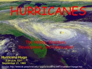
Bangladesh in 1970 • Officially 300,00 people died. • Unofficially, 1 MILLION died • Galveston, 1900 • Worst natural disaster in US history • 7000-8000 people died
What causes storm surge? • 1. Low pressure at the center of the storm. • Only responsible for about 1 m of storm surge.
What causes storm surge? • 2. Heavy rains during the hurricane. • Only a small part of the surge.
What causes storm surge? • 3. Strong winds drive the water towards the shore. • Also, EKMAN TRANSPORT!
Surge is hard to forecast! • Depends on: • The shape of the coastline • The shape of the bottom topography • The lunar tides at landfall
Six “basins” • North Atlantic • Northeast Pacific • Northwest Pacific • Northern Indian • North of Australia • Northeast of Madagascar
North Atlantic • Begin in June or July • Few storms at this time due to TUTT and low SSTs • Peak on September 10 • End in mid November • Formation of STJ, thunderstorm in Amazonia mean more shear
North Atlantic – 9/y • Why aren’t there more storms in the N.ATL? • ITCZ is quite close to the equator • SSTs aren’t particularly warm • TUTT
Northeast Pacific – 18/y • Sudden onset in June • Trade wind trough becomes a monsoon trough, STJ is gone. • Sudden end in October • Monsoon trough becomes a tradewind trough, STJ redevelops TYPICAL TRACKS:
Northeast Pacific & N. Atlantic • Number of hurricanes is ANTICORRELATED. • El Nino—warm water in E. Pacific, good for hurricanes. • But shear is bad for hurricanes in ATL.
Northwest Pacific – 28/y • Hurricanes all year long. • More during July-November, when there is a monsoon trough in the north Pacific
Northern Indian Ocean • 4/y in Bay of Bengal • 1/y in the Arabian Sea • Why no storms between June and October? • ITCZ is on LAND! • These storms track NORTH!
North of Australia – 16/y • NE of Australia---storms move into the SPCZ • NW of Australia---storms go west into Indian Ocean • Recurve POLEWARD
Madagascar – 10/y • Storms start in the central Indian ocean. • Move west and poleward towards Madagascar and South Africa
Monsoon Troughs • Monsoon troughs are favorable regions for tropical cyclone development because:
Monsoon Troughs • 1. They are typically 10° poleward of the equator. • 2. They have cyclonic vorticity. • 3. They have active thunderstorms, pumping lots of humidity into the midlevels of the atmosphere • MORE
Monsoon Troughs • 4. High SSTs (because they occur in the late summer and the fall). • 5. High SSTs and radiative cooling of cirrus anvils imply that instability is maintained. • Monsoon troughs have everything a growing TS needs!
In the North Atlantic… • Storms are NOT formed by monsoon troughs. • This is the only basin where hurricanes form in flow coming off a large continent. • AEWs!
AEWs • About 60% of Atlantic TSs originate from easterly waves. • About 85% of intense hurricanes start that way!
Where DON’T hurricanes happen? • Southeast Pacific: • Waters are too cold • SPCZ is baroclinic—wind shear • Rare storms during El Nino • South Atlantic: • SSTs are not all that warm due to upwelling • Far too much shear • ITCZ is always in the northern hemisphere here!
Project STORMFURY • Know about Project STORMFURY, its goals and methods, and how this lead to the hurricane hunters.