Download
1 / 45
450 likes | 591 Vues
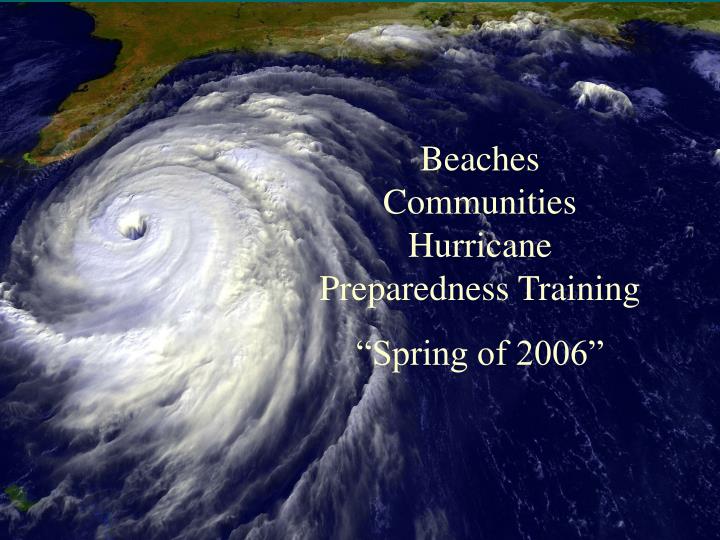
Beaches Communities Hurricane Preparedness Training “Spring of 2006”. General Information. Hurricanes are devastating powerhouses of wind, rain, and surf. Wind gust can reach 200 mph. Can bring 6 to 12 inches of rainfall.

E N D
Beaches Communities Hurricane Preparedness Training “Spring of 2006”
General Information • Hurricanes are devastating powerhouses of wind, rain, and surf. • Wind gust can reach 200 mph. • Can bring 6 to 12 inches of rainfall. • Storm surge can lift the ocean 15-24 feet or more above main sea level, with additional wave action. • Tornadoes are likely. • Loss of power and communication abilities likely.
The ingredients for a hurricane include a pre-existing weather disturbance, warm tropical oceans, moisture, and relatively light winds aloft. A hurricane is a type of tropical cyclone, which is a generic term for a low pressure system that generally forms in the tropics. The cyclone is accompanied by thunderstorms and, in the Northern Hemisphere, a counterclockwise circulation of winds near the earth's surface. Formation of a Hurricane
The process by which a tropical cyclone forms and subsequently strengthens into a hurricane depends on at least three conditions shown in the figure below A pre-existing disturbance with thunderstorms. Warm (at least 80ºF) ocean temperatures to a depth of about 150 feet. Light upper level winds that do not change much in direction and speed throughout the depth of the atmosphere (low wind shear). Hurricane Formation
Hurricane Anatomy The main parts of a hurricane (shown below) are the rainbands on its outer edges, the eye, and the eyewall. Air spirals in toward the center in a counter-clockwise pattern, and out the top in the opposite direction. In the very center of the storm, air sinks, forming the cloud-free eye.
Continued Hurricane Information • Just as many factors contribute to the birth of a hurricane, there are many reasons why a hurricane begins to decay. Wind shear can tear the hurricane apart. Moving over cooler water or drier areas can lead to weakening as well. Landfall typically shuts off the hurricane's main moisture source, and the surface circulation can be reduced by friction when it passes over land.
Hurricane: Terminology • Tropical Storm Watch:An alert given when a tropical storm ( wind speeds of 39-73 mph) poses a threat to a specific area within 36 hours. • Tropical Storm Warning:An alert given when a tropical storm poses a threat to a specific coastal area within 24 hours. • Hurricane Watch:An announcement for specific coastal areas that hurricane conditions are possible within 36 hours. • Hurricane Warning:A warning that sustained winds of 74 mph or higher associated with a hurricane are expected in a specified coastal area within 24 hours or less.
Saffir-Simpson Hurricane Scale • The scale below categorizes storms based on sustained wind speeds. Cat storm Winds Surge (FT) Example Category 1: 74-95 MPH 4-5 Irene 1999 Category 2: 96-110 MPH 6-8 Floyd 1999 Category 3: 111-130 MPH 9-12 Alicia 1993 Category 4: 131-155 MPH 13-19 Hugo 1989 Category 5: Greater than155 MPH 19+ Andrew 1992 Surge Indicator Poles, located in each community indicate the maximum expected surge per category. Cat-1 red, Cat -2 orange, Cat-3 yellow, Cat-4 green, and Cat-5 purple.
Hurricane: Storms Surge • Storm surge is simply water that is pushed toward the shore by the force of the winds swirling around the storm. This advancing surge combines with the normal tides to create the hurricane storm tide. • In addition, wind driven waves are superimposed on the storm tide. This rise in water level can cause severe flooding in coastal areas, particularly when the storm tide coincides with the normal high tides. Because much of the Atlantic coastline is less than 10 feet above mean sea level, the danger from storm tides is tremendous. Waves may reach 20 feet. • The level of surge in a particular area is also determined by the slope of the continental shelf. A shallow slope such as the our area, allows a greater surge to inundate coastal communities., although large breaking waves can still present major problems.
Hurricane: Storm Surge • During Katrina, debris line was recorded at 12 ft. 5 miles inland.
Hurricane: Flooding Problems • Typically 6-12 inches of rainfall produced. • Drowning is the #1 cause of deaths related to hurricanes. • 59% of children killed by hurricanes drowned in freshwater flooding. • 23% of all victims drowned while trying to abandon their vehicles. • Will be a significant inland problem.
Hurricane: Tornadoes Most hurricanes produce tornadoes. They occur in thunderstorms embedded in the rain-bands. Weak Moderate Strong less 110 MPH 110-205 MPH 205 MPH+
Category 1 & 2(Minimal to moderate damage) • Possible outcomes • Wind damage • Substandard structures • Signs, trees, power lines • Significant damage • Pier • Marina & boats • Waterfront property • Flooding • Structural damage to homes and businesses • Barrier islands
Category 3, 4, & 5(Extensive/catastrophic damage) • Possible outcomes • Many complete building failures and marinas/boats destroyed. • Failure of communications (Telephone, cell phones, radios). • Extensive damage to city infrastructure (power, water, sewer). • Bridges destroyed. • Severe flooding. • Roadways covered with sand, washed out and not passable. • Potential loss of life. • Disruption of government services.
CHARLEY: Landfall August 13th, Cat 4-138 MPH, Punta Gorda Claimed 22 lives, $6.8 Billion US damages
JEANNE: Landfall Sept 25th, Cat 3-120 MPH, south end of Hutchinson Island in Martin County Claimed 6 deaths in Florida $6.2 Billion US damages
FRANCES: Landfall Sept 5th, Cat 2-105 MPH, north of Stuart in Martin County Claimed 15 lives $2.5 Billion US damages
Hurricane IVAN: Sept 16th, Cat 3-130 MPH, landfall near Gulf Shores, Alabama and Escambia County Florida. Claimed 60 lives, largest hurricane of the 2004 season.
The 2005 Hurricane Season • 28 named storms • 15 hurricanes, 7 landfalls , 104 Billion damage, 1400 lives lost. • 3 cat 5 storms Katrina, Rita, and Wilma • Hurricane Katrina was the costliest (80 billion), and one of the deadliest hurricanes in American history (over 1300 lives lost). It was the eleventh named storm, fifth hurricane, third major hurricane, and second Category 5 hurricane of the 2005 Atlantic hurricane season, and was the sixth-strongest Atlantic hurricane ever recorded.
What Can We Expect in 2006“Dr. William Gray” • The 2006 Atlantic hurricane season will be much more active than the average 1950-2000 season. We estimate that 2006 will have about 9 hurricanes (average is 5.9), 17 named storms (average is 9.6). • Do not expect as many US landfalls. • No El Nino conditions likely, El Nina conditions may exist. • We are in a period of heightened hurricane activity for next few years. (Increased Atlantic water temp, little El-Nino activity).
What damage could we expect from a Cat-3 hurricane force winds (115+ MPH), flooding, wave action, and possible tornadoes.
Preparing Your Home • Ensure you have ample insurance/flood/mold. • Utilize shutters (metal or plywood) to protect against flying debris. • Secure all outside objects. • Unplug all electrical equipment. Store equipment elevated and covered with plastic. • Inventory property and photograph. • Use cautions with generators (CO and electrical issues.)
Boats Owners Preparation • For trailerable boats: - Take them with you if possible. - Secure all equipment and tarps. - Secure the boat if possible. • Boats at a marina: (Do not stay aboard…) - If possible move to a sheltered area (gunk hole) and secure with multiple anchors. - If left at the dock , strip all equipment and anything that might blow, secure with multiple lines and pad (fenders). - Leave room for the tidal variations 5-10 ft if not a floating dock.
Pets and Hurricanes • Most public emergency shelters do not allow pets because of health and safety regulations. Animals who assist people with disabilities are usually the only animals allowed in shelters. This year there will be several shelters allowing pets in Duval County. - Take pets withyou if possible. - Find a safe pet refuge ahead of time. - Take supply of food/water/ collar with ID . - Make a list of Vets and meds, first and kit , and recent photos. - If you have to leave them, have food, water, and an escape route for them. - Have a suitable travel container.
Sample Evacuation Kit • Prepare for a 3-4 day stay. Make plans to go somewhere…. • Radio, flashlight, batteries. • First aid supplies and sanitation supplies. • Medications and baby supplies. • Bottled water. • Clothing. • Bedding. • Food, non perishable. • Extra money. • Pets and supplies. • Copy of important papers and documents • Re-entry pass (Residents can pick up at city hall)
General Population Evacuation The Mayor’s of Duval County announce the evacuation. • All citizens should seek shelter well inland. • Shelter information will be announced over radio and TV broadcasts. The telephone book has a detailed section on evacuation. • Special needs Transportation available . • Have a destination, stay out of flood zone. • There are no shelters for pets. • Take evacuation kit with you and fill up fuel tank on vehicle. • Ensure your house is secure and shuttered if possible. • Plan you route, however law enforcement may have to re-direct traffic to keep it flowing.
Special Needs Population • Special needs is defined as those with special medical needs( dependent on medical care, electricity for support equipment, chronic condition, or contagious condition that requires isolation) or those that need transportation to a shelter. • Residents of nursing homes or elderly housing facilities should check with their facility about evacuation plans. • Register each year in the spring with Co/Jax EOC, 3 ways. • Telephone EOC @ 630-2472 • On-line at www.coj.net • At City Hall ( Pick up a Special Needs form)
After a Hurricane: What Then? • Listen to media (radio and TV) for information on re-entry. • Realize it will be a slow process. Be patient. • Emergency operations will be coordinated with each city through the Beach Complex to Co/Jax EOC. • Power will usually be out. And may take days to restore. City Government will be trying to get water, sewer, and power restored. • The first priority will be damage assessment and search and rescue operations. • Debris will be everywhere. Each city has plans for debris removal. • Curfew’s may be necessary.
Re-Entry Process • May be days before residents are allowed back due to safety. Re-entry Checkpoint: • Residents must show a valid re-entry pass. • Business managers/owners will be allowed back into the beach area but should have a pass. • Law enforcement will coordinate re-entry operations.
Local Recovery Efforts • For a major event, theCounty will be dividedinto four sections utilizing the NIMS management system and ICS. The beach cities are in the Beach Complex. • Each beach city is responsible for directing their own recovery efforts, however it will be coordinated through the Beach Complex to Co/Jax EOC to utilize County, State and Federal assistance/resources. • After a initial damage assessment, search/rescue efforts will be the first priority, while at the same time restoration of power, water, and sewer services. • Debris management will also be initiated early on to clear major roadways. • Recovery will be a slow process….
FEMA: What can they do? • Federal Emergency Management Association may provide assistance to victims of a disaster. - Low interest loans. - Those who become unemployed may receive unemployment benefits. - Temporary housing. - Special Grants. - Disaster recovery centers for assistance. - For Public Assistance offer several mitigation grants.
Questions/Information • We have members from each beach communities, the Co/Jax EOC, and a State Insurance representative to try and answer any of your questions. • There is also hand out material that will give you more detailed information.. • There is a lot of hurricane preparation information on the web that will assist you in making early preparations. • Preparations is the key.