Download
1 / 46
460 likes | 546 Vues
Explore tide forecasting projects and real-time data systems along the Texas coast for navigation, storm response, and water quality studies. Harness harmonic analysis for accurate tidal predictions.

E N D
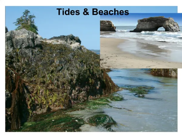
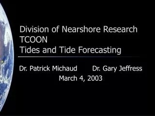
Division of Nearshore ResearchTCOONTides and Tide Forecasting Dr. Patrick Michaud October 27, 2003
Division of Nearshore Research Projects • Texas Coastal Ocean Observation Network • NOAA/NOS Natl Water Level Obs Network • Houston/Galveston PORTS • National/Global Ocean Observing System • TWDB Intensive Surveys • Nueces Bay Salinity Project • Corpus Christi Real-Time Navigation System • CMP - Neural-Network Forecasting • CMP - Waves
TCOON Overview • Started 1988 • Over 50 stations • Primary Sponsors • General Land Office • Water Devel. Board • US Corps of Eng • Nat'l Ocean Service Gulf of Mexico
TCOON Overview • Measurements • Precise Water Levels • Wind • Temperature • Barometric Pressure • Follows NOAA/NOS standards • Real-time, online database
Wind anemometer Radio Antenna Satellite Transmitter Solar Panels Data Collector Water Level Sensor Water Quality Sensor Current Meter Typical TCOON Station
Nueces Bay Salinity Project • Started 1991 • Informs data management officials of opportunities to avoid water releases • Water quality data collected every 30 minutes
Other Real-Time Systems • Real-time Navigation • Port of Corpus Christi • Port Freeport • NOAA PORTS • Offshore Weather
Data Management • Automated Acquisition, Archive, Processing, Retrieval • 10-year Historical Database • Most processing takes place via Internet • Infrastructure for other observation systems
Data ManagementDesign Principles • Preserve source data • Annotate instead of modify • Automate as much as possible • Maintain a standard interchange format • Avoid complex or proprietary components • Emphasize long-term reliability over short-term costs
Uses of DNR/TCOON Data • Tidal Datums • Littoral Boundaries • Oil-Spill Response • Navigation • Storm Preparation/ Response • Water Quality Studies • Research
Tidal Datums • Used for • Coastal property boundaries • Nautical charts • Bridge and engineering structures
New Data Collection Hardware • PC-104 based computer • Linux operating system • Solid-state Flash memory • 10 serial ports, 16 A/D channels • Low power consumption • Rugged for harsh environments
New Data Collection Hardware • Linux operating system • 2.4.9 kernel • 16MB RAM, 32MB HDD • 486 or Pentium processor • Concurrent processes • GNU shell/tools • cron • bash • gcc
Research • Real-time Automated Data Processing • Tidal Datum Processing • Web-based Visualization and Manipulation of Coastal Data • Neural-Network-based forecasts from real-time observations • Specialized sensor and data acquisition system development • Support for other research efforts
Water level forecasting Isidore begins to (re-)enter the Gulf… …what will happen next?
Tide predictions tide: The periodic rise and fall of a body of water resulting from gravitational interactions between Sun, Moon, and Earth. Tide and Current Glossary, National Ocean Service, 2000 According to NOS, changes in water level from non-gravitational forces are not “tides”.
Harmonic analysis • Standard method for tide predictions • Represented by constituent cosine waves with known frequencies based on gravitational (periodic) forces • Elevation of water is modeled as h(t) = H0 + Hc fy,c cos(act + ey,c – kc) h(t) = elevation of water at time t H0 = datum offset ac = frequency (speed) of constituent t fy,c ey,c = node factors/equilibrium args Hc = amplitude of constituent c kc = phase offset for constituent c
Harmonic tide predictions • Obtain amplitudes and phases of harmonic constituents from trusted sources (e.g., NOS) or • Perform a least-squares analysis on observations to determine amplitudes and phases of harmonic constituents To predict tides using harmonic analysis:
Harmonic prediction Apply the amplitudes/phases to get:
Prediction vs. observation It’s nice when it works…
Prediction vs. observation …but it often doesn’t work in Texas
Water level != tide In Texas, meteorological factors have a significant effect on water elevations
Uses of harmonic predictions However, harmonic predictions can still be useful! Consider… Isidore begins to (re-)enter the Gulf… …what will happen next?
Uses of harmonic predictions If we add harmonic prediction… …what will happen next?
Uses of harmonic prediction landfall
Isidore & JFK Causeway • Effect of Isidore at JFK causeway
Harmonic WL prediction -present capabilities • Automated system for computing harmonic constituent values from observations database • Harmonic predictions available via query page for many TCOON stations
Opportunity • Problem: The tide charts do not work for most of the Texas coast • Opportunity: We have extensive time series of water level and weather measurements for most of the Texas coast
Data Intensive Modeling • Real time data availability is rapidly increasing • Cost of weather sensors and telecommunication equipment is steadily decreasing while performance is improving • How to use these new streams of data / can new modeling techniques be developed
TCOON Data in CC Bay • 6 TCOON Stations Measuring: • Water levels (6) • Wind speeds (4) • Wind directions (4) • 10 x 8760 hourly measurements per year • Barometric pressure • Air temperature • Water temperature Port Aransas Aquarium Ingleside Nueces Bay Corpus Christi Bay Gulf of Mexico Naval Air Station Packery Channel Oso Bay Port of Corpus Christi Bob Hall Pier
Data Intensive Modeling • Classic models (large computer codes - finite elements based) need boundary conditions and forcing functions which are difficult to provide during storm events • Neural Network modeling can take advantage of high data density and does not require the explicit input of boundary conditions and forcing functions • The modeling is focused on forecasting water levels at specific locations
Neural Network Features • Non linear modeling capability • Generic modeling capability • Robustness to noisy data • Ability for dynamic learning • Requires availability of high density of data
Neural Network Forecasting • Use neural network to model non-tidal component of water level • Reliable short-term predictions CCNAS ANN 24-hour Forecasts for 1997 (ANN trained over 2001 Data Set)
BHP Performance Analysis harmonic forecasts (blue/squares), Persistence model (green/diamonds), ANN model without wind forecasts (red dashed/triangles) and ANN model with wind forecasts (red/circles)
CCNAS Performance Analysis Harmonic forecasts (blue/squares), Persistent model (green/diamonds), ANN model with only NAS data (red dashed/triangles) and ANN model with additional BHP data (red/circles)
Tropical Storms and Hurricanes • Need for short to medium term water level forecasts during tropical storms and hurricanes • Tropical storms and hurricanes are relatively infrequent and have each their own characteristics. • ANN model performance?
Forecasts in storm events CCNAS ANN 12-hour Forecasts During 1998 Tropical Storm Frances (ANN trained over 2001 Data Set)
CCNAS ANN 24-hour Forecasts During 1998 Tropical Storm Frances (ANN trained over 2001 Data Set)
Conclusions • Long-term, data-rich observation network • Web-based infrastructure for automated collection and processing of marine data • Research in datum computation and coastal forecasting