Download
1 / 20
200 likes | 317 Vues
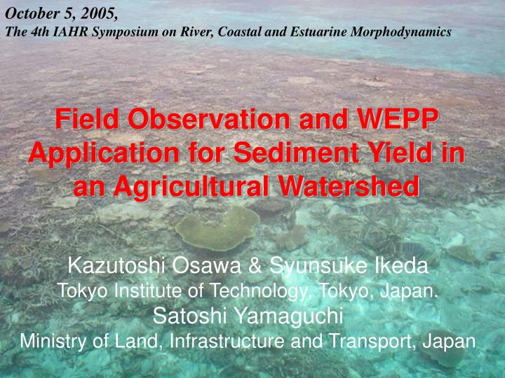
October 5, 2005, The 4th IAHR Symposium on River, Coastal and Estuarine Morphodynamics. Field Observation and WEPP Application for Sediment Yield in an Agricultural Watershed. Kazutoshi Osawa & Syunsuke Ikeda Tokyo Institute of Technology, Tokyo, Japan. Satoshi Yamaguchi

E N D
October 5, 2005, The 4th IAHR Symposium on River, Coastal and Estuarine Morphodynamics Field Observation and WEPP Application for Sediment Yield in an Agricultural Watershed Kazutoshi Osawa & Syunsuke Ikeda Tokyo Institute of Technology, Tokyo, Japan. Satoshi Yamaguchi Ministry of Land, Infrastructure and Transport, Japan
INTRODUCTION Location of the Okinawa region in Japan Tokyo Ishigaki Island Okinawa region 1000km 1000km Location of the Okinawa region
Introduction Upland fields and bare lands become the main source of sediment Red-soil runoff problems in Okinawa region Recently many farm land reclamation projects are carried out. Land use is changed dramatically from forest to upland fields. Subtropical climate (high intensity of rainfall) Red soil (high erodibility) Steep slope ( ~14%) Soil erosion is accelerate heavily
Red soil runoff problems in Okinawa region Dead corals in near of the mouth of the river Corals barely live in Nagura Bay, Ishigaki Island Corals in the unpolluted water Heavy soil erosion occurs Flow into channels and the rivers Very short river length (5-10km) Discharged into the sea directly Marine pollution Disruption of the oceanic ecosystems (coral, fishes, etc.) Corals have been damaged by oversupply of sediment and nutrients from the river basin including agricultural zone.
Introduction Objectives Soil erosion plot test was carried outto compare the amounts of sediment yield depending on the difference of agricultural management Water Erosion Prediction Project (WEPP) model was applied to these test fields in predicting sediment yield at farmland and simulated sediment runoff in watershed
Field plot test Outlines St-1: Non-cultivating (control) St-2: Spring sugarcane by conventional tillage Canopy cover effect Grass strip effect Zero-tillage effect St-3: Spring sugarcane with grass strip St-4: Perennial sugarcane by zero-tillage farming
Temporal variations of measured parameters only put the data during each rainfall event
Amount of sediment yields 94% 59% 8% 85% Sediment runoff reduction ratio 59 % Canopy cover effect 94 % Zero-tillage effect (vs. non-cultivating) 85 % Zero-tillage effect (vs. spring sugarcane) 8 % Grass strip effect
Water Erosion Prediction Project (WEPP) Constructed by Nearing et al. in 1989 as hillslope erosion model In 1995, the model was expanded to the watershed scale Physically-based model Erosion, climate, hydrology, daily water balance, plant growth, residue decomposition, etc. Different from the USLE, the WEPP model was constructed for the purpose of estimating soil loss at every rainfall event Constructed as a post-USLE, however, little study has been done to apply the WEPP model to Japan
Hillslope components of WEPP model 1. Climate 2. Overland flow 3. Water balance 4. Plant growth 5. Soil condition 6. Managements 7. Erosion Climate Evapo-transpiration Plant growth Managements Tillage, Plant seedlings, Harvest, etc. Interrill erosion Overland flow Rill erosion Soil condition conductivity erodibility Infiltration Percolation
Erosion process of WEPP model Sediment continuity equation G: sediment load, Di: interrill erosion rate, Df: rill erosion rate Interill erosion Ki: interill erodibility, Ie: effective rainfall intensity, σir: interrill runoff rate, SDRrr: sediment delivery ratio Fnozzle: adjustment factor for sprinkler irrigation, Rs: rill spacing, W: rill width Rill erosion and deposition erosion Tc: transport capacity of flow in the rill τf: flow shear stress acting on soil particles τc: critical shear stress of the soil Kr: rill erodibility β: raindrop-induced turbulence coefficient Vf: effective fall velocity qir: flow discharge. deposition
Watershed components of WEPP model Hillslope erosion Hillslope scale Channel Plant transportation deposition erosion Soil Interrill erosion Rill erosion Impoundment deposition transportation Management Watershed scale
WEPP model verification Most of calculated results were agree with observed ones. Disagreements of discharge at St-4 would be attributed to the overestimate of the hydraulic conductivity. Differences of sediment runoff at St-1 can be attributed to the growth of weeds and the loss of fine and easily erodible sediment at the actual plot. If these conditions were expressed properly with the model, these gaps will be improved.
Simulated results by WEPP model spring-perennial sugarcane cycle was more effective cropping method in view of sediment yield reduction than summer sugarcane. The measures of residue mulch and no-tillage planting at summer sugarcane field reduced sediment yield more effective than that at spring-perennial sugarcane field.
Outlines and land use of Kandabara basin Farmlands occupied most of the basin. Sugarcane: 49% (Summer: 38%, Spring: 4%, Perennial: 6%) Pineapple: 2%, Paddy: 24%, Grassland: 14%
Calculated sediment yield and discharge Sediment yield tended to be large at summer sugarcane fields or pineapple fields. As slope length or slope angle enlarged, sediment yield tended to be increased. • The feasible combinations of sediment yield reduction methods: • shifting land use of summer sugarcane into spring-perennial sugarcane cycle • mulching by residue of sugarcane • installing the grass strip.
Calculated sediment yield reduction ratios The reduction ratio was high at sugarcane fields with measure (1) and pine-apple fields with measure (2) and (3). Sediment discharge at outlet of the basin was decreased by 56% in comparison with present situation.
Conclusion We have carried out multi-points observations at four test plots in sugarcane fields to compare the amounts of sediment yield depending on the difference of agricultural management at each plot. Zero-tillage perennial farming is found to reduce sediment effectively. The WEPP model is effective to estimate the sediment yield at farmlands affected by various agricultural management conditions. In the present application to the watershed, the authors carried out some case studies to choose proper combinations of sediment yield reduction methods. The calculation has shown that the sediment runoff can be reduced by 56% at the watershed if the combination is adequately chosen.
Field plot test Outlines Amount of discharged sediment is calculated as the product of water discharge and sediment concentration.
Nutrients yield SS concentration g・L-1 N mg・L-1 P mg・L-1 June 8, 2004