Download
1 / 28
310 likes | 920 Vues
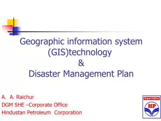
Geographic information system (GIS)technology & Disaster Management Plan. A. A. Raichur DGM SHE –Corporate Office Hindustan Petroleum Corporation . Introduction . GIS technology is increasingly being used in decision support systems.

E N D
Geographic information system (GIS)technology& Disaster Management Plan A. A. Raichur DGM SHE –Corporate Office Hindustan Petroleum Corporation
Introduction • GIS technology is increasingly being used in decision support systems. • In the past few years, GIS emerged as a powerful risk assessment tool and is being put to use to assess risk to property and life stemming from natural hazards such as earthquakes, hurricanes, cyclones and floods.
Introduction • Manipulation, analysis, and graphic presentation of the risk and hazard data can be done within a GIS system, and because these data have associated location information which is also stored within the GIS, their spatial (3D)interrelationships can be determined and used in computer based risk assessment models by government planners for better disaster preparedness.
Use GIS in Natural disaster Scenario • A fundamental principal of Risk Assessment is that risk due to natural catastrophes such as earthquakes, hurricanes and flood, is location dependent, and that it can be assessed within an acceptable range of uncertainty if reliable historical and location specific data is available.
Use GIS in Natural disaster Scenario • For e.g. a location which is surrounded by seismic faults and has a weak surface geology has a higher hazard potential than a location for away from faults and with strong surface geology. • Similarly, hurricane, hazard at a location near the coast and with a flat, bare terrain is far higher than at a location etc. • Hence with help such data early safe evacuation are planed &executed
Preplanning -&DMP inputs • GIS in conjunction with remote sensing and photogrammetry, can be used to identify hazards. Seismic faults and flood prone areas can be identified by scientists using GIS to analyse satellite image, aerial photos and field survey data.
Preplanning -&DMP inputs • Once the hazards have been identified, their representation can be stored conveniently in GIS databases. • For hurricane risk, information on land use, land cover, coastline and distance from coast are important. Similarly topology data is required for flood assessment and storm surge analysis.
Preplanning -& DMP inputs • Inventory data can also be stored easily in a GIS database. Data on building stock, liveliness, utilities, etc. can be aggregated into manageable gographic regions such as census wards, pin codes, or larger administrative regions such as villages, talukas, and even districts. • Using statistical functions available in GIS systems, the average value of various properties of different building classes can be computer (e.g. average monetary value of residential dwelling in particular village) and stored with their corresponding geographic regions in the GIS database.
Preplanning -& DMP inputs • The information retrieved by querying the GIS database serves as inputs for the risk assessment models. • These risk assessment models can run both deterministic as well as probabilistic risk assessment. • It helps computing the damage associated with that event, • THUS GIS GOES LONG WAY In CONTOL & ASSESMENT OF NATURAL DIASTER
Disaster preparedness programme in Andhra • Now, the Andhra Pradesh State Remote Sensing Applications Centre (APSRC) has developed a remote sensing application to overcome some of the problems that the state faces. The application areas include surface water, ground water, marine resources, geology and mines, energy, agriculture, soils, urban planning, roads, forestry, animal husbandry and environmental hazards. It’s base is GIS • Also similar plan is developed in Maharashtra & Mumbai
GIS usage in Industry emergency planning • Fire , law /security enforcement, and medical and public health divisions needs to prepare comprehensively for attending emergencies • Traditionally, first responders have relied on experience, practiced skills, good equipment, and teamwork for effective and successful emergency response • But to respond to large-scale catastrophic emergencies which common today the traditional methods need to be supported by technology and this need can be achieved through GIS .
GIS use in Industrial fire emergency • As industrial complex expands for better response more personnel, stations, and equipment are purchased • Today response-related investments must also invest in better planning, evaluation, and data communication tools and technologies such as geographic information system (GIS)technology. • This approach will ensure better utilization available resource and in consequence reduction
GIS use in Industrial fire emergency • Effective planning for response involves understanding how to minimize consequences of emergencies and acquire the information and data necessary to respond. • Depending on the nature of the emergency, every first responder requires certain equipment and personal protection gear. • Increasingly today , fire responders will also require the best data and information relevant to the risks to which they are exposed. • Knowing where critical assets are located and having first access to key data and information, response can well planed & executed ,this can be addressed through the purposeful implementation of GIS—digital (or geospatial) data
GIS use in Industrial fire emergency –first responder • GIS—digital (or geospatial) data Information will be useful from the moment an emergency call is received and all that you have do is to punch in data of the location & it would answer the following questions: • What is the best route? • Where are the closest hydrants? • What is the layout of the facility? • What is the occupancy type, and how many people may need rescue or evacuation?
GIS use in Industrial fire emergency –first responder • Beyond maps, other information and data suplied may include • Photographs of the facility • Floor plans and main utility control panels • Existing fire protection systems • Inventory of the facility (hazardous materials) • Pre-incident plan (a pre-inspection and fire protection plan) • Previous call history
GIS use in Industrial fire emergency –Emergency controller • GIS data and information will also support rapid decision making including the following: • What additional exposures or facilities are threatened by this event? • Where should incoming units be positioned to access critical hydrants that will effectively support the mission? • If an equipment staging area or incident command post is required? • where are parking lots, schools, churches, malls, or other suitable facilities located?
GIS use in Industrial fire emergency –Emergency controller • If helicopter evacuation of victims is required, where are suitable landing sites? • If medical triage or decontamination is required, what facilities are closest and available? • If hazardous materials are involved or a chemical plume is being generated, in what direction will it drift, what is likely to be threatened, and what is required in protecting and evacuating the public • If an explosion has occurred or is eminent, who needs to be evacuated and where are the closest evacuation facilities and resources?
GIS use in Industrial fire emergency –Emergency controller • All of these decisions require geospatial information (maps, directions, building layouts, etc.), and most will be in different places and digital formats GIS helps to combine them . • The GIS can provide first responders the right information, at the right time, and in the most relevant place easy to access and use. Data inter-operability is one of the greatest values of a GIS, • since GIS can integrate disparate information and provide useful visual information quickly to first responders.
GIS use in Industrial fire emergency –Emergency controller • GIS can also create various scenarios through spatial modelling that produce visualization that can more accurately and realistically describe the direction and extent of explosions, plumes, fire behaviour, or disease outbreak. • For example, instead of guessing or estimating evacuation requirements, transportation network delays, or blockages, GIS can provide an actual prediction of the scale of the event and visually display potential consequences.
GIS based ERDMP: A case study of HPCL Mumbai refinery" • At Mumbai refinery with help DMI Bhopal Under leadership of Dr. Rakesh Dubey Director ,GIS based DMP study was carried out • It has given us insight to plan our fire fighting strategy • To elaborate this let us look at GIS based snap shots Refinery DMP
Crude Tk 115 Fire orange =12.5 KW, Red line hydrant location, we can plan parking trucks ,persons, evacuation parked trucks out side etc
TK 253 naphtha tank on fire 12.5 KW range ,gives idea how fight fire, cooling to done on which tanks ,which road closed ,where park fire trucks etc
ATF tank close to boundary wall , out side road traffic to be controlled
Summary • First responders require effective physical tools, as well as intangible information tools, to evaluate and manage risk and, at the same time, increase their overall capacity for effective response. • Fire-fighters, should adopt of information technologies, such as GIS, that both increase capacity and leverage existing informational resources toward prevention and preparedness. • Complex incidents involving multiple agencies and private organizations require the ability to create common operational pictures that are capable of guiding both preparedness and response.
To conclude • If a picture is worth a thousand words, then certainly an intelligent map is worth much more. • Today's GIS produces intelligent, relevant, and useful spatial (3D)information that achieves critical response missions. First responders deserve nothing less.
THANK YOU for any further information e mail aaraichur@hpcl.co.in