Download
1 / 25
250 likes | 372 Vues
This document outlines a rule-based optimization process for calibrating models to set Environmental Optimization System (EOS) targets for river basins. It describes the steps to adjust parameters based on sensitivity analysis, the handling of multiple streams and sub-basins, and the calculation of necessary loads using empirical formulations. The methodology leverages data from USGS and employs mass balance principles to ensure accurate EOS predictions, ultimately aiming for effective river flux management and attenuation strategies.

E N D
Using Empirical ModelsTo Set EOS Targets For Phase 5 Gary Shenk 1/10/07 Modeling Subcommittee
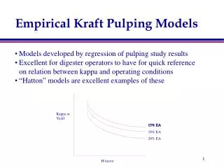
River Calibration Rule-Based Optimization Process Parameter Files • Assume the sensitivity of the simulation to each parameter • Determine an appropriate adjustment direction for each parameter • Take a small step in that direction
Calibration Information • Consistent with recommendations of STAC review team • Observed and simulated CFDs for paired data
Potomac Calibration Change in transformation vs iteration
How to arrive at appropriate EOS loads? • Assume watershed with one river and a gauge • Start from the outlet • Add stream attenuation • Leaves necessary EOS Segment Transport Factor = EOS / EOF
2 1 3 What about multiple streams? • Each sub-basin has preliminary estimate of EOF • Calculate EOF * product of down stream delivery for each sub-basin • Determine ratio for all preliminary EOF ESTIMATOR = TF * ( EOF1 * DF1 * DF3 + EOF2 * DF2 * DF3 + EOF3 * DF3 )
2 1 3 What about nested streams? • Same as above, but subtract out stations ESTIMATOR(3) = ESTIMATOR(1) * DF3 + TF * ( EOF2 * DF2 * DF3 + EOF3 * DF3 )
Where do we get all of the data? • EOF = targets • Loads at Stations = USGS ESTIMATOR • Stream Attenuation = USGS Sparrow
Estimatorlocations Assign non-gauged areas based on gauged results
In-stream loss:Sparrow formulation Streams are grouped into size categories and each stream group has a particular reduction rate ThetaSc = first-order loss rate for streams of certain size T = Travel time http://pubs.usgs.gov/tm/2006/tm6b3/
Big difference: 2004 included reservoir settling factor at 14.3 meters per year
New Sparrow Formulations Empirical formulation Q = average flow ThetaS[1,2] = empirical coefficients ‘Settling-velocity’ formulation DS = Average Depth ThetaMT = mass settling rate http://pubs.usgs.gov/tm/2006/tm6b3/
River Geomorphology Data Bankfull Height vs Drainage area in the Piedmont
New Sparrow Formulations Reservoir Attenuation: qR = outflow / area ThetaR0 = mass settling rate http://pubs.usgs.gov/tm/2006/tm6b3/
Conclusions • Using mass balance and literature to determining EOS targets results in regional biases • Using ESTIMATOR and Sparrow estimates of river flux and attenuation, we can empirically calculate overall necessary EOS loads. 2 1 3